As millions braced for its arrival along India’s east coast, Phailin, a massive coiling pack of stormy clouds, swooped down the Bay of Bengal shoreline around 9 pm, an hour late than predicted. It wasn’t this big when it had set off.
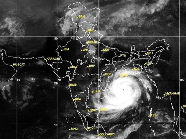
On the Indian Met department’s digitally enhanced moving satellite images, it showed up as an ashen disc surging frame by frame. A cyclone is said to make a landfall when its fast-moving “eye” aligns over the coastline so that half of the system is on land and the remaining half on the sea, such as the Bay of Bengal.
The word cyclone comes from the Greek word “cyclos”, literally a coiled-up snake. But cyclones are actually “low-pressure rotational systems” that twirl violently across the high seas.
“It is a very big system, with several layers of smaller embedded cells or sub-systems in the entire cyclone,” Met chief LS Rathore said. This means that a single cyclonic system is made up of heaps of densely packed “cumulonimbus” rainstorm clouds. These “cells”, like super-powerful jet turbines, throw shafts of piercing downward winds.
According to India’s ocean weather-classification norms, a cyclone is said to be “very severe”, like Phailin, when it packs wind speeds of 210-220 km an hour. Such wind shears can uproot trees and power poles as well as dislodge framed houses. “It is like driving a car at over 100 km an hour, and then stretching your hand out to get hit by double the impact,” Rathore said, describing the force.
{{/usCountry}}According to India’s ocean weather-classification norms, a cyclone is said to be “very severe”, like Phailin, when it packs wind speeds of 210-220 km an hour. Such wind shears can uproot trees and power poles as well as dislodge framed houses. “It is like driving a car at over 100 km an hour, and then stretching your hand out to get hit by double the impact,” Rathore said, describing the force.
{{/usCountry}}Phailin formed when a tiny depression developed in the south Pacific on October 8. It then grew in size and intensity over the next three days. Most cyclones are set off when winds caused by the Earth’s rotation fuse with a low-pressure area over oceans.
On an average, three to four cyclonic storms develop over the north of Indian Ocean a year, mostly when the June-September monsoon begins to taper off. The cyclone season lasts until December.
When cyclones enter the Bay of Bengal basin, it can suddenly grow stronger, helped by a typically warm ocean full of moisture. “The Bay of Bengal is a happy trigger (for cyclones)” the Met official said.
Along their trajectory, well-developed cyclones release the same amount of energy as 100 hydrogen bombs, according to the Weather Channel. Phailin was predicted to be fiercest in the first six hours after landfall. It will wreck wide swathes of a heavily populated rice-growing belt, while creating strong walls of sea water pounding the shoreline, and travelling up to 600 metre inwards. Waves could rise up to 14 metre, Rathore said. Preparedness remains the best bet, according to meteorologists.