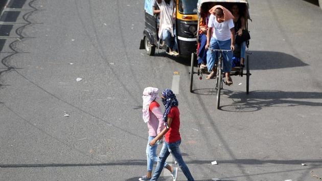
On Sunday, heatwave conditions persisted in many parts of north India, including Noida where the maximum temperature was 44.4 degrees Celsius (°C), five notches above normal. The India Meteorological Department (IMD) expects these conditions for the next two days at least.
On May 29 and 30, a western disturbance -- a wind system that originates over the Mediterranean Sea -- is expected to hit the region and bring dust storm or thunderstorm along with high-speed winds.
On Saturday too, the city recorded an above-normal temperature of 44.7°C. The minimum temperature on Sunday was 28.7°C, two notches above the season average, same as a day earlier.
IMD predicts maximum temperatures to rise further up to 46°C on Monday and Tuesday.
According to weather analysts, Noida, Ghaziabad and adjoining regions will suffer an intense heatwave as the temperatures are set to soar in the parts of the western Uttar Pradesh on Monday and Tuesday. Met officials said that the western disturbance would reach the region on Wednesday and have an impact from Thursday that would only reduce the intensity of heatwave, but the maximum temperature is expected to remain above 40°C.
“There are high chances of intense heatwaves, which happens when temperatures rise seven degrees above the season’s average. For the past two days, a large part of north-west India, especially Delhi-NCR and western Uttar Pradesh was already suffering heatwaves which will intensify. However, another western disturbance between May 27 and 28 will lessen the effects of intense heatwaves, yet the mercury will still be above 40°C. On May 29 and 30, region may see a proper respite from the heat with a thunderstorm, and winds at speed of 60 kmph,” said Kuldeep Srivastava, head, regional weather forecasting centre, IMD. He added that the thunderstorm, with a slight possibility of rains and a change in wind direction from warm westerly to cool easterly, will lead to pacify the rough weather by the month-end.
{{/usCountry}}“There are high chances of intense heatwaves, which happens when temperatures rise seven degrees above the season’s average. For the past two days, a large part of north-west India, especially Delhi-NCR and western Uttar Pradesh was already suffering heatwaves which will intensify. However, another western disturbance between May 27 and 28 will lessen the effects of intense heatwaves, yet the mercury will still be above 40°C. On May 29 and 30, region may see a proper respite from the heat with a thunderstorm, and winds at speed of 60 kmph,” said Kuldeep Srivastava, head, regional weather forecasting centre, IMD. He added that the thunderstorm, with a slight possibility of rains and a change in wind direction from warm westerly to cool easterly, will lead to pacify the rough weather by the month-end.
{{/usCountry}}According to Srivastava, the intense heat waves are normal at this time of the year.
“During this period, until up to June 20 the sun rays fall vertical to the ground, there are lesser clouds and even those clouds are at higher altitude. The winds are also westerly and north-westerly which are very warm. So, the cumulative effect leads to such intense and rough meteorological conditions here,” Srivastava added.
Stay updated with all the Breaking News and Latest News from Mumbai. Click here for comprehensive coverage of top Cities including Bengaluru, Delhi, Hyderabad, and more across India along with Stay informed on the latest happenings in World News.
Stay updated with all the Breaking News and Latest News from Mumbai. Click here for comprehensive coverage of top Cities including Bengaluru, Delhi, Hyderabad, and more across India along with Stay informed on the latest happenings in World News.