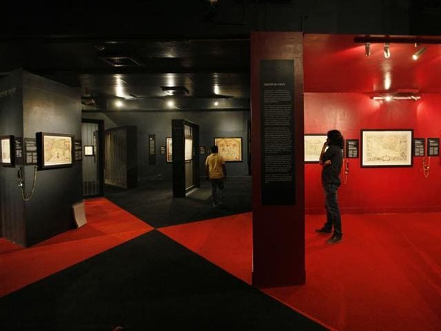
Today, it isn’t at all difficult to locate a place. Google maps can find any place on the globe and GPS-enabled phones can lead you right to your destination. In this era, it is difficult to imagine how people found their way across the world a century or two ago. The ongoing exhibition, Cosmology to Cartography, at the National Museum, aims to take visitors back to an earlier era, to imagine how our predecessors got by in a pre-Internet world.
Hyderabad-based Prshant Lahoti has been collecting maps for over 12 years - a journey which began in a small antiques shop in Edinburgh, Scotland, where he found himself looking at a rare map of India. Since then, Lahoti’s collection of maps has grown to 3,000.
The exhibition, which provides a rare glimpse of the world of Indian maps, displays 70 exquisite maps culled from the collection, and is broadly divided into two parts. The Cosmology section begins with early Hindu and Jain cosmological representations, which include depictions of the universe as Lokapurusa or the Cosmic man. Sacred rivers, pilgrimage sites and city-temples are also mapped. The Cartography section reveals the origin of maps of India through works printed in Germany, Italy, England and Ottoman Turkey. Here, sub sections like Clash of Empires features the dramatic struggle between the European powers and Indian states aiming to establish supremacy. Likewise, Rise of Raj focuses on Britain’s quest to scientifically map the subcontinent. The section on Cities/Urbanism displays maps that bear witness to the birth of modern Indian cities.
But why combine cosmology and cartography, two distinct intellectual streams? “These [cosmic maps] represent the Indian tradition of religious and experiential mapping of places. They are accurate in spatial description. However, they are not measurable on a Cartesian scale,” says architectural historian Vivek Nanda, who has co-curated the exhibition with Alexander Johnson, an international authority on the historical mapping of the British Empire.
{{/usCountry}}But why combine cosmology and cartography, two distinct intellectual streams? “These [cosmic maps] represent the Indian tradition of religious and experiential mapping of places. They are accurate in spatial description. However, they are not measurable on a Cartesian scale,” says architectural historian Vivek Nanda, who has co-curated the exhibition with Alexander Johnson, an international authority on the historical mapping of the British Empire.
{{/usCountry}}Art, aesthetics, antique collections, geographical representations, and a great deal of history runs parallel to the evolution of maps. “Paper maps are vanishing. This just might be the last generation with some experience of them,” says Lahoti. “Collections like these become of great historical importance and a resource for a learning experience”.
Where: National Museum, Janpath. Till October 11, 10am to 5pm.
(Maps and art from the collections of Kalakriti Archives, Hyderabad and National Museum, New Delhi)