
 E-Paper



Monsoon to enter new active phase, more rains this week: IMD
Although El Nino conditions set in earlier this month, according to the World Meteorological Organisation, India is yet to see its impact on the monsoon.

 Prefer HTon Google


After an interaction between a western disturbance and monsoon winds led to extreme rain and floods over northern India in the past fortnight, another active phase of the south-west monsoon is expected to begin this week, India Meteorological Department said on Sunday.
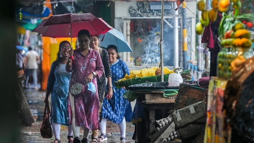
A low-pressure area has formed over northern Odisha and adjoining Gangetic West Bengal and Jharkhand, which is expected to bring heavy and widespread rainfall over central and adjoining eastern India in the next five days. Rainfall will increase over the west coast, while heavy rainfall will continue over parts of northwest India, including Himachal Pradesh and Uttarakhand, for at least two more days, the weather bureau said.
Also read: 624 killed in ongoing monsoon season, highest in Gujarat: Data
“For the next one week, we can expect active monsoon over central India. A low-pressure area has developed while another cyclonic circulation will develop around Tuesday. These will lead to good rainfall and may cover the rain deficiency over central and peninsular region,” said M Mohapatra, director general at the weather office. “The western disturbance will also continue to being rain to north India.”

Although El Nino conditions, which usually dampens monsoon rainfall, set in earlier this month, according to the World Meteorological Organisation, India is yet to see its impact on the monsoon, experts said.
Distribution of monsoon rainfall, however, has been extremely skewed so far since June 1, with no deficiency overall but 49% excess over northwest India; 19% deficiency over eastern and northeastern India; 22% deficiency over peninsular India and 1% excess over central India.
Out of 36 meteorological subdivisions, 15 continue to record deficient rain (-59% to -20%); 10 normal (-19% to 19%); five excess (20% to 59%) and six large excess (60% or more). Monsoon made a delayed onset over Kerala on June 8, but conditions were weak for two weeks because extremely severe Cyclone Biparjoy had pulled away all convection and moisture. June had ended with 10% rain deficiency.
A low-pressure area has formed over northern Odisha and adjoining Gangetic West Bengal and Jharkhand on Sunday. The western end of the monsoon trough is running near its normal position and the eastern end is running south of its normal position. A western disturbance is seen as an upper air cyclonic circulation over northern Pakistan and adjoining Jammu and Kashmir. Another cyclonic circulation is likely to form over northwest Bay of Bengal around July 18.
“Due to the formation of the low pressure area, rainfall will now increase over east and central India, including Odisha, Chhattisgarh and Madhya Pradesh,” said Mahesh Palawat, vice-president of climate and meteorology at Skymet Weather Services, a private forecaster. “The low pressure area is expected to interact with the cyclonic circulation over Gujarat and bring rainfall to the west coast particularly east Rajasthan, Gujarat up to Vidarbha. There is also a western disturbance over north Pakistan, which is likely to interact with these systems leading to good rainfall over Punjab, Delhi, Haryana and parts of the hills also.”
“An El Niño year does not mean we will always have weak monsoon conditions throughout the season. El Niño affects monsoon by bringing more frequent weak spells and breaks and prolonging them. Even in the worst monsoon year like 1987, we had active conditions for few days,” explained M Rajeevan, climate scientist and former secretary at the earth sciences ministry.
El Nino has a strong influence on the south-west monsoon in India. It is characterised by an unusual warming of waters in the eastern equatorial Pacific, which has a high correlation with warmer summers and weaker monsoon rains in India. El Nino is also associated with extreme weather events such as floods and droughts.
The world had the hottest week on record between June 3 to 7, according to preliminary data, the World Meteorological Organisation said last Monday. It follows the hottest June on record, with unprecedented sea surface temperatures and record low Antarctic Sea ice extent, it added.
The weather agency’s statement came at a time when Himachal Pradesh, parts of northern Punjab, Haryana and Delhi recorded unprecedented rainfall and Himachal Pradesh saw massive damage to bridges, highways and other infrastructure last week.
“The exceptional warmth in June and at the start of July occurred at the onset of the development of El Niño, which is expected to further fuel the heat both on land and in the oceans and lead to more extreme temperatures and marine heatwaves,” Christopher Hewitt, WMO’s director of climate services, said in a statement. “We are in uncharted territory and we can expect more records to fall as El Niño develops further and these impacts will extend into 2024. This is worrying news for the planet.”



