Western Himalayan Region and East and Northeast India are likely to witness a significant reduction in wet spells from today, according to the Indian Meteorological Department (IMD). The Met department has also predicted fairly widespread to widespread rainfall with thunderstorms, lightning and hailstorm over sub-Himalayan West Bengal and Sikkim today.
Widespread light to moderate rainfall with thunderstorms is likely over northeast India, with isolated heavy rainfall over Arunachal Pradesh during the next 24 hours. Isolated to scattered light rainfall is very likely over Western Himalayan Region on February 6-7 under the influence of a feeble Western Disturbance.
Under the influence of another Western Disturbance, scattered to fairly widespread light/moderate rainfall is very likely over the Western Himalayan region on February 8-9. Isolated light rainfall is expected over northern parts of Punjab, Haryana, and Chandigarh on February 8-9.
Cold and fog conditions
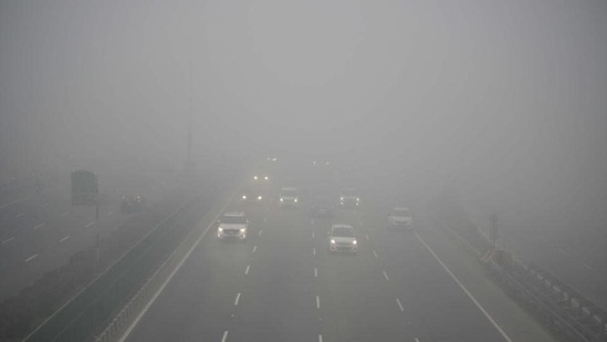
Cold to severe cold day conditions is likely to prevail in some parts over Uttarakhand, Punjab, Haryana, Chandigarh, Delhi and West Uttar Pradesh during the next 24 hours. Dense to very dense fog conditions in isolated pockets is expected over plains of northwest India during the next 2-3 days.
Dense to very dense fog conditions are likely in some parts in the night and morning hours over Uttarakhand, Punjab, Haryana, Chandigarh, Delhi, north Rajasthan and Uttar Pradesh during the next two days.
{{/usCountry}}Dense to very dense fog conditions are likely in some parts in the night and morning hours over Uttarakhand, Punjab, Haryana, Chandigarh, Delhi, north Rajasthan and Uttar Pradesh during the next two days.
{{/usCountry}}The MeT department said that the induced cyclonic circulation over north Haryana and neighbourhood is very likely to move east-northeastwards away from northwest India by February 5.