
 E-Paper



Uttarakhand flash floods: Seen via satellite in ’22, lake strengthens glacier theory
However, NIDM did not confirm that glacial lake outburst flood (GLOF) could be the cause of the disaster.

 Prefer HTon Google


The National Institute of Disaster Management (NIDM) has identified a glacial lake upstream of the Kheer Ganga river, lending support to the analysis by some glaciologists who opined that flash floods and mudslides that ravaged Dharali in Uttarakhand may have been set off by a glacier collapse.
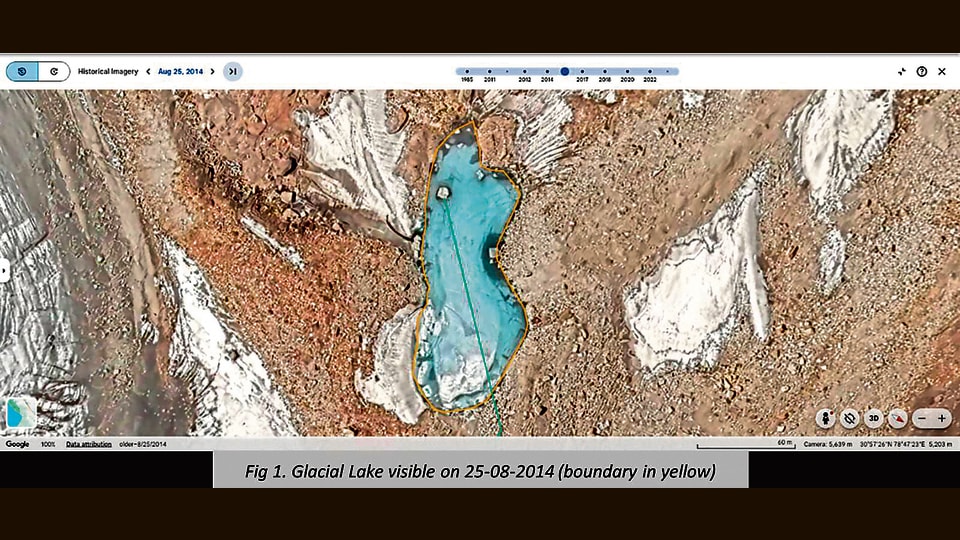
However, NIDM did not confirm that glacial lake outburst flood (GLOF) could be the cause of the disaster.
In its note released on Friday, NIDM identified the glacial lake (area 0.8156 ha; perimeter 423 m; height 5,200m) in four optical satellite images taken in 2014, 2020 and twice in 2022. However, there is no optical imagery available post-2022 to confirm the existence of the glacial lake. Further, volume of the lake remains unknown, limiting the ability to estimate the potential outburst discharge or its downstream impact.
“It is clearly established that the Dharali catchment contains glacial mass and debris, moraines, and a steep slope gradient conducive to glacio-fluvial debris-laden flash flows. NIDM’s GIS Data Lab’s catchment analysis using SRTM 30m DEM (Digital Elevation Model) reveals that location of the lake and drainage pattern indicate potential hydrological connectivity to Dharali via the Kheer Ganga rivulet, which descends roughly 2,660 metres over 11.38km before joining the Bhagirathi River,” the note said.
This hypothesis, NIDM said, is based purely on “remote sensing and topographical analysis.”
“High-resolution imagery, in-situ field surveys to confirm moraine stability and sediment dynamics, and hydrological modeling will be essential to validate or rule out the role of this glacial lake,” it added.
“While NIDM is not confirming that a GLOF could be the cause of the disaster, the institution is contributing a fresh hypothesis that the scientific community could consider when evaluating the causes,” NIDM has said.
A GLOF is a release of meltwater from a moraine- or ice-dam glacial lake due to dam failure. Experts have not yet confirmed if the August 5 disaster can be specified to be a GLOF. They have only indicated that the debris may be linked to an event associated with the glacier.
HT reported on Friday that the flash floods in Uttarakhand on Tuesday caked much of Dharali village in mud and debris, burying entire buildings, roads, trees and plantations, satellite images taken two days after the disaster show.
Sediments that barrelled down the Kheer Ganga river and swept through the remote village in the upper reaches of Uttarakhand has also blocked a large span of the Bhagirathi river downstream, cutting off a significant part of its pathway, show the images from the National Remote Sensing Centre.
The satellite pictures, from June 13 and August 7 show that a bridge and what appears to be orchards are also inundated.
Experts said the images will help the administration and scientists understand what caused the carnage, which left hundreds missing. Some experts have postulated that the flash floods and mudslides may have been set off by a glacier collapse upstream of Kheer Ganga.



