
 E-Paper



Six decades of Delhi Master Plan and its future
In November 1959, the government notified the scheme of “Large-Scale Acquisition, Development and Disposal of Land in Delhi”

 Prefer HTon Google


The basic object of the Delhi Development Act, 1957, is “to promote and secure the development of Delhi according to the Plan”. Delhi Master Plan was given statutory shape on September 1, 1962. It assessed the existing deficiencies in housing, community facilities, services, etc. and projected requirements for 4.6 million (revised to 5.3 million) population in 1981. The urbanised area of 42,700 acres in 1958-59 was enlarged to 1,10,500 acres.
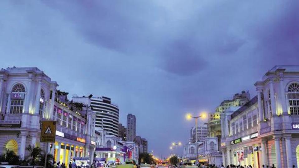
In November 1959, the Government under the Land Acquisition Act of 1894, notified the scheme of “Large-Scale Acquisition, Development and Disposal of Land in Delhi”.
The Master Plan of Delhi in 1962 (MPD-62) set the ball rolling for the planned development of Delhi and infrastructure services. The process was largely public sector-led. As per the DDA surveys the total urban area of Delhi in 1981 was 48,777 ha, which was quite close to the projection of the MPD 1962. This was added by about 20,000 ha during 1981-2001, making a total urban area of 68,777 ha, which comprised mainly Rohini, Narela and Dwarka sub-cities.
The Master Plan of Delhi -2001 (MPD–2001) projected a population of 12.20 million to 13.8 million for the year 2001. The Master Plan of Delhi 2021 was notified in February 2007, which projected the population of Delhi to be 22 to 23 million in the year 2021. The Census 2021 has not yet been undertaken. However, preliminary estimates by the Census of India indicate a population of 20.6 million.
After more than six decades of planning, Delhi is facing the challenges of pollution, water and energy shortages, climate change, transportation and environment. The Draft Master Plan for Delhi-2041 approved by the DDA on February 28, 2023 and sent for the final approval of the Union government, has followed the approach of 20 years master planning. Today, more than half of Delhi remains unplanned with slums and unauthorised colonies. More than 80% of Delhi’s workforce belongs to the informal sector with precarious jobs and limited access to health, education and food security. The master plan, and the planning process, need to be redefined given the emergence of new technologies, the ‘Whole of Government Platform’, smart systems and Sustainable Development Goals in the last decade. It is necessary to rationalise densities and FAR by a compact and composite urban form. The strategy of green building needs to be interfaced with smart systems and services.
This means that the Master Plan is segmented into the following set of plans:
Emergency Plan (5 Years), Strategic Plan (10 Years) and Vision Plan (20 Years)
These plans manifest innovative concepts of energy, circular economy and construction, low carbon, climate and disaster resilience, interlinked greens and sustainable water, energy and waste management systems.
The Emergency Plan
Air Quality: Air quality in Delhi is deteriorating due to the indiscriminate use of fossil fuels in vehicles, dust and industrial emissions. Relatively high levels of suspended particulate matter, dust, SPM, SO2, NO2, CO2 and heavy metals, including lead content in the exhaust of automobiles have been observed (Central pollution Control Board, 2018). The recent changes in the fuels, electric and hydrogen powered vehicles, adoption of clean technologies, new emission norms, development of shared taxis, NMTs and mass rapid transport system can reduce the pollution levels due to vehicular emissions. The indoor and outdoor air should be free from microbial, allergy, toxins, dust and mites, by proper ventilation, sun and temperature control.
The installation of engine optimisation and promoting rail, cable cars and waterways for public transport and freight can reduce black carbon emissions by 90%. The electric cars, e-rickshaws, e-buses, car-pooling and ridesharing can contribute much in this task.
To control dust, it is necessary to adopt green cover, trees and shrubs and the vacuum sweeping of roads. Dust particles can be controlled by screens, filters, flagging machines, vacuum cleaning, humidification, sprinkling of water and artificial rain.
Water Resources and Rejuvenation of River Yamuna
The 1376 km-long Yamuna river flows for 48 km in Delhi. It has become a dirty drain with the disposal of sewage by 22 major drains, industrial wastes, solid waste dumps, fly ash ponds, unsewered slums and unauthorised colonies in the watershed.
The National Mission for Clean Ganga (NMCG) has plans for the construction of 1,840 MLD STPs through 21 projects in Delhi, which is being executed by the Delhi Jal Board under demand-supply model. The solutions may further include sponge cities, recycling of the waste, zero waste discharge, river health monitoring, pollution control, water sensitive design and floodplain management.
Conservation and cleaning of the polluted Yamuna, drains and water bodies and biodiversity parks have been taken up to improve the river ecology. Under the Namami Gange, city-wide integration of the STPs, and creation of new capacity have been taken up. Conservation of wetlands along the river, and pollution control of the other rivers such as the Hindon, has also been initiated.
Clean and Congestion Free Transport
Multi-modal connectivity integrating BRT, Metro, and trains, together with last mile connectivity, pedestrian and cycle lanes, can provide sustainable and clean transport. The public transit nodes and corridors can be flanked by public, semi-public, high-density developments. Metro, trains, and sub-ways can run underground for easy bike and pedestrian traffic on the grade. Along major roads right hand turning can be without signals by providing the underpasses.
Also Read:‘Delhi is in an utter mess’: Supreme Court rebukes Centre on Master Plan delay
Existing roads can be revamped and landscaped to enhance space for pedestrians, cyclists and public transit systems. All major roads, highways and railway/metro lines should provide safe crossings for pedestrians, wheelchairs, prams and animals.
Digital parking metres inform on mobile phone the availability of parking space, reducing traffic caused by drivers trolling for space. The concepts of cordon pricing, minimum occupancy vehicles, ceiling on new registration of private vehicles and establishment of a Unified Metropolitan Transport Authority are necessary for congestion free and clean urban transport.
Climate and Disaster Resilience and Heat Mitigation
With rising temperature and climate change, climate resilience is a critical area of planning and design of built-up areas. In view of the Isarael-Palestine- Syria-Lebanon-Iran and Russia-Ukraine wars, the disaster management plan should include the preparation for chemical, biological, radiological and nuclear (CBRN) attacks.
In a built-up area, the hot air dome affects the microclimate. The greenery and open space in windward direction and cooler surface materials (roads, parking, buildings, roofs, etc.) help in mitigating the effects of climate change and urban heat island. This needs preparation of a city-wide Heat Mitigation Plan and mandatory use of heat reflective and permeable materials for rooftops, pavements and roads. Insulation, white paint, cavity walls, water fountains, greenery, vegetation and cross ventilation also mitigate the urban heat.
A Climate-sensitive design approach recognises that the design of a built-up area directly influences the climatic comfort in an urban environment. Green urban planning combines climate sensitive solutions and adaptation strategies in the context of the SDGs, national and local policies. For a scientific analysis of carbon emissions and impact on climate change, a climate compass can be developed for the urban processes- ecology, resources, health and wellbeing and place-making. Location is most important for the livelihoods and to reduce the need to commute. As a principle, the distance between work and home should be below 15 minutes by public transport, cycle or walk, that is 10 km, 3 km, and 1 km respectively.
Low carbon lifestyle is a cluster of habits and sustainable lifestyle requires a change in social norms and rethinking the ways of living based on the principles of organicity, non-accumulation (aparigraha), minimalism and slowing down. The reuse and repair culture needs to be promoted by provision of repair workshops in all the localities. Environment and climate strategies cannot work without involving women, who comprise nearly half of the population and work every day in home and on fields. They often face the ‘gender service gap’ in terms of access to energy, water, and toilets. A sustainable city must be gender sensitive with adequate, safe and affordable spaces for living, working and vending by the women.
Informal Settlements and Housing
Delhi has a population of 206 lakh (2021), which is projected to grow to 292 lakhs in 2041. About half of the total population and 70% of the poor are living in slums and informal settlements. According to the 2011 Census, Delhi has 44.8 lakh Census houses of which 61% comprise two rooms or less. About one-sixth of the population of Delhi is living in the slums and slum clusters.
Delhi is a conglomeration of 2025 planned colonies, 367 villages, old city (Shahjahanabad), 2000 unauthorised colonies, namely 57 pre-master plan residential colonies, 36 rehabilitation Colonies, 60 resettlement colonies, 126 cooperative societies, 800 cooperative societies (Group Housing), DDA housing (about 5.4 lakh units) and government staff housing (about 1.5 lakh units).
For grant of ownership rights in the 1797 unauthorised colonies, the MOHUA vide its notification dated October 29, 2019 enacted the NCT of Delhi (Recognition of Property Rights of Residents in Unauthorised Colonies) Regulations, 2019.
The Master Plan of Delhi (MPD 2021) provide for the composite redevelopment of unplanned areas by amalgamation of the plots to a minimum combined area of 1670 sqm with an incentive FAR up to 400, along with widening of roads, parking spaces and the structures conforming to fire and structural safety standards.
The Strategic Plan
Land Pooling and Urban Extensions Plan
With a view to facilitate landowners to participate in urban development, the MPD 2021embarked upon the concept of land pooling. However, after 17 years, it is still not operational. It needs a rethinking and adoption of a hybrid land policy with digital ledger and blockchain.
A hybrid land pooling policy prioritises the laying of the public services (water system, sewage, drainage, electricity and roads), which take about 5 years. The present policy stipulates handing over 40% of land to the DDA/service agencies as and when required, which may lead to fragmented development, delays and illegal building. This can be avoided by digital planning and land management.
Digital Innovations and New Technologies
New technology is changing the script of urban planning and management. The ICT (Information and Communication Technology), Artificial Intelligence, Big Data Analytics, Machine Learning, Deep Learning, blockchain, GIS, GPS, etc. are disrupting the urban processes by intelligent and smart planning, infrastructure and services, transport systems, land management and enforcement. Digital Twins provide a technology platform for 3D modelling and virtual representation of an object or a system that uses sensors, drones, 5G Internet of Things (IoT) and industrial IoT (IIot) data.
The Ministry of Housing and Urban Affairs (MOHUA) has launched the National Urban Digital Mission (NUDM). It aims to push for the outcome-based digitalisation of planning and governance. The Data Acquisition and Exchange Programme enables data to be exchanged, analysed and linked with National Urban Learning Platform, Smart Code, National Urban Governance Platform and Delivery of Online Governance.
The Integrated Command and Control Centre (ICCC) is one of the key projects under the Smart Cities Mission. The ICCC coordinates multiple municipal functions, disaster management /resilience, traffic and transportation, environmental monitoring, weather, and emergencies.
The Whole of Government Platform as adopted in Gati Shakti Master Plan, enables easier collaborations across departments, dramatically simplifying the planning process while ensuring the design that is mindful of all economic, environmental and social aspects. Area Development Approach creates convergence of various infrastructure services, workspaces and social amenities such as education and hospitals, parks, art and cultural spaces, tourism, etc. common platform enables better synchronisation bridging gap between the plan and implementation.
Unified Development Controls and Building Regulations
With the passage of time development control regulations and building byelaws have become too complex with multiple authorities controlling various aspects like land pooling, building bylaws, fire safety and so on. All these need to be put on a common digital platform integrating planning, environmental and building regulations and enforcement.
The Vision Plan
The vision plan aims to address the wide and long ranging issues:
Regional Decentralisation
The NCR Plan under NCR Planning Board Act, 1985 covers the National Capital Region (55,083 sq. km). It envisages the decentralisation of economic activities for a balanced regional growth. No new central government and public sector undertaking offices should be located in the NCTD. Industrial growth in Delhi should be restricted to high-tech and zero polluting units. Legal and fiscal measures be adopted to restrict employment in industries and distributive trade.
Major regional transport corridors with dedicated freight and logistic nodes may be developed along the highways, railway corridors and Regional Rapid Transit System (RRTS) to help in decentralisation of economic activities.
The Natural Zone covering the Forests, Wildlife Sanctuary, Ridge, River Yamuna and water bodies should be conserved and kept free from urban evelopment.
Local Food Production and Urban Farming
Urban farming and local food production can be initiated in Delhi to bridge the gap between urban and rural and to reduce movement of agriculture products. Making the city to grow its own food can be possible by vertical farms, rooftop, and household agriculture. Satellite controlled micro-irrigation system cuts water consumption and pumping power. Vertical farms could reduce fertilizer and freshwater use, shorten transport and recycle grey water and rainwater.
Green Infrastructure and Amenities
Surveys reveal that approximately 40% of urban population in Delhi is not covered by sewerage, sanitation, drainage and solid waste disposal. Various alternative technologies can make the services smart and intelligent. The common method of land filling for solid waste disposal is an environmental disaster. Instead, decentralized systems based on 5 R strategy of reduce, refuse, reuse, recovery and recycling should be explored. Three bins provide separate bins for trash, recyclables and compost. Biotechnology, enzyme based STP, bio-remedial treatment, vessel system, sludge gas/energy recovery, vermi-culture, fossilization and compositing options can be adopted for solid and liquid waste management. Underground pneumatic conveying systems which are more hygienic, can avoid movement of trucks for transportation of wastes.
Financing and Mobilising Investments
The McKinsey report estimates that nearly 45% of the urban financial requirements can be met through various land and asset monetization strategies, such as development charges, impact fees, building fees, land use conversion charges and sale of Floor Area Ratio (F.A.R) or air rights. Besides the government grants, innovative tools, such as green Municipal Bonds, Urban Infrastructure Development Fund, Tax Incremental Financing, Toll Tax, Land Banking, Infrastructure Investment Trust, Value Capture Finance, Impact Fees, Betterment Levy, land use charges, etc. can be adopted for urban financing.
AK Jain is Former Commissioner Planning, Delhi Development Authority)


