
 E-Paper



Kashmir higher reaches receive snow, rains in plains
The rains and snow brought down temperatures across Kashmir; Meteorologist M Hussain Mir said rains and snow were indicative of the ‘change of season’ from autumn to winter


Rainfall in plains and light snow on mountains continued for the second day on Monday in Kashmir. The weather improved by the afternoon.
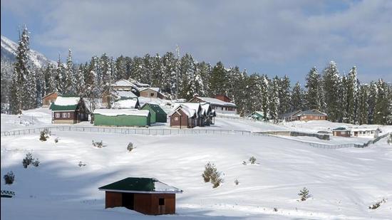
The rains and snow brought down temperatures across the valley.
The intermittent rains lashed the valley from Sunday wee hours and continued on Monday night and morning as well. By the afternoon, the weather improved and the sun was out, though the temperature still was below normal.
Meteorologist M Hussain Mir said the rains and snow were indicative of the ‘change of season’ from autumn to winter.
“The rains were the result of a combination of westerly and easterly disturbances with moisture from the Arabian Sea and the Bay of Bengal,” Mir said.
“The precipitation affected the whole union territory,” he said.
Director, J&K meteorological department, Sonam Lotus said the weather will improve from Monday afternoon.
“Mainly dry weather is expected from October 19 to 22. There is no forecast of any major rain or snow for next 1 week, “ Lotus said.
However, Mir said from October 23 the weather was expected to remain mostly cloudy.
He said the latest rains brought down the day temperatures by 6-7°C.
The ski resort of Gulmarg in north Kashmir received the highest precipitation of 33.2 mm till morning on Monday with the day temperature of 7.2 °C on Sunday down from a normal of 13.1 °C.
Summer capital Srinagar got 14.8 mm of rain with the maximum temperature recorded at 15.1°C.
In south Kashmir, the tourist resort of Pahalgam recorded 11.4 mm precipitation and a maximum temperature of 12.6 °C.
This month has already witnessed two spells of rain. Jammu and Kashmir’s (J&K) mountain tops received snowfall while rains had lashed the union territory on October 11.


