
 E-Paper



Deep depression to cause extremely heavy rainfall over Gujarat, Rajasthan: IMD
Since June 1, there has been a 9% surplus rainfall over the country, with 20% deficiency over east and northeast India.

 Prefer HTon Google


Heavy to very heavy rainfall is likely to continue over southwest Rajasthan and north Gujarat, with possibility of extremely heavy rain (over 20 cm) at isolated places over Saurashtra and Kutch regions between Monday and Tuesday, the India Meteorological Department (IMD) has said.
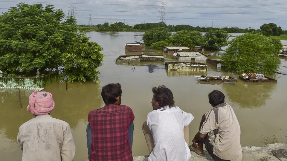
Since June 1, there has been a 9% surplus rainfall over the country, with 20% deficiency over east and northeast India; 37% excess over northwest India; 11% excess over central India and 8% excess over Peninsular India.
According to the IMD forecast, isolated heavy to very heavy rainfall is likely over sub-Himalayan West Bengal and Sikkim till September 10; Arunachal Pradesh, Assam and Meghalaya during September 12 to 14 and Nagaland and Manipur on September 11 and 12, India Meteorological Department has warned. A fresh spell of heavy to very heavy rainfall is likely over Odisha on September 11 and 12.
Met department officials said the monsoon trough is running south of its normal position, while the depression over north Gujarat and adjoining southwest Rajasthan moved nearly westwards and intensified into a deep depression over the same region on Sunday.
“It moved slowly west-northwestwards and lay centred over southeast Pakistan and adjoining Rajasthan and Kutch at 8.30am on Monday, about 90km southeast of Chhor (Pakistan), 120 km southwest of Barmer (Rajasthan), 170 km northwest of Radhanpur (Gujarat), 190 km west-northwest of Jaisalmer (Rajasthan), and 210 km north-northeast of Bhuj (Gujarat). It is very likely to move nearly northwestwards as a deep depression across southeast Pakistan and adjoining Rajasthan. Thereafter, it is likely to move nearly westwards and weaken gradually into a depression,” the IMD said in its bulletin.
An upper air cyclonic circulation is lying over south Punjab and its neighbourhoods in the lower tropospheric levels. A trough is running from cyclonic circulation associated with deep depression over southeast Pakistan and adjoining Rajasthan and Kutch to south Punjab in lower tropospheric levels. An upper air cyclonic circulation is also lying over northwest Bay of Bengal and adjoining west central Bay of Bengal off south Odisha and north Andhra Pradesh coasts in lower, and middle tropospheric levels tilting southwards.
Under the influence of these systems, there is likely to be heavy to very heavy rainfall with extremely heavy showers (in excess of 21cm) at isolated places over Saurashtra and Kutch on September 8 and isolated heavy to very heavy rainfall over north Gujarat, with isolated heavy rainfall over Saurashtra and Kutch on September 9 (Tuesday).
Meanwhile, light to moderate rains, and thunderstorms, are likely at some places in Uttarakhand on September 12 and 13; west Uttar Pradesh on September 12 and 13; east Uttar Pradesh on September 11 and 12.



