
 E-Paper



Dense fog continues to envelop Indo-Gangetic plains region
Whenever an intense Western Disturbance passes, there is a lot of moisture in the air and the air is also cool. These conditions are favourable for fog formation, says IMD


There is dense to very dense fog over Punjab, Haryana, Chandigarh, Uttar Pradesh and moderate to dense fog over Delhi, north west Rajasthan, north west Madhya Pradesh, Bihar, Assam and Meghalaya today according to India Meteorological Department (IMD).
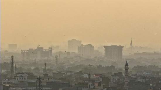
Visibility at 5.30am today at Chandigarh, Bareilly and Gorakhpur was less than 25 m; Amritsar, Ambala, Ganganagar, Gwalior, Baharaich, Patna, Gaya, Bhagalpur, Purnea, Guwahati, Tezpur, Agartala and Silchar less than 50 m; Patiala, Hisar, Agra, Lucknow at less than 200 m and Delhi’s Safdarjung and Palam at less than 500 m.
There is spell of dense fog or a low cloud layer over the entire Indo-Gangetic plains region since Saturday.
“We had predicted dense fog. Whenever an intense Western Disturbance (WD) passes, there is a lot of moisture in the air and the air is also cool. (A WD caused widespread snowfall in the hills and rain in the plains on January 6 and 7). These conditions are favourable for fog formation and also for development of cold day to severe cold day conditions. Today, there was a dense fog in Punjab, Uttar Pradesh and Bihar,” said M Mohapatra, director general, IMD.
Current spell of dense to very dense fog across Indo-Gangetic plains is likely to reduce during the next 2-3 days with likely occurrence of dense to very dense fog in isolated to some pockets very likely over Punjab, Haryana, Chandigarh, Delhi, Uttar Pradesh, north Rajasthan, Bihar, Sub-Himalayan West Bengal & Sikkim, Odisha, Assam, Meghalaya and Nagaland, Manipur, Mizoram and Tripura during the same period. Cold day to severe cold day conditions in isolated pockets is very likely over Punjab and Haryana, Chandigarh and Delhi during the next 24 hours and cold day conditions in isolated pockets over Uttar Pradesh, Bihar and West Bengal during the next two days.
Currently, easterly winds are prevailing at lower levels over plains of north India. This is likely to cause gradual rise in minimum temperatures by 2-4 degrees C over most parts of northwest India during the next 48 hours (till January 19). Thereafter, reversal of wind direction to westerly/northwesterly is likely from January 20. This is likely to cause gradual fall in minimum temperatures by 2-4 degrees C during subsequent 2-3 days (January 20 to 22) over the same region.
According to IMD, a cold day or a severe cold day is classified as such based on two parameters—a minimum temperature of under 10 degrees C and maximum temperature of 4.5 degrees C or 6.4 degrees C below normal, respectively.
A cold wave occurs in the plains when the minimum temperature is 10 degrees Celsius or below and/or is 4.5 notches lower than the season’s normal for two consecutive days. A cold wave is also declared when the minimum temperature is less than 4 degrees C in the plains.


