Rain lashed parts of Delhi and the national capital region amid a red alert warning issued by the India Meteorological Department (IMD) for several districts for a couple of hours on Tuesday.
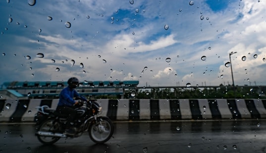
The red alert was effective from 2:45 pm till 4:45 pm, according to IMD nowcast.
Latest radar image of Delhi showed intense convection over western parts of the city and adjoining districts of Haryana.
Districtwise nowcast warning on IMD website showed red alert over South Delhi, West Delhi, Northwest Delhi, Southwest Delhi and New Delhi districts, while South east, East and North Delhi were under an orange-coloured warning. East Delhi, Uttar Pradesh's Noida and Ghaziabad were under yellow alert.
A red alert was issued for Haryana's Gurugram as well.
Parts of the national capital region woke up to light to moderate rain on Tuesday morning, however, there were no known reports of severe waterlogging.
The minimum temperature settled at 23.9 degrees Celsius, 2.5 notches below normal on Tuesday, while the maximum was expected to settle around 31 degrees Celsius.
{{/usCountry}}The minimum temperature settled at 23.9 degrees Celsius, 2.5 notches below normal on Tuesday, while the maximum was expected to settle around 31 degrees Celsius.
{{/usCountry}}In the last 24 hours ending 8.30 am on Tuesday, the city’s primary station Safdarjung recorded 10.4 mm of rainfall, while other stations reported 8.9 mm at Palam, 5.4 mm at Lodhi Road, 12.6 mm at Ridge, and 16 mm at Pitampura, according to the IMD.
The relative humidity was 100 per cent at 8.30 am.
Meanwhile, the air quality in Delhi remained in the satisfactory level with an Air Quality Index (AQI) reading of 55, according to the Central Pollution Control Board (CPCB).
CPCB categorises an AQI between zero and 50 as “good”, 51 to 100 “satisfactory”, 101 to 200 “moderate”, 201 to 300 “poor”, 301 to 400 “very poor”, and 401 to 500 “severe”.