
 E-Paper



Mumbai rains: Same spots flood every year, but BMC refuses to listen, say residents
Encroachments and poor planning plague low lying areas in Mumbai, say residents


Sion, Kings Circle, Kurla, Bandra, Mahim, Dadar, and Matunga were severely flooded on Tuesday, with public and private transport coming to a standstill. These areas form the backbone of Mumbai, connecting the island city to its suburbs, or forming entry points to the suburbs. However, they flood every monsoon, with the civic body refusing to listen to residents’ claims, said activists.
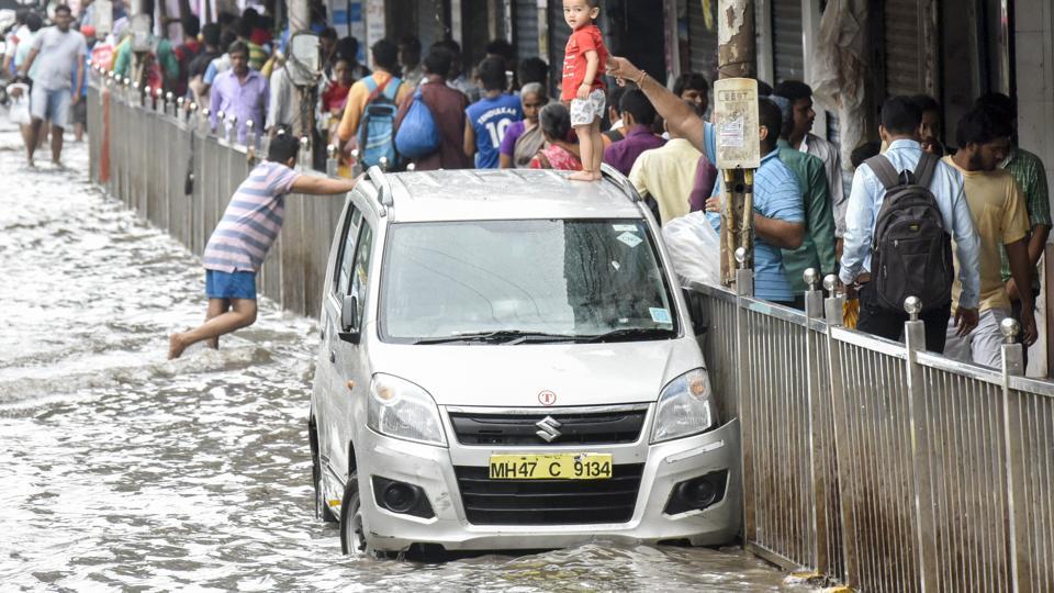
These areas are low lying. Coupled with encroachment on their river banks and a lack of planning on the BMC’s part, they are often water logged, said environmentalists.
The Madhav Chitale committee — set up after Mumbai’s 2005 deluge — determined these areas to be the worst affected in the city, along with Kalina, Govandi, and Chembur. It suggested area-specific measures to mitigate flooding, such as risk zone mapping, and creating special disaster response guidelines in high-risk zones. However, the disaster management department has no such plans.
“I don’t know about zone mapping as the storm water drains department carries out this task. It must have done so this year,” said a senior official.
Transport expert Ashok Datar, who was associated with Concerned Citizens’ Committee, which submitted suggestions to the Chitale Committee said maps can be used to inform residents that their areas are likely to flood. “Authorities can use these areas to formulate precautionary measures,” he added.
George Abraham, former Kalina corporator, had resigned over the “BMC’s lack of will to prevent flooding”. He said little has changed since 2005. “Two months before the 2005 monsoon, I asked the BMC to pay attention to Bandra and Mahim as they were likely to flood. As the BMC did not act, the areas flooded, so I resigned in protest,” he said.
Abraham said Bandra and Kalina are prone to floods owing to the narrow mouth of the Mithi river. Though the river was subsequently widened, Godfrey Pimenta, of Watchdog Foundation,sent the BMC recently Google images of the river taken in 2005 and 2017. He said people continued to encroach on the river banks.
“The city has several low-lying areas that are prone to seasonal flooding. To mitigate this, the Development Plan 2034 suggests buffer zones along rivers, creeks and nullahs. But, some have been marked and some have not,” he said.
“The dewatering pumps in these areas were all working on Tuesday. Desolating of nullahs in these areas has been systematically done,” said a senior civic official, who did not wish to be identified.
Stay updated with all the Breaking News and Latest News from Mumbai. Click here for comprehensive coverage of top Cities including Bengaluru, Delhi, Hyderabad, and more across India along with Stay informed on the latest happenings in World News.


