The monsoon season may have officially ended on paper on Wednesday, but its withdrawal from Uttar Pradesh is likely to take another two to three days, with the process stalled since September 23 due to a depression over central parts of the state, according to the India Meteorological Department (IMD).
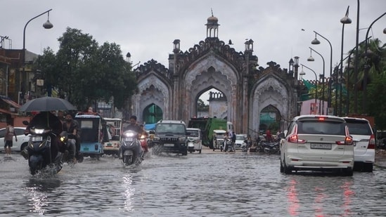
The delay comes as the state recorded more than 802.9 mm of monsoon rainfall this season, crossing the 800-mm mark for the first time in 10 years. The rainfall pushed UP’s seasonal total to 8% above normal, with the excess concentrated largely in western parts of the state.
Also Read: India monsoon ends 12.6% below normal, fourth-lowest rainfall since 2001
“Theoretically, the four-month monsoon season, from June 1 to September 30, has ended. However, withdrawal from the remaining parts of UP is likely to take another few days,” said Atul Kumar Singh, senior scientist at the Regional Meteorological Centre, Lucknow.
The withdrawal of the southwest monsoon began from western UP on September 23, four days ahead of its normal schedule, but made no further progress thereafter due to the influence of the depression that moved across central UP. “Conditions are now likely to become favourable for further withdrawal of monsoon from remaining parts of the state during the next two to three days,” Singh said.
{{/usCountry}}The withdrawal of the southwest monsoon began from western UP on September 23, four days ahead of its normal schedule, but made no further progress thereafter due to the influence of the depression that moved across central UP. “Conditions are now likely to become favourable for further withdrawal of monsoon from remaining parts of the state during the next two to three days,” Singh said.
{{/usCountry}}Also Read: Rain subsides, danger persists: LMC to inspect 214 unsafe bldgs
“The latest position of monsoon withdrawal is passing through the western extremity of the state from Agra to Muzaffarnagar via Aligarh,” he said.
Traditionally, the normal withdrawal date is September 27 for Bijnor, September 28 for Agra, September 29 for Bareilly, September 30 for Jhansi and Mainpuri, October 3 for Lucknow and Kanpur, and October 4 for Prayagraj, Gorakhpur and Varanasi.
According to IMD officials, UP received 802.9 mm of rainfall against its long-period average (LPA) of 746.2 mm, a surplus of 8%. East UP recorded 817 mm against an average of 799.2 mm, a surplus of 2%, while west UP received 782.7 mm against an average of 672 mm, a surplus of 16%.
A well-marked low-pressure area over northern parts of central UP, along with its associated cyclonic circulation that moved north-northwestwards across the state, triggered extremely heavy rainfall between September 25 and 27.
Also Read: 81 dead as UP reels under three days of heavy rain
During these three days, UP recorded 111.3 mm of rain, an excess of 1,084% over the long-term average of 9.4 mm for the period. Rainfall above normal in 70 districts—excluding Mathura, Shamli, Gautam Buddha Nagar, Baghpat and Ghaziabad in western UP—pushed the state’s rainfall deviation from minus 6% on September 24 to plus 8%.
For the first time this monsoon, the seasonal rainfall deviation in eastern UP also turned positive, at plus 2%.
IMD data shows Farrukhabad recorded the highest rainfall at 307.7 mm, while Lucknow received 180.4 mm.
September emerged as the wettest month for UP in recent years, with the state receiving more than 244.7 mm of rainfall, nearly double the 122.4 mm recorded in the same month last year. The state received 221.4 mm in September 2024, while the figures for September 2023 and 2022 were 123 mm and 200.7 mm, respectively.