
 E-Paper



IIT Kanpur to assist ASI in Gyanvapi survey without digging or damaging structure
Professor Javed N Malik, the head of the Earth Sciences department at IIT-K, would lead the survey with ASI experts.


KANPUR An expert team from the Indian Institute of Technology (IIT) in Kanpur will help the Archaeological Survey of India (ASI) conduct a survey of the disputed Gyanvapi premises in Varanasi without damaging or digging the structure.
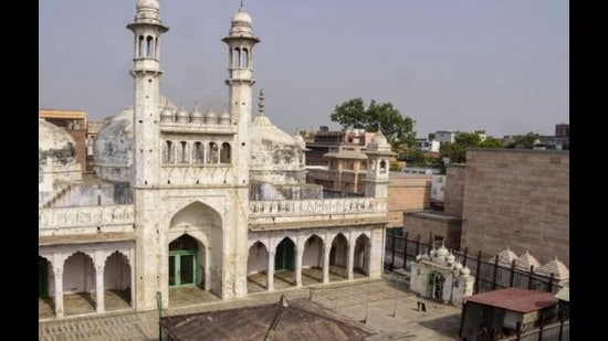
The premier institute was approached by the ASI in July. Now, the survey process will be set in motion as the Allahabad High Court on Thursday allowed Gyanvapi’s scientific survey as requested by the Hindu petitioners’. IIT-K would use the ground penetration radar (GPR) for this scientific survey/investigation.
Professor Javed N Malik, the head of the Earth Sciences department at IIT-K, would lead the survey with ASI experts. “We have worked with the ASI in the past as well. I will lead the team, comprising my colleagues, in the survey of Gyanvapi premises through GPR,” added Prof Malik.
Explaining GPR, Malik said, “GPR is a robust technique, which is non-intrusive and non-destructive, in imaging the underground structures and sub-surface mapping.”
Earlier, on July 26, the ASI told the Allahabad HC that it would be taking technical support from IIT-K to undertake the survey. This was after chief justice Pritinker Diwaker, while hearing a petition, asked the Additional Solicitor General of India to call any expert member of ASI from Varanasi to demonstrate to the court how the survey would be conducted. Justice Diwaker was hearing the plea filed by Anjuman Intezamia Masjid Committee (AIMC) challenging the Varanasi district court’s order (dated July 21) for the ASI survey of the Gyanvapi premises.
Subsequently, ASI’s additional director Alok Tiwari appeared before the court and informed the bench that during the survey, ASI won’t damage or demolish any structure or its parts (like walls or pillars). “We will not cut or dig any part of the structure. The survey will be done by non-destructive techniques. For this GPR survey, we have contacted IIT-K experts,” Tiwari told the court.
“A team will go to the Gyanvapi premises and there, the equipment can easily detect any structure, metal, concrete, or cables (8-to-10-metre-deep) in the ground. There will be two and three-dimensional profiling of whatever is found in the survey,” he said, adding that the whole survey could take a week or a little more.
Director of IIT Kanpur, Dr Abhay Karandikar, also confirmed that the experts of the institute would assist the ASI in the survey with the GPR. “Our team is prepared for the job; it will move as and when ASI asks for our assistance in the process. If the team is asked to conduct the survey on Friday morning, our team will move accordingly,” he said.
However, it is worth mentioning that Prof Malik, who is to lead the team, is presently in Singapore and is set to return to India on August 5 morning.
How GPR works?
Ground penetrating radar (GPR) is a non-destructive geophysical method, which uses radar pulses to image something beneath the surface, especially underground. It is extensively used in archaeology to detect and map buried artifacts, structures, and archaeological features. It helps archaeologists in the non-destructive exploration of historical sites and provides valuable insights into the past.
GPR emits a pulse of electromagnetic energy into the ground using a transmitting antenna. The energy pulse travels through the ground and reflects off the underground structure based on the electrical permittivity.
Thereafter, a receiving antenna records variations in the return signals, which the GPR device uses to generate images that indicate changes in electrical properties. The GPR provides images of the subsurface by using the electromagnetic spectrum in the microwave range between 10 MHz and 2.6 GHz.
The data may be plotted as profiles, as plan-view maps isolating specific depths, or as three-dimensional models. The GPR can detect both metallic and non-metallic objects giving it a wide range of applications.


