
 E-Paper



Making sense of an early monsoon | Number Theory
What does an early monsoon mean for overall rainfall during the year? An HT analysis of IMD’s rainfall data and existing research answers these questions
Updated on: May 25, 2025, 11:09:07 IST

 Prefer HTon Google
Share via


Copy link

The India Meteorological Department (IMD) announced on May 24 that the monsoon has set in over Kerala, arriving eight days before the normal June 1 date for the southernmost region of mainland India. How often does the monsoon arrive early in India? What does an early monsoon mean for overall rainfall during the year? An HT analysis of IMD’s rainfall data and existing research answers these questions.

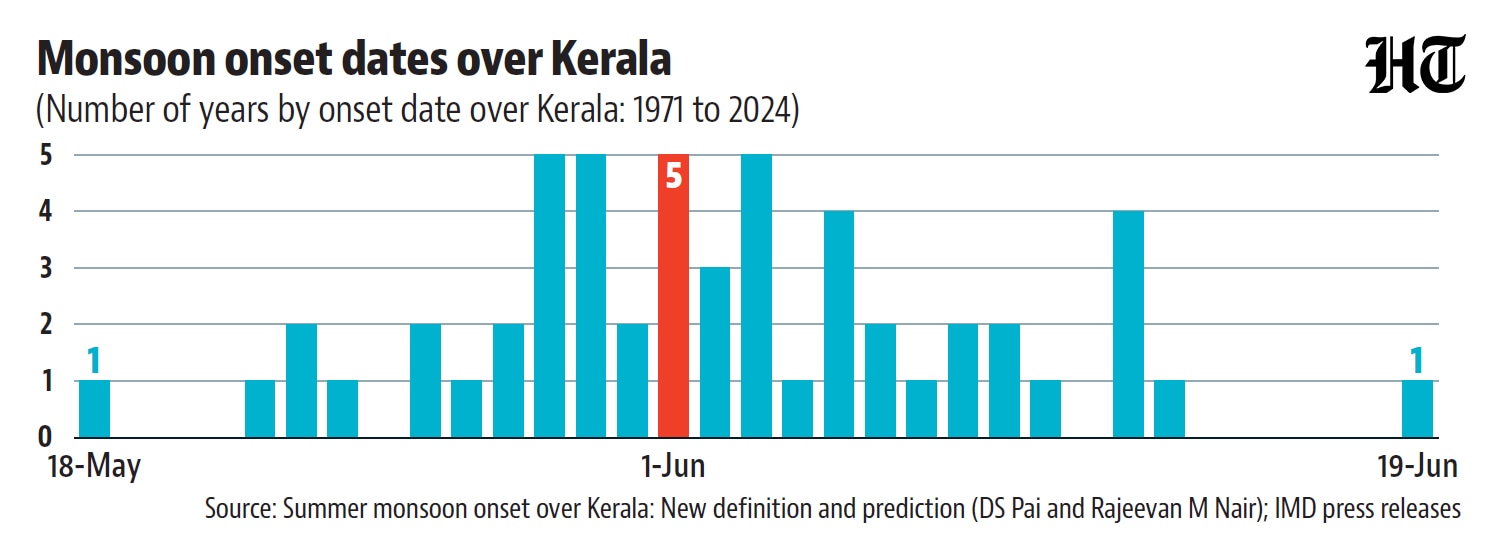
 What defines the arrival of monsoon in Kerala? It depends on a set of meteorological conditions being fulfilled. The current requirements—adopted in 2006—include: a sharp increase in rainfall over coastal Kerala stations sustained over two days, accompanied by westerly winds (up to 600 millibar or around 4-4.5 km in the 0-10°N, 55-85°E region) and a decrease in outgoing longwave radiation (a proxy for dark clouds formed through convection) below 200 watts per square meter in the 5-10°N, 70-75°E region. However, former IMD scientists DS Pai and Rajeevan M Nair have recalculated onset dates based on the new criteria going back to 1971. This shows that the monsoon arrived in Kerala before June 1 in 22 of the 54 years between 1971-2024. In 27 years, it arrived after June 1. This year’s May 24 arrival is the fifth earliest monsoon onset in the last 55 years—the earliest date being May 18, 1990.
- India’s monsoon performance is not correlated with Kerala onset dateThe onset of monsoon over Kerala is an important landmark because it indicates that the broad atmospheric patterns of the season are in place—the monsoon system actually travels a longer distance before hitting Kerala than it covers within the subcontinent. However, as the pattern of monsoon progress suggests, the onset over Kerala doesn’t predict rainfall during the June-September season. For example, the deviation in onset date over Kerala shows no correlation with the departure of rain from the Long Period Average (LPA), currently defined as the average rainfall during 1971-2020.
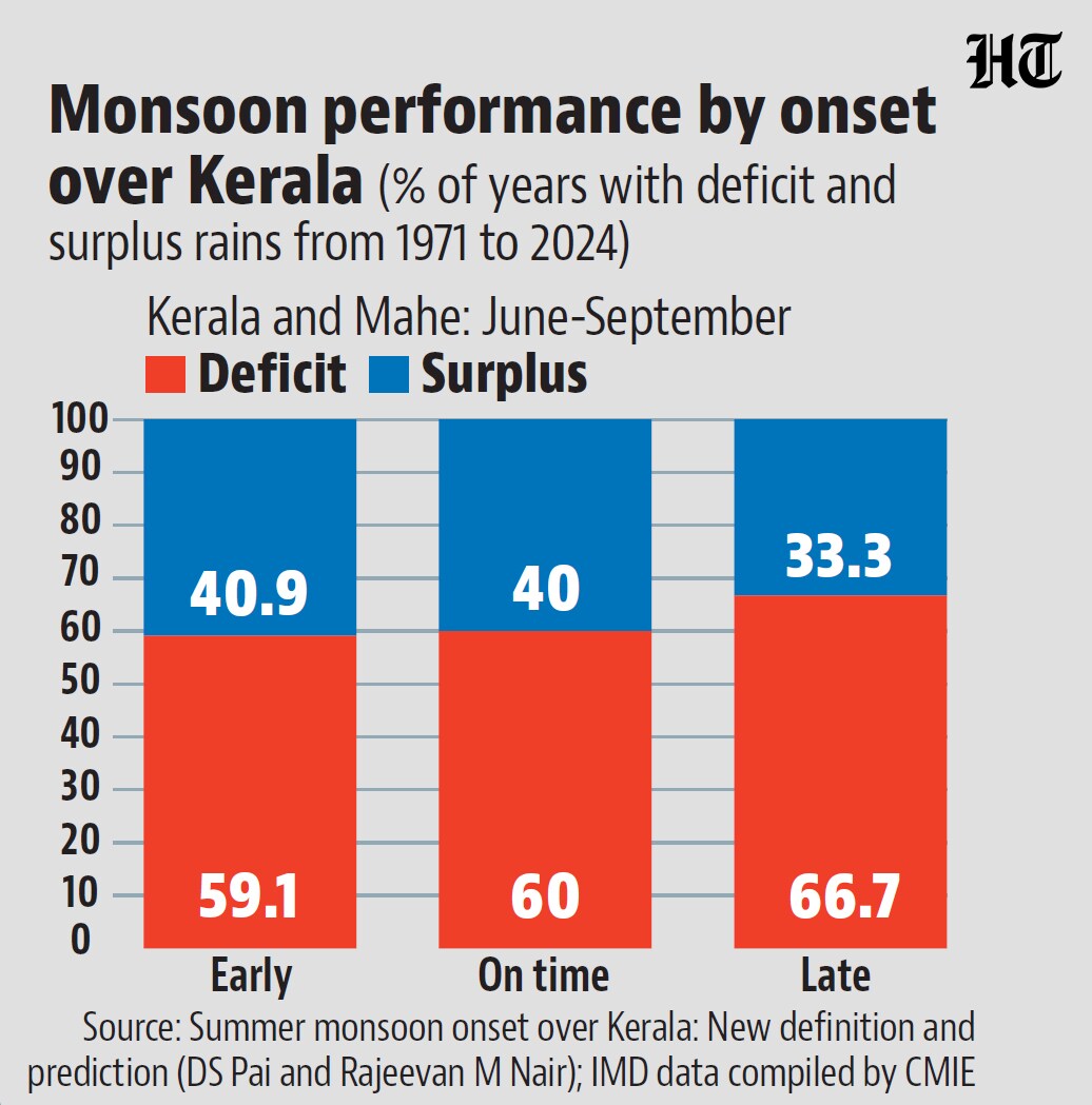
- However, an early onset over Kerala somewhat decreases the probability of deficit in KeralaIn the 27 years of late monsoon onset over Kerala, the Kerala and Mahe subdivision experienced a rainfall deficit in 78% of years in June and 67% of years during June-September. This means deficit was the most probable outcome in Kerala and Mahe subdivision during late onset years. This broad trend—deficit being the most probable event—doesn’t change for the five years when the monsoon arrived exactly on June 1 or the 22 years when it was early. However, the probability of deficit decreased to 59% (in both June and June-September) when onset was early. This means surpluses occurred more frequently in early onset years than other years, but early onset is no guarantee of surplus. This is expected because multiple factors determine monsoon performance, including the sea surface temperature (SST) difference between the western and eastern Indian Ocean (Indian Ocean Dipole), SST patterns in the equatorial Pacific Ocean (El Niño, La Niña, or neutral), and the movement of elongated low-pressure regions called monsoon troughs.


Unlock a world of Benefits with HT! From insightful newsletters to real-time news alerts and a personalized news feed – it's all here, just a click away! -Login Now!


