
 E-Paper



Cold conditions to continue for three more days: IMD
Some meteorologists separately predicted an intense western disturbance to impact the Western Himalayan region around January 26 which is likely to bring snowfall to the region

 Prefer HTon Google


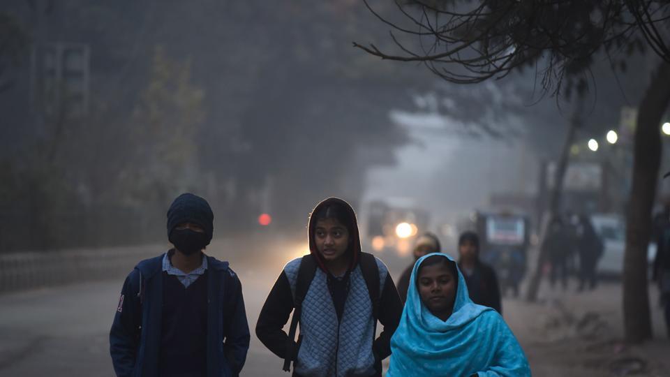
Cold wave to severe cold wave conditions are likely to continue over north India over the next three days, the India Meteorological Department said on Friday also predicting dense to very dense fog to prevail over the region for the next five days.
Some meteorologists separately predicted an intense western disturbance (WD) to impact the Western Himalayan region around January 26 which is likely to bring snowfall to the region. IMD, however, did not make a mention of the WD in its bulletin.
“Cold day to severe cold day conditions are likely to continue to prevail over North India during next 3 days. Cold wave to severe cold wave conditions are likely to continue over plains of Northwest India during next 3 days,” the bulletin said.
IMD scientists, on Thursday said that the severe weather over northwest India, including the Capital, was largely due to three reasons: a lack of active western disturbances, the prevailing El Nino conditions, and a strong jet stream.
“This severe weather over north India primarily owes to lack of any western disturbances over northwest India during December and January. Generally, five to seven WDs impact northwest India during December to January. But this winter no such WD has been impacted,” IMD said in its note, adding that there was about 80% rainfall deficiency in December and no rain or snow was recorded in January.
Since December 29, maximum temperatures are running 5-8°C below normal over the north Indian plains. These temperatures went into the normal range briefly on January 8 due to a western disturbance. Minimum temperatures, meanwhile, have dipped below 4°C at several stations in northwest India from January 12 to 17.
HT reported on January 17 that dense fog and low clouds over the Himalayan foothills and the Gangetic plains till the Bay of Bengal has persisted because of high moisture content in the upper atmosphere and lack of strong western disturbances, compounded by heavy particulate pollution and cold day temperatures.
The unusually low number of active western disturbances this winter has led to extremely dry conditions over upper reaches of western Himalayas that are normally covered by snow during this time of the year. Lack of active WDs also means there is no weather system to disrupt fog conditions developing every day.
The lack of active WDs can also be attributed to El Nino conditions over the equatorial Pacific.
Additionally, strong jet stream winds with speed of about 250 to 320 kmph at about 12 km above sea level have been causing subsidence of cold air and enhancing both the chill both at night and during the day.
“It is leading to subsidence of cold air and enhancing cold wave/cold day conditions over North India. Similar intensity of the jet stream is likely to continue during next 3-4 days,” IMD said in its bulletin on Friday.
Minimum temperatures are in the range of 2-5°C in isolated pockets of north Rajasthan, south Haryana; in the range of 6-10°C over most parts of Punjab, Chandigarh, Delhi, Uttar Pradesh, remaining parts of Rajasthan and Madhya Pradesh. These are below normal by 2-4°C in isolated pockets of south Haryana, south Uttar Pradesh and north Rajasthan, IMD said on Friday.
The lowest minimum temperature of 2.4°C was reported at Bikaner (West Rajasthan) and Kanpur (East Uttar Pradesh) on Friday. Cold wave conditions prevailed in isolated pockets of Punjab, East Uttar Pradesh, West Rajasthan and north Madhya Pradesh.
A cold wave is declared when the minimum temperature (is less than 10°C over plains) is 4.5 to 6.4°C below normal or actual minimum temperature is less than 4°C. A severe cold wave is declared when minimum temperature is over 6.5°C below normal or the actual minimum temperature is less than 2 degree C. A cold day is declared when maximum temperature (is less than 10°C over plains) and is 4.5 to 6.4°C below normal and a severe cold day is declared when maximum temperature is 6.5°C below normal.
Such cold conditions are likely to continue for five more days due to strong jet stream winds, the note added.
Dense to very Dense fog was recorded over most parts of Punjab, Haryana; in some parts of East Rajasthan, Uttarakhand; in isolated pockets of Uttar Pradesh, West Rajasthan; Dense Fog in isolated pockets of northeast Madhya Pradesh, Odisha, Sub-Himalayan West Bengal & Sikkim, Assam & Meghalaya and Tripura. Cold day to Severe Cold day conditions prevailed in many parts of Uttar Pradesh; in some parts of Bihar, West Rajasthan; in isolated pockets of Punjab, Haryana, north Madhya Pradesh, Uttarakhand and East Rajasthan.
Meanwhile, private weather forecaster Skymet has predicted snowfall in hill states from January 26, bring some respite from the largely dry winter.
“Cheer up, intense WD may dump heavy snowfall over J&K, Himachal, Uttarakhand, and Ladakh from January 26 and may continue into the first week of February. New lease of life to tourism, apple and saffron crops,” Mahesh Palawat, vice president, climate and meteorology at Skymet Weather, said on X, formerly Twitter.


