Delhi continued to swelter through what could be the last lap of summer on Tuesday, with weather experts saying that the southwest monsoon is likely to make its onset over the national capital around July 3 or 4 as favourable conditions develop across northern India.
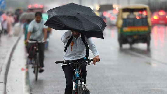
Mahesh Palawat, Vice President, Skymet Weather, said the seasonal monsoon trough has currently extended from Punjab to the north Bay of Bengal, while the monsoon has already advanced over many parts of Uttar Pradesh, most of Uttarakhand, Himachal Pradesh and Ladakh, and some more parts of Madhya Pradesh.
Read also: Delhi's temperature read 37°C. It felt like 53°C. Here's why that is dangerous
Low-pressure system likely over Bay
A cyclonic circulation persists over the north Bay of Bengal, and under its influence, a low-pressure area is expected to develop and move westwards, triggering widespread rain activity across the Indo-Gangetic plains from Bihar to north Punjab over the next few days, he added.
He further said that rain activity is expected to intensify over Punjab, Haryana, Delhi and north Rajasthan by July 2 or 3, with the monsoon likely to reach Delhi and adjoining areas around July 3 or 4.
Easterly winds still awaited
{{/usCountry}}He further said that rain activity is expected to intensify over Punjab, Haryana, Delhi and north Rajasthan by July 2 or 3, with the monsoon likely to reach Delhi and adjoining areas around July 3 or 4.
Easterly winds still awaited
{{/usCountry}}"The seasonal trough extends from Punjab to the north Bay of Bengal. Monsoon has already advanced over many parts of Uttar Pradesh, most parts of Uttarakhand, Himachal Pradesh and Ladakh, and some more parts of Madhya Pradesh," he told PTI.
Explaining the delay, Palawat said the humid easterly winds from the Bay of Bengal, which are essential for sustained monsoon rainfall, have not yet reached Delhi.
Also read: Delhi logs 55.6% rain deficit in June amid heatwave; monsoon likely in 4 days
"The monsoon generally advances along the seasonal trough, which currently stretches from Punjab to the Bay of Bengal over a distance of nearly 1,500 kilometres. The easterly winds from the Bay of Bengal are expected to reach Delhi around July 3 or 4 along with the trough. Until then, the city is likely to receive only isolated spells of rain. Once these easterly winds set in and the trough becomes more favourable, monsoon activity will pick up significantly," he added.
The trough acts as the backbone of the southwest monsoon. It is an elongated zone of low atmospheric pressure that draws moisture-laden winds from the Arabian Sea and the Bay of Bengal deep into the Indian mainland, helping organise widespread rainfall.
Heat and humidity persist
Even as the city looked ahead to the monsoon's arrival, Delhi reeled under oppressive weather conditions, with the apparent, or "feels like", temperature soaring to 53.5 degrees Celsius at 5.30 pm. However, the IMD said the city did not meet the criteria for a heatwave. The maximum temperature at Safdarjung, the city's base station, settled at 40.5 degrees Celsius, 3.1 notches above normal.
Also read: Delayed monsoon slows down paddy transplantation in Haryana
Palam recorded 41.0 degrees Celsius, 3.2 notches above normal, while Lodhi Road recorded 40.1 degrees Celsius, 3.1 notches above normal.
Ridge was the hottest station at 41.5 degrees Celsius, 4.8 notches above normal, and Ayanagar recorded 40.1 degrees Celsius, 2.0 notches above normal.
IMD rules out heatwave
Trace rainfall was recorded till 8.30 am at Safdarjung, Palam, Lodhi Road and Ayanagar, while Ridge did not receive any rain. Between 8.30 am and 5.30 pm, trace rainfall was recorded at Palam and Ayanagar, while no rainfall was recorded at Safdarjung, Lodhi Road and Ridge.
The minimum temperature at Safdarjung settled at 30.2 degrees Celsius, 2.3 notches above normal. Palam also recorded a minimum of 30.2 degrees Celsius, 2.4 notches above normal. Lodhi Road and Ayanagar recorded 31.2 degrees Celsius, 4.2 notches and 4.4 notches above normal, respectively, while Ridge recorded 29.3 degrees Celsius, 3.8 notches above normal.
The IMD said no heatwave was declared over Delhi as the prescribed criteria were met at only one station in the Haryana-Chandigarh-Delhi subdivision, whereas at least two stations are required for a heatwave declaration.
Experts said dry westerly winds from Pakistan are keeping temperatures elevated, while southwesterly winds from the Arabian Sea are also reaching Delhi and increasing humidity.
"When these dry and moist air masses interact, clouds do form, but there is not enough moisture for widespread rainfall. By the time cloud formation takes place, usually around 4 or 5 pm, the day's maximum temperature has already been recorded. That is why both the maximum temperature and the 'feel-like' temperature have remained unusually high," Palawat from Skymet said.