
 E-Paper



Downpour drenches Lucknow; orange alert for 12 UP districts
The overall rain deficit in UP pegged at 27%; state received 281.6 mm of rain since June 1 against a long period average of 387.7 mm

 Prefer HTon Google


LUCKNOW For the second consecutive day, the state capital remained soaked in rain as the district recorded 40.2 mm of rainfall (from 8:30 am to 5:30 pm) on Tuesday. With the strengthening of the monsoon current, rainfall activity across UP is expected to intensify over the next 2 to 3 days, bringing widespread rainfall and downpours in isolated areas.
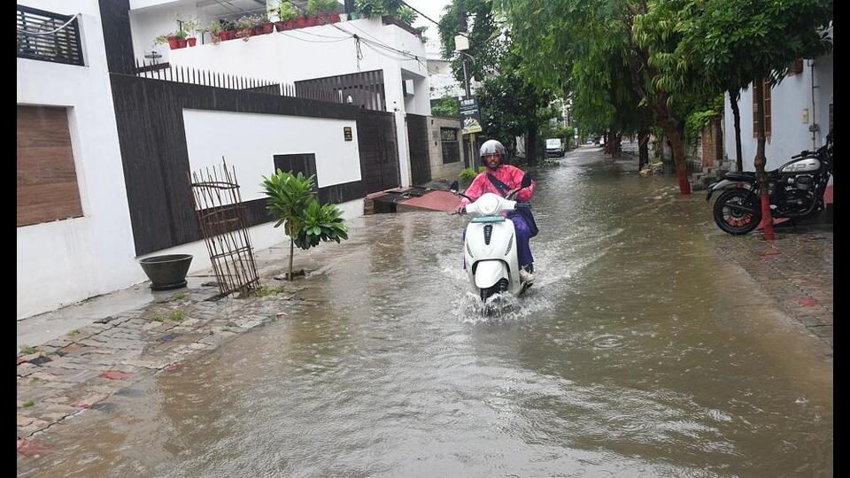
The monsoon trough has shifted towards Delhi, Shahjahanpur and Chhapra, strengthening the monsoon flow across the Gangetic plains. As a result, an orange alert has been issued in UP. “Consequently, active monsoon conditions are expected to prevail in the region over the next 2 to 3 days, bringing widespread rainfall with isolated instances of heavy to very heavy rain,” a meteorological official said.
“This will likely result in a significant drop in day temperatures by 3 to 5°C, offering relief from the humid conditions,” said Atul Kumar Singh, a senior scientist at Regional Meteorological Centre.
As per the IMD bulletin, the observatory at Lucknow’s Amausi airport recorded 66.6 mm of rain, Hanuman Setu 30.4 mm, Lucknow Control Room (Aliganj) 25.8 mm, Bani in Lucknow 25 mm, Malihabad 20 mm and Mohanlalganj 18.2 mm of rain.
Rain deficit in Lucknow reduced from 42% to 34% in a day. Since June 1, Lucknow received 227.7 mm of rainfall against the long period average of 345.9 mm, a deficit of 34%, which means the state capital falls in the deficient category ranging from 20% to 59%.
Due to rainfall, the day temperature in Lucknow dropped from 33.9 degrees Celsius on Monday to 29.5 degrees on Tuesday. The forecast for Wednesday is an overcast sky with intermittent spells of moderate to intense rain/thundershowers. The maximum and minimum temperatures will be around 27 and 24 degrees, respectively.
Chibramau (Kannauj) received the highest rainfall at 125 mm (that falls in the category of heavy to very heavy rainfall: 115.6 mm to 204.4 mm) in the last 24 hours. Other observatories that received heavy rainfall include Nanpara (Bahraich) 104 mm, Chakar Nagar (Etawah) 100 mm, Ayodhya 94.8 mm, Shardanagar (Kheri) 81.6 mm, Kanpur Tehsil 75 mm, Haidergarh (Barabanki) 70 mm, Jaunpur 68.6 mm and Lucknow (Airport) 66.6 mm, according to the IMD bulletin.
For Wednesday, an orange alert for heavy rainfall was issued in 12 districts: Banda, Chitrakoot, Kaushambi, Fatehpur, Kanpur Dehat, Kanpur City, Unnao, Rae Bareli, Saharanpur, Muzaffarnagar, Bijnor, Hamirpur and surrounding regions.
A yellow alert for high probability of heavy rainfall was issued in 40 districts, including Lucknow, Barabanki, Amethi, Prayagraj, Pratapgarh, Mirzapur, Gorakhpur, Basti, Kushinagar, Maharajganj, Balrampur, Shravasti, Bahraich, Lakhimpur Kheri, Sitapur, Hardoi, Farrukhabad, Kannauj, Shamli, Baghpat, Meerut, Kasganj, Mainpuri, Etawah, Auraiya, Amroha, Moradabad, Rampur, Bareilly, Pilibhit, Shahjahanpur, Sambhal, Badaun, Jalaun, Mahoba and surrounding regions.
The overall rain deficit in UP is pegged at 27%. The state received 281.6 mm of rain since June 1 against a long period average of 387.7 mm. East UP received 280.8 mm rainfall against normal of 415.6 mm, 32% deficit, while West UP recorded 282.8 mm rainfall against normal of 348.6 mm, deficit 19%.
As many as 50 out of 75 districts in UP face below normal to excessively below normal rainfall because of the El Nino effect that is proactive all throughout this monsoon season. The IMD forecast suggests rainfall will remain largely below normal in the remaining months of August and September.


