
 E-Paper



More data needed to predict cyclone intensification accurately, says IITM
PUNE The first pre-monsoon deep depression is strengthening in Bay of Bengal which is later likely to hit the Tamil Nadu coast


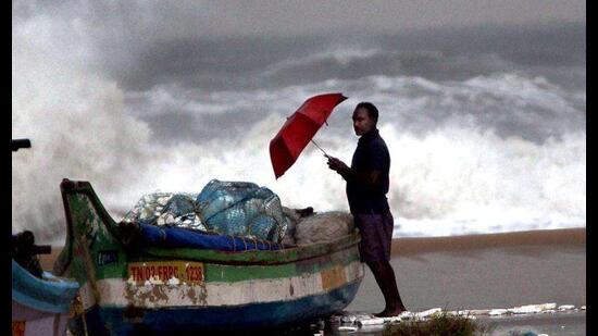
PUNE The first pre-monsoon deep depression is strengthening in Bay of Bengal which is later likely to hit the Tamil Nadu coast. According to India Meteorological Department (IMD), this is only the third depression to form in March in the Bay of Bengal since satellite era 1980 onwards. Earlier such depressions were reported in 2000 and 1994.
Scientists from Indian Institute of Tropical Meteorology (IITM) said that it is observed that cyclones in Arabian Sea as well Bay of Bengal are rapidly intensified. However, this rapid intensification may not be captured accurately by forecast models.
Speaking about the cyclones, MK Roxy, scientist at IITM said, “In recent decades, we have seen that the north Indian ocean has been more fragile than earlier. Arabian Sea on the other hand has reported an increase in frequency of cyclones. However, both basins have reported rapid intensification of cyclones in a very short time. But due to challenges in forecasting this rapid intensification cannot be predicted by models.”
He added that accurate prediction can help in better forecast and disaster management actions to safeguard life and property on the coastal areas. “So far, we have seen that forecast models do not incorporate sufficient ocean data. there has to be constant measurements of heat and moisture from the ocean. Surface and subsurface temperature are important for that. However, we have only a handful of buoys in the Arabian Sea and Bay of Bengal. If these buoys are increased, we can provide models with better data and more accurate cyclone prediction can be given for disaster management,” said Roxy.
“At present there are a lot of gaps in surveying systems for cyclones. Right now, we have a resolution of 500 square kilometers but we need to go ahead and make this resolution at least 200 square kilometers. Ocean Moored Buoys are essential in providing surface and subsurface temperature reading continuously to the models,” he added.
“Another important aspect is the wind speed of the cyclones. Right now, there are two satellites that give us the wind speed of the cyclone. However, these two satellites cover only 60 per cent of the Indian Ocean. If we keep getting the correct wind speed by the satellite, it can further help us give more accurate predictions for cyclone speed,” said Roxy.
Box
“The depression over Southwest Bay of Bengal moved north-northwestwards and intensified into a deep depression on March 4. It is likely to move northwestwards till evening of March 5 and then west-south westwards towards north Tamil Nadu Coast during subsequent 36 hours,” said IMD officials.


