
 E-Paper



Better air quality, drop in minimum temp likely over parts of northwest India
Strong surface winds are very likely over the plains of northwest India during the next three days according to India Meteorological Department’s Sunday bulletin

 Prefer HTon Google


Air quality over northwest India is likely to improve and minimum temperatures are likely to drop further on Monday due to strong cold northwesterly winds.
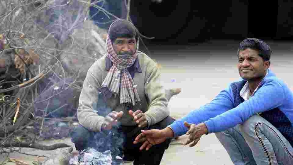
Minimum temperature had started dropping over many parts of northwest India including Delhi on Sunday following a western disturbance that affected the western Himalayas on January 7 and 8.
Bahadurgarh, Ballabhgarh, Bhiwadi, Bhiwani, Gurugram recorded “moderate” air quality this morning while Delhi, Ghaziabad, Greater Noida and Noida recorded “poor” air quality.
Delhi recorded a minimum temperature of 7.8 degrees Celsius on Sunday compared to 10.8 degree Celsius on Saturday. Delhi’s Palam also recorded “cold day” conditions as maximum temperatures dropped significantly below normal on Sunday.
On Sunday, Palam recorded a maximum temperature of 14.2 degrees Celsius, 6 degrees below normal while Safdarjung recorded 16.2 degrees Celsius, 4 degrees below normal.
Also Read: Heavy snowfall declared as state specific natural calamity under SDRF in J&K
Due to the prevalence of dry north or northwesterly winds over most parts of northwest India, minimum temperature is likely to fall gradually by 3-4 degrees Celsius during the next 3-4 days which may cause isolated cold wave conditions over Punjab, Haryana, Chandigarh, Delhi and north Rajasthan on January 12 and 13.
Strong surface winds (speed 15-25kmph) are very likely over the plains of northwest India during the next three days according to India Meteorological Department’s Sunday bulletin.
“Very cold northwesterly winds are blowing from snow-clad Himalayas towards Delhi so both maximum and minimum temperatures have fallen. Winds are blowing at 20-25kmph so the perception of cold is stronger. They are chilly winds. We are expecting cold day conditions over Delhi for the next few days,” said Kuldeep Shrivastava, head, regional weather forecasting centre.
According to IMD a “cold day” or “severe cold day” is considered based on two parameters—a minimum temperature of under 10 degrees Celsius and maximum temperature is 4.5 degrees or 6.4 degrees below normal respectively. A cold wave occurs in plains when the minimum temperature is 10 degrees Celsius or below and/or is 4.5 notches lesser than the season’s normal for two consecutive days. Cold wave is also declared when the minimum temperature is less than 4 degrees Celsius in the plains. Witnessing a cold day and cold wave together means the gap between day and night temperatures is lower than normal.
Despite very strong winds Delhi recorded “poor” category air quality with an air quality index of 245 on Sunday. Strong winds and better ventilation conditions are likely to prevail from January 10 to 13. The air quality is likely to remain in “poor” to “moderate” category on January 11 and 12 according to the air quality early warning system for Delhi under ministry of earth sciences.
“Air quality was in ‘very poor’ category. It has improved to ‘poor’ category and is improving further. We are likely to see ‘moderate’ air quality for two or three days due to strong winds,” said VK Soni, scientist at IMD’s air quality division.
Under the influence of a cyclonic circulation over equatorial Indian ocean and adjoining central parts of South Bay of Bengal up to mid tropospheric levels, fairly widespread to widespread rainfall with moderate thunderstorm and lightning is very likely over Tamil Nadu, Kerala and Lakshadweep during the next three days. Heavy to very heavy rainfall also likely over south Tamil Nadu during January 11 and 12 and over Kerala and Mahe on January 12.
Due to a trough (area of low pressure) in low-level easterlies from southeast Arabian Sea to northwest Madhya Pradesh, scattered rainfall with isolated thunderstorm and lightning is very likely over Maharashtra, Goa, Gujarat and west Madhya Pradesh on Sunday.


