
 E-Paper



Delhi has a ‘normal’ cold day; air severe
The day’s high temperature at the Safdarjang observatory was 20.5 °C, which was 1 °C above normal.


After a record cold spell spanning 18 consecutive days, when day temperatures were unusually low, sunshine and clear skies brought relief on the New Year’s Day to the national capital, which recorded its first above-normal maximum temperature this winter.
The day’s high temperature at the Safdarjang observatory was 20.5 °C, which was 1 °C above normal.
The minimum temperature, however, continued to be low at 2.4 °C, which was 5 °C below normal, meeting the “cold wave” criteria.
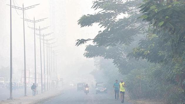
Though a shallow fog cover formed in the morning dissipated quickly, the air quality index (AQI) slipped into the “severe” category. After settling at 387 on Tuesday, AQI was recorded at 437 on Wednesday.
A “cold wave” is when night temperature is either 4.5°C below normal, or not more than 4°C for more than a day. A “cold spell” is defined as any period longer than a day when the maximum temperature is 4.5°C below normal and the minimum temperature is below 10°C. A “severe cold spell” is when the maximum temperature is 6.4°C below normal.
Of the 18-day cold spell, the Capital experienced six cold and 12 severe cold days. On Monday, the city recorded a maximum temperature of 9.4°C -- the lowest day temperature in at least 119 years. The main reason behind a wide gap of 18.1 °C between maximum and minimum temperatures (diurnal range) on Wednesday was clear skies, according to Kuldeep Srivastava, head of the regional weather forecasting centre in Delhi. “There was radiational cooling (the ground radiates heat at night) because there was no cloud cover. That is also the reason why the day temperature was normal and not unusually cold. The ground received sun’s energy. Conditions were similar in most parts of north-west India,” he explained.
According to scientists, the easing of the cold spell over Delhi and several parts of north India is because of a change in wind directions on Tuesday — from northwesterly, which brings cold winds from the Himalayas to the northern plains, to easterly, which brings moist air originating in Bay of Bengal from states such as West Bengal and Bihar.
Meteorologists said weather conditions were undergoing a transition, with a western disturbance affecting the region.
“There may be very light rain on Thursday morning and cloudy skies. We are expecting both minimum and maximum temperature to go up for a couple of days under the influence of these systems. But the easterly trough has weakened the influence of the WD (western disturbance), which is why we are not forecasting widespread rains in the Delhi-NCR region,” said Srivastava.
RK Jenamani, a senior scientist at National Weather Forecasting Centre, said, “We are expecting a light drizzle during night or early morning of Thursday. There will be overcast skies for the next couple of days. The western disturbance is near central Pakistan now, very close to north-western India. It will have an impact on the region till January 4 or 5... it’s too early to say if cold spell will develop again. We are expecting another western disturbance around January 7 and 8.” The India Meteorological Department (IMD), in its Wednesday bulletin, said that under the influence of the approaching western disturbance, scattered to fairly widespread rainfall/snow is likely over Jammu and Kashmir, Himachal Pradesh and Uttarakhand during January 2-4.
“Under the influence of lower level easterlies and their likely interaction with approaching mid and upper tropospheric westerly trough, scattered to fairly widespread rainfall accompanied with thunderstorms, lightning and hail is likely at many places to few places over central India during January 1-3 and over major parts of northwest and Central India during January 1-4, over east India during January 2-4 and northeast India January 3-5, 2020,” the bulletin said.
The maximum temperatures have already increased by 4-6°C over Punjab, Haryana, Chandigarh, Delhi, Uttar Pradesh and Bihar. This year, Delhi has recorded the longest cold spell since 1992, the year when cold spell records began being maintained. In December 1997, there was a 17-day cold spell and a 13-day cold spell in January 1997.


