
 E-Paper



Mapping the scale of Uttarakhand carnage
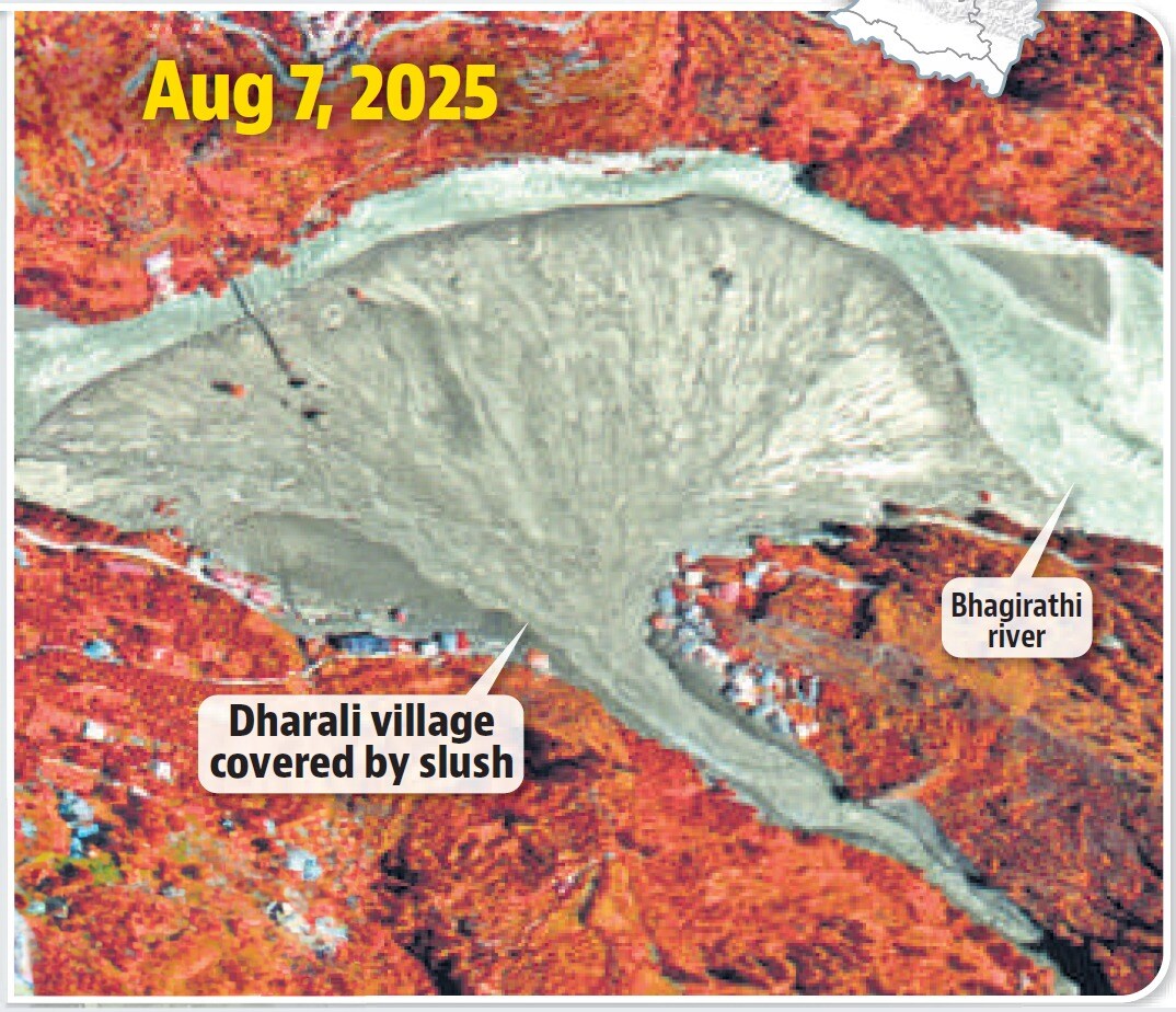
The satellite pictures, from June 13 and August 7, show that a bridge and what appears to be orchards are also inundated.

 Prefer HTon Google


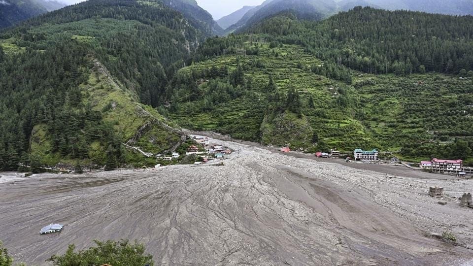
The flash floods in Uttarakhand on Tuesday caked much of Dharali village in mud and debris, burying entire buildings, roads, trees and plantations, satellite images taken two days after the disaster show.
Sediments that barrelled down the Kheer Ganga river and swept through the remote village in the upper reaches of Uttarakhand has also blocked a large span of the Bhagirathi river downstream, cutting off a significant part of its pathway, show the images from the National Remote Sensing Centre.
The satellite pictures, from June 13 and August 7, show that a bridge and what appears to be orchards are also inundated.

Experts said the images will help the administration and scientists to understand what caused the carnage, which left hundreds missing. Some experts have postulated that the flash floods and mudslides may have been set off by a glacier collapse upstream of Kheer Ganga.
“The Kheer Ganga river originates from glaciated terrain. Satellite imagery of September 2022 was analysed [to understand the Kheer Ganga basin]. It is useful imagery as during this time snow had mostly melted and glacier ice and landforms can be seen clearly,” Anil Kulkarni, distinguished visiting scientist, Divecha Center for Climate Change at the Indian Institute of Science, said in a noteto be circulated among researchers.
“Satellite imagery indicates that glacier ice is mostly melted and glacier ice can be seen in a very small area. However, a well-developed deglaciated valley can be seen,” Kulkarni said in the note.
“Outlet of deglaciated valley is bounded by end moraine and a small river is passing between the end moraine and the side wall. Upstream of end moraine, meandering stream pattern was observed. It indicates flat terrain and also formation of a lake in the past,” Kulkarni added.
This means that there are signs of landslide from the moraine which may have blocked the flow of meltwater creating backwater. It may have happened that this overflowed and came down in the channel feeding Kheer Ganga.
“The flash flood mud flow may have been caused due to outburst of the lake,” he said.
A moraine is material left behind by a moving glacier. This material is usually soil and rock.
Kulkarni also said there are signs of past flash floods in the channel but they may not have been of the same magnitude.
National Disaster Management Authority (NDMA) officials are waiting for the clouds to clear for sharper satellite imagery to analyse the glacier feeding Kheer Ganga.
“There are indications that a glacial snout at 6,700m detached some days ago and large glacio-fluvial debris deposits collected. Incessant rain over the past few days is believed to have led to loosening of the debris. Once critical mass was crossed, the massive collection of debris cascaded downstream with water in the Kheer Ganga, accelerating due to the steep gradient upto Dharali,” Safi Ahsan Rizvi, Advisor (mitigation), NDMA and executive director, NDMA said on Wednesday.
“According to the National Remote Sensing Centre Atlas of 2023, there are 7,500 glacial lakes larger than 0.25 hectare in the Himalayas. Of these NDMA categorised 195 as ‘at-risk’. It is clear that none of the 195 at-risk glacial lakes are in the Dharali catchment,” he added.



