
 E-Paper



Monsoon hits Kerala, earliest onset since 2009
IMD earlier forecast above-normal monsoon rainfall at 105% of the Long Period Average for the June-Sept season, with only a 2% probability of deficient rainfall

 Prefer HTon Google


The southwest monsoon made onset over Kerala on Friday, arriving eight days before its normal June 1 date and marking the earliest arrival since 2009, the India Meteorological Department (IMD) announced.
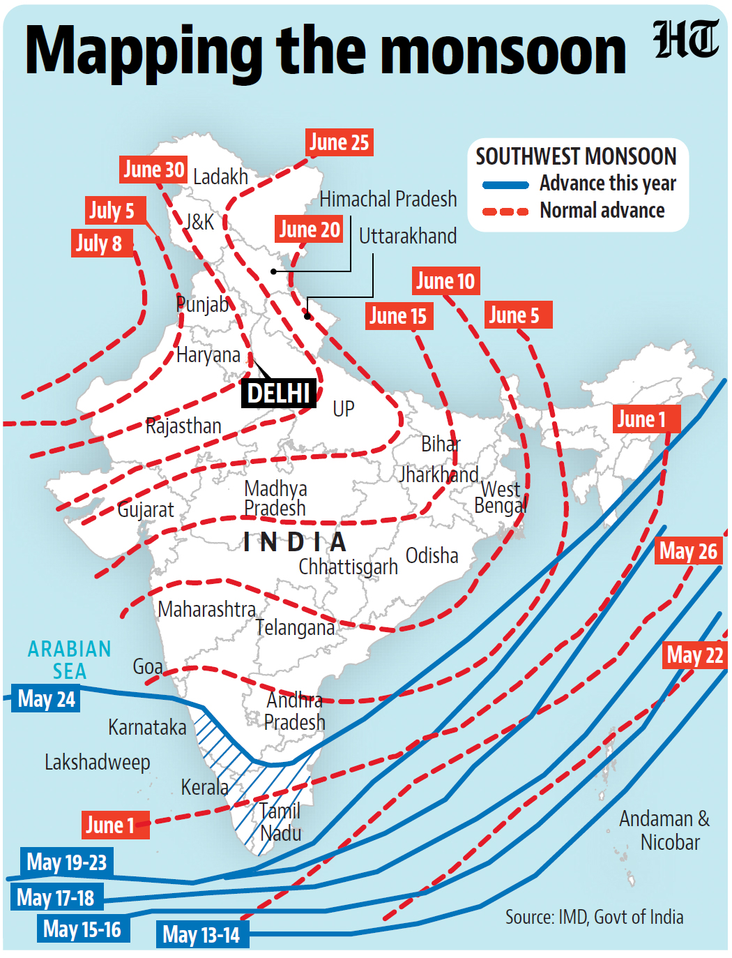
The May 24 onset is in line with IMD’s prediction of May 27 arrival and represents the fifth earliest monsoon onset in the last 55 years. The earliest recorded onset was May 18 in 1990.
“During monsoon onset we sometimes see low pressure systems develop which turn into depression. A depression has developed and monsoon has strengthened, all the criteria for monsoon onset are fully satisfied now. Large scale processes such as cross equatorial flow are also met. Monsoon will cover some more areas in the next 2-3 days,” said M Mohapatra, director general of IMD.
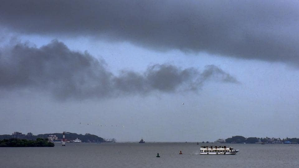
The onset occurred after all meteorological criteria were satisfied. During the past two days, cloud cover increased over southeast Arabian Sea and adjoining peninsular areas, with westerlies extending up to 4.5 km above mean sea level. Widespread rainfall occurred on May 23 and 24, with heavy to very heavy precipitation across Kerala.
An HT analysis of IMD’s rainfall data reveals that early monsoon onset over Kerala occurs frequently. Between 1971-2024, the monsoon arrived before June 1 in 22 of the 54 years, while arriving after June 1 in 27 years.
However, historical data shows no correlation between Kerala onset dates and overall monsoon performance across India. Multiple factors, including sea surface temperature patterns in the Indian Ocean and Pacific Ocean, influence monsoon behaviour as it marches to cover the rest of the country by July.
One technical concern remains for the broader monsoon season this year. The formation of a ‘heat low’ over northwest India is typically important for normal monsoon performance across the country, as it creates a trough of low pressure that draws moist air from the monsoon system. Currently, no such heat low exists, though IMD and independent scientists had predicted the monsoon would still arrive before its normal date.
Despite this absence, the strong onset conditions and early arrival suggest the monsoon system has sufficient strength to progress normally across the country.
A low pressure area is likely to form over north Bay of Bengal around May 27, IMD has forecast. “The low pressure area will also pull monsoon winds over the region while the depression over Arabian Sea has moved inland. Both are expected to help pull monsoon inland into many states. We can say for the next few days progress can be good but it’s difficult to forecast immediately how it will move after these systems dissipate,” said Mahesh Palawat, vice president, climate and meteorology, Skymet Weather.
The monsoon delivers nearly 70% of India’s annual rainfall, with 51% of the country’s farmed area relying entirely on rainfall and 47% of the population dependent on agriculture for livelihood — making the season crucial for the economy.
IMD had earlier forecast above-normal monsoon rainfall at 105% of the Long Period Average for the June-September season, with only a 2% probability of deficient rainfall.
Along with covering Kerala, the monsoon has simultaneously advanced into remaining parts of the south Arabian Sea, some parts of west central and east central Arabian Sea, the entire Lakshadweep area, Mahe, some parts of Karnataka, remaining parts of the Maldives and the Comorin area. It has also covered many parts of Tamil Nadu, remaining parts of southwest and east central Bay of Bengal, some parts of west central and north Bay of Bengal, and some parts of Mizoram.
A well-marked low-pressure area over east central Arabian Sea off the south Konkan coast concentrated into a depression and crossed the south Konkan coast between Ratnagiri and Dapoli, bringing increased rainfall over Kerala.
Conditions remain favourable for further advancement over the next 2-3 days into some more parts of central Arabian Sea, entire Goa, parts of Maharashtra and Andhra Pradesh, additional areas of Karnataka, remaining parts of Tamil Nadu, more sections of west central and north Bay of Bengal, northeastern states, and parts of sub-Himalayan West Bengal and Sikkim.
IMD follows strict criteria to declare monsoon onset. After May 10, at least 60% of 14 designated stations—including Minicoy, Thiruvananthapuram, Kochi, Kozhikode, and Mangalore—must report rainfall of 2.5 mm or more for two consecutive days. The wind pattern must be southwesterly, and Outgoing Longwave Radiation (OLR), which represents the total radiation going to space emitted by the atmosphere — a proxy for extent of cloudiness — must be low.
During the 22 years of early onset, Kerala and Mahe subdivision experienced rainfall deficit in 59% of cases during June-September, compared to 67% deficit probability during the 27 years of late onset. While early onset increases the chances of adequate rainfall in Kerala, it provides no guarantee of surplus.
(With inputs from Abhishek Jha)



