
 E-Paper



Wayanad tragedy: How Kerala can improve its early warning systems for landslides
Union coal minister G Kishan Reddy recently said that the regional Landslide Early Warning System (LEWS) will be available nationwide by 2030

 Prefer HTon Google


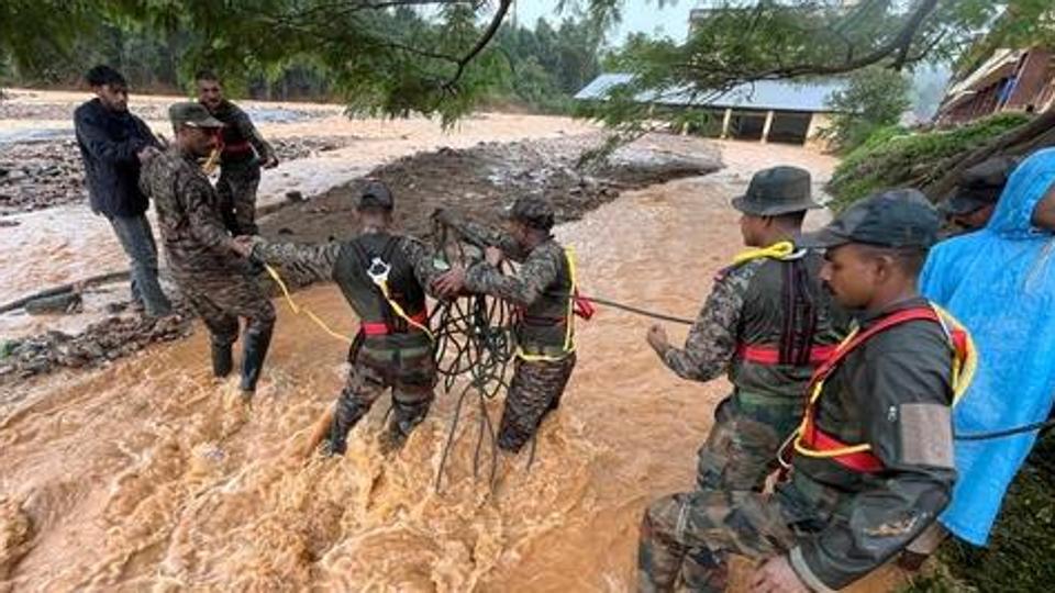
Chennai: A series of landslides triggered by heavy rains in Kerala’s Wayanad district earlier this week resulted in over 250 deaths while many are still missing. This has ignited a debate over early warning systems (EWS) for landslides and the debris flow.
Even though some pilots on landslide warning systems are being done in Himachal and Kerala, experts said a better landslide warning system can be developed by improved integration of historic rainfall data, real-time satellite imagery, and hill slope studies with mechanisms for better public dissemination of warnings.
As of now, the India Metrological Department (IMD), the Geological Survey of India (GSI), and the National Disaster Management Authority (NDMA) issue advance alerts on heavy rainfall and possible landslides. The Central Water Commission issues flood alerts based on hydrological data it receives from IMD and from barrages and dams across rivers in the country.
Also Read: Erratic rain pattern, topography behind Kerala’s vulnerability to disasters
Union coal minister G Kishan Reddy, while inaugurating the National Landslide Forecasting Centre (NLFC) at GSI in Kolkata in July this year, had said that the regional Landslide Early Warning System (LEWS) will be available nationwide by 2030.
Equipped with advanced technology, the NLFC will provide early information to local administrations and communities, update landslide inventories, and integrate real-time rainfall and slope instability data for enhanced forecasting accuracy.
The GSI has one such centre in Wayanad. However, the NLFC failed to warn about massive landslides; its advisory on July 29 put the landslide possibility at ‘low’ for the Wayanad district and rainfall intensity of 64 to 111.5 mm for the district. An official at the forecasting centre said “the process has not been streamlined yet and was at the experimental stage.”
“The centre was running on a trial basis, and the information we sent out was just for reference and not for public use,” said V Ambili, deputy director general at the GSI, Kerala unit.
“Along with historic rainfall and soil data, the system runs on the predicted rainfall data by IMD. There was a time gap between when the IMD sent the data and when we ran the analysis and released the information,” said Ambili.
Union home minister Amit Shah on Wednesday told the Parliament that the NDMA had warned about heavy rains and possible landslides a week before the tragic incident. Kerala chief minister Pinayari Vijayan debunked his statement, saying the IMD had failed to issue a “red” alert regarding heavy rainfall.
Officials and experts said that even if the Wayanad landslides could have been predicted correctly, the magnitude could not be predicted due to the technological gaps.
“We don’t have the soil thickness data, which is essential for the prediction. Secondly, we don’t have automated weather stations or a network of rain gauges to provide data in a real-time mode,” Sajinkumar K S, an expert on landslides and an assistant professor with the department of geology at the University of Kerala, said, explaining the difficulties.
In India, landslide prediction relies on three primary methods – sensors installed on soil or slopes, satellite data analysis, and numerical-analytical modelling, using field data.
According to Dr. K V Uday, associate professor at IIT-Mandi, who is conducting a pilot on landslide prediction in Himachal, said, “The movement of the slope and parameters like rainfall data or satellite images are key indicators for predicting landslides.”
Also Read: Rahul Gandhi, Priyanka leave for Wayanad; death toll in landslide crosses 250
Supported by the NDMA and Himachal Pradesh’s State Disaster Management Authority, Dr Uday’s team has deployed 60 landslide monitoring and early warning systems across Himachal Pradesh. These systems have forecasted landslides during June-July 2023, significantly mitigating their impact.
Professor Deepankar Choudhury of IIT-Bombay, who has worked on landslide monitoring systems in Kerala and is chairman of the technical committee on disaster resilience and capacity building under the State Disaster Management Authority, Maharashtra government, said the satellite data is an accurate way of predicting landslides as the sensors on slopes could collapse during landslides.
By researching static (land slopes, soil types, and rock types) and dynamic (rainfall and anthropogenic) factors, the nature of the landslides can be studied, said Sajinkumar.
Warning systems in India can sense the origin of landslides but not the pathways, which are important for developing mitigation strategies and reducing human impact, experts said.
Sajinkumar said in the case of the devastating landslide in Wayanad on July 30, though the landslide occurred in high landslide susceptible zones, the devastation occurred in low susceptible zones.
“Modelling landslides and identifying the flow path of landslides using soil parameters, soil volume, and water required is essential for mitigation strategies,” he said. Such studies, he said, could help in making people aware of the danger of living in susceptible zones. Kerala University is developing a mobile application to provide land slide-related data directly to local communities.
Uday said the GSI should integrate historic rainfall data to predict landslides. “A model can be created by analyzing historical rainfall data from Wayanad during periods of frequent landslides,” he said. By assessing the intensity of rainfall vs. landslides through statistical methods, a threshold can be developed, he added.
Choudhury, said unplanned vegetation, an unplanned drainage system, and unplanned development on the slopes without considering the pattern of water flow are reasons behind landslides having a huge impact.
“Water flows in the original path but not in the path created by human beings. So, during landslides, it automatically washes away everything that comes in the way of the human-created diverted path of natural flow of water in slopes,” he said.
In 2023, the National Remote Sensing Centre (NRSC) developed a landslide atlas covering landslide-vulnerable regions in 17 states and 2 Union Territories in the Himalayas and Western Ghats.
According to the atlas, Kerala witnessed a total of 6039 landslides between the monsoon seasons of 2014 and 2017 and from 2018 to 2021. Even though the number is lesser than in the north, such as Uttar Pradesh, and in the north-eastern states, such as Mizoram and Tripura, the vulnerability is significant in Kerala.
“The vulnerability of the inhabitants and households is more significant in the Western Ghats due to the very high population and household density, especially in Kerala, even when fewer landslides exist than in the Himalayan regions,” the research explained. Wayanad also occupies the 13th position among the 143 districts of India for their exposure to landslides.
The Kerala government has initiated some projects for landslide prediction. According to officials aware of the matter, Kerala University is working on rainfall thresholds for early warning and the Kerala Development & Innovation Strategic Council’s (K-DISC) landslide prediction system. However, these projects remain in the pilot phase and have not yet been fully implemented.


