
 E-Paper



Widespread rain, snowfall in western Himalayan region this weekend: IMD
Once the rain, snowfall causing-Western Disturbance passes, the minimum temperature is likely to fall by 3 to 4°C over Delhi and other parts of northwest India


A Western Disturbance (WD) is likely to cause widespread rain and snowfall in the Western Himalayan region between January 22 and 24, according to India Meteorological Department (IMD). After the Western Disturbance passes, the minimum temperature is likely to fall by 3 to 4 degrees C (°C) over Delhi and other parts of northwest India.
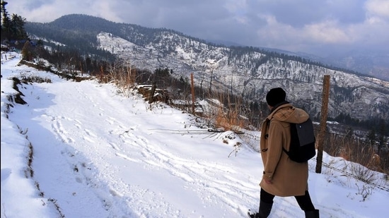
The WD will affect the western Himalayan region from Thursday and is likely to cause widespread rain and snow over Jammu and Kashmir, Ladakh, Gilgit-Baltistan, Muzaffarabad, Himachal Pradesh and isolated rain and snow over Uttarakhand till Sunday and light rain and thundershowers over some parts of Punjab and Haryana, Chandigarh and Delhi on Saturday. There is likely to be heavy snowfall in parts of Jammu and Kashmir and Himachal Pradesh on January 23 [Saturday], IMD has said.
Dense to very dense fog is likely over parts of Punjab, Haryana, Chandigarh and Delhi during the next two days; over Uttar Pradesh and West Rajasthan during the next 24 hours and over Assam, Meghalaya, Nagaland, Manipur, Mizoram and Tripura between January 22 and 24. Dense fog is also likely over Bihar during the next three days; over Odisha and sub-Himalayan West Bengal and Sikkim during the next 24 hours.
Cold day to severe cold day conditions are likely in isolated pockets over Punjab, Haryana, Chandigarh and West Rajasthan during the next 24 hours.
“The Western Disturbance is likely to be of moderate intensity. On January 23 [Saturday], there is likely to widespread and intense rain and snowfall over Jammu and Kashmir and Himachal Pradesh. There is likely to be light rainfall over Punjab, Haryana and Uttarakhand. In Delhi, we can expect shallow to moderate fog on Friday but the wind speed is likely to pick up from Saturday. On Saturday and Sunday, we can expect overcast sky here. Once the WD passes, minimum temperatures are likely to fall to around 4°C on January 25 and 26. Day temperature may also be significantly low as strong, chilly northwesterly winds are likely to blow over the region,” said Kuldeep Shrivastava, head, regional weather forecasting centre.
On Wednesday, Delhi’s minimum temperature was 7.8°C, a degree above normal. According to IMD, a cold day or a severe cold day is classified as such based on two parameters—a minimum temperature of under 10°C and maximum temperature of 4.5°C or 6.4°C below normal, respectively.
A cold wave occurs in the plains when the minimum temperature is 10°C or below and/or is 4.5 notches lower than the season’s normal for two consecutive days. A cold wave is also declared when the minimum temperature is less than 4°C in the plains.


