
 E-Paper



Widespread snowfall expected in Western Himalayan region today
Under the influence of Western Disturbance, rain and snow is very likely over Jammu and Kashmir, Ladakh, Gilgit-Baltistan, Muzaffarabad, Himachal Pradesh during December 7 to 9


A Western Disturbance is likely to cause widespread and heavy snowfall in the Western Himalayan region today.
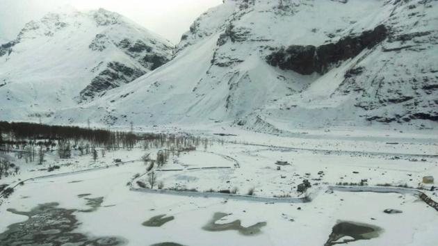
Under its influence, rain and snow is very likely over Jammu and Kashmir, Ladakh, Gilgit-Baltistan, Muzaffarabad, Himachal Pradesh during December 7 to 9. Heavy rain and snow also very likely over Jammu and Kashmir, Ladakh, Gilgit-Baltistan, Muzaffarabad on Tuesday.
But temperatures in the northern plains will not fall immediately. “We are not expecting a fall in temperatures immediately because there are consecutive Western Disturbances which are affecting the Western Himalayas. With a Western Disturbance, there is usually clouding and temperatures are marginally above normal. Just behind tomorrow’s Western Disturbance, there is another Western Disturbance approaching on December 11 so it’s unlikely that temperatures will fall significantly now. A significant drop in temperatures is expected only once the Western Disturbances pass and there is no other Western Disturbance approaching,” said K Sathi Devi, head, national weather forecasting centre.
Air quality hovered in the very poor to severe range in most parts of northwest India on Tuesday. While Delhi recorded an air quality index (AQI) of 394 in very poor category, Ghaziabad, Greater Noida, Kanpur, Noida, Bulandshahr recorded severe air.
There is mild to moderate fog in most parts of northwest India on Tuesday morning.
A Western Disturbance was impacting the Western Himalayan region on Monday and brought rain and snow to the higher reaches. There was also an intense cyclonic circulation over Haryana and neighbourhood and winds were somewhat easterly which means they are moisture laden winds. The combination of moisture availability, convergence of winds, relatively low temperature in some places has led to dense fog developing on Monday,” said Sathi Devi.
Moderate to very dense fog had disrupted traffic and flights on Monday over many parts of Delhi, west Uttar Pradesh, Haryana, West Rajasthan, east Uttar Pradesh, Bihar, Assam, Meghalaya, Nagaland, Manipur, Tripura, sub-Himalayan West Bengal and Sikkim.
A cyclonic circulation is lying over Gulf of Mannar and another cyclonic circulation lies over southeast Arabian Sea and adjoining Maldives. Under the influence of these systems, widespread and heavy rain with thunderstorm and lightning is very likely over Tamil Nadu, Puducherry, Karaikal, Kerala, Mahe and Lakshadweep on Tuesday.


