
 E-Paper



Chandigarh | Visibility worsens, AQI very poor in some areas
While AQI remained poor category through the day, at the Continuous Ambient Air Quality Monitoring Stations (CAAQMS) in Sector 53, it was recorded at 314 at 11pm. This was followed by CAAQMS Sector 22 with 266 and CAAQMS Sector 25 at 191. AQI between 301-400 is considered very poor and can cause respiratory illness on prolonged exposure


The city’s air quality index (AQI) fell from “poor” to “very poor”in some parts by Tuesday evening, owing to smog and fireworks on Guruparb.
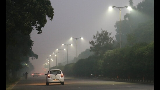
While AQI remained poor category through the day, at the Continuous Ambient Air Quality Monitoring Stations (CAAQMS) in Sector 53, it was recorded at 314 at 11pm. This was followed by CAAQMS Sector 22 with 266 and CAAQMS Sector 25 at 191. AQI between 301-400 is considered very poor and can cause respiratory illness on prolonged exposure.
In comparison, on Diwalinight, the average AQI in Sector 53 was 119, in Sector 22 it was 130 and in Sector 25 it was 114. UT director environment Debendra Dalai said, “AQI is worsening due to fall in temperature and high pressure in the atmosphere. Also, for the past two days, the sky was cloudy. When sunlight is not adequate, the AQI often increases.”
The city’s visibility levels also remained low on the day. Normally, it stays between 4,000 to 5,000 metres around this time of the year.
The city’s visibility normals stays between 4,000 to 5,000 metres around this time of the year and drops during winters when fog starts forming. However, on Tuesday, the visibility went down to 1,500 metres to 2,000 metres early in the morning. It was slightly better during the day as it went upto 4,000 metres but again came down to between 2,000 metres to 2,500 metres in the evening.
IMD Chandigarh director Manmohan Singh said, “While fog is declared when visibility drops below 1,000 metres, this drop in visibility can be attributed to smog. It forms as smoke mixes with sand particles and humidity, leading to a drop in visibility and a slight drop in maximum temperature as well if it comes during the day.”
Visibility had also remained affected on Monday going down to between 2,000 metres and 2,500 metres at the lowest.
Meanwhile, met officials said the city can expect rain on Wednesday and Thursday as another western disturbance (WD) will affect the city. This will be the second consecutive WD to affect the region and is expected to be more powerful in the region.
Over the next three days, the maximum temperature will remain between 25°C and 27°C while minimum temperature will remain between 14°C and 15°C.


