
 E-Paper



Decoding the monsoon onset: signs, signals and surprises
The monsoon progressed rapidly in May this year despite most of the country witnessing a mild summer

 Prefer HTon Google


MUMBAI: While torrential downpours across many regions in India, including Mumbai, in May, have captured national attention, behind the dramatic skies lie critical questions about the timing of the declaration of the monsoon’s onset, its implications for key stakeholders, and how inaccurate weather alerts can undermine disaster preparedness.
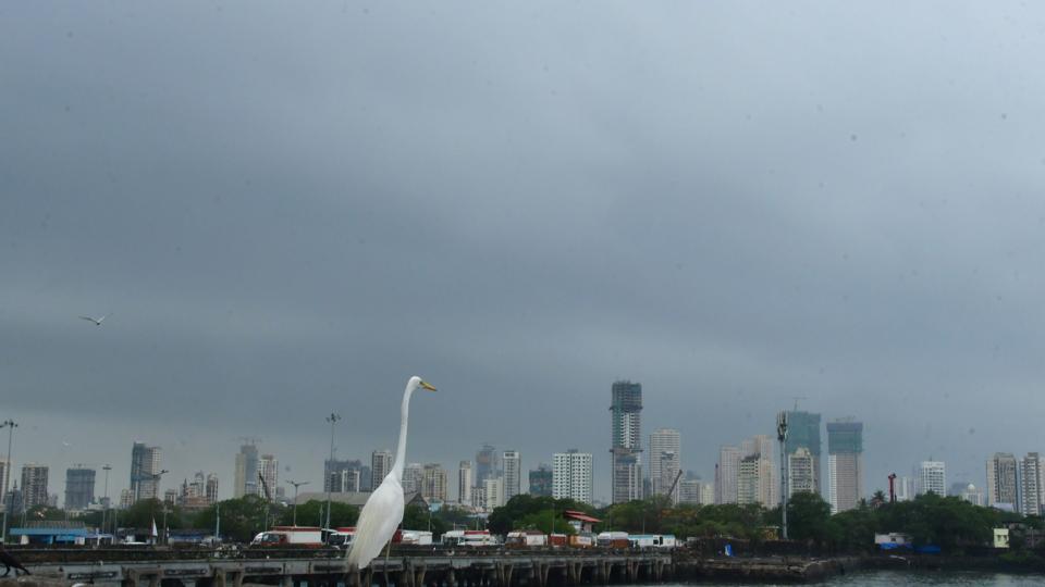
The declaration of the monsoon’s onset in India is undoubtedly one of the most awaited events of the year. More than simply a season of rain, it is, in fact, a massive seasonal shift in winds that transports vast amounts of moisture from the Indian Ocean toward the Indian subcontinent, ultimately leading to a large amount of rainfall. At a very basic level, the monsoon can be considered to be a giant land-sea breeze, arising from the differential heating between land and Indian Ocean. Since land warms faster than water, air pressure over South Asia is reduced compared to that over the Indian Ocean during summer months, drawing in moisture-laden south westerly winds toward land. One could therefore argue that a hot summer season is essential for a timely onset of the monsoon and excess rainfall in the country. And yet, the monsoon progressed rapidly in May this year despite most of the country witnessing a mild summer.
This curious case demonstrates that there is no correlation between surface temperatures during the summer and the monsoon onset. As previous research has shown, what matters is the differential heating that occurs high up in the sky, typically above 20,000 feet. The monsoon onset in Kerala happens when the heating at this height over India and neighbouring land is stronger than that over the Indian Ocean. This process must have happened much earlier this year, which helped the monsoon reach Kerala almost a week in advance.
The declaration of the onset of monsoon over Kerala has often sparked debate in the past. Heavy rainfall in the state during some years such as 1967, 1979, 1986, 1995, 1997 and 2002 tempted officials to declare the monsoon onset, but the weather soon cleared up leading to a ‘bogus onset’. A monsoon onset is deemed ‘bogus’ when atmospheric conditions mimic the monsoon but are short-lived or incomplete. Such premature declarations in the past led to the implementation of a formal set of criteria in 2006. Under the current guidelines, the onset over Kerala is declared only when specific thresholds are met: consistent and widespread rainfall over Kerala, coastal Karnataka, and Lakshadweep; the establishment of monsoon winds in the atmosphere; and the presence of deep clouds off the Kerala coast.
It is generally observed that once the monsoon reaches Kerala, the role of wind patterns in subsequent onset declarations tends to diminish, with greater emphasis placed on rainfall — often making the process more subjective. On May 26, the IMD declared the monsoon’s arrival in Mumbai, marking the earliest onset in over 75 years. However, weather models used by the IMD and Doppler radar observations in Mumbai revealed a notable absence of the characteristic westerly or southwesterly monsoon winds, both at the surface and up to 5,000 feet above sea level. Instead, air was flowing in from Rajasthan and Gujarat, rather than the Indian Ocean — in stark contrast to the wind pattern over Goa, where the monsoon was firmly established. The heavy rainfall that day was, in fact, the result of strong pre-monsoon thunderstorms that approached the city from the northeast, rather than a true monsoonal surge. Undoubtedly, the monsoon progressed rapidly this year along the west coast of India, but the monsoon winds in Maharashtra are yet to extend beyond south Konkan.
What lies ahead is a particularly intriguing weather pattern. A surge of dry air from arid regions to India’s west and northwest is now sweeping into the country, effectively stalling the further advance of the monsoon. News of the monsoon’s arrival in Mumbai and Konkan often brings hope to farmers in interior Maharashtra, who assume the rains will soon follow in their regions. However, premature or inaccurate monsoon onset declarations can mislead them, prompting sowing decisions in the absence of dependable rainfall—a gamble with serious consequences.
The monsoon is generally a stable weather system, with onset and withdrawal dates for a region such as Mumbai varying by not more than a week from year to year. While triple-digit rainfall totals are not uncommon for the city, the challenge arises when such volumes fall within just a few hours. As the planet warms due to global warming, the atmosphere is increasingly primed to unload intense bursts of rain in shorter durations, particularly during pre-monsoon thunderstorms. This growing volatility calls for a shift in preparedness: civic authorities must not adhere rigidly to traditional early-June timelines, but instead complete all pre-monsoon works before the first signs of pre-monsoon thunderstorms appear. It is important that weather alerts are issued prior to the onset of a severe weather event.
In the days that followed the May 26 downpour in Mumbai, real-time warnings and text message alerts also lacked accuracy. A recurring pattern of delayed or false alarms erodes public trust in the forecasting system — increasing the risk that genuinely dangerous events may be downplayed or ignored when swift action is most needed.
(Dr Akshay Deoras is a research scientist at the National Centre for Atmospheric Science and the Department of Meteorology, University of Reading, UK.)

Stay updated with all the Breaking News and Latest News from Mumbai. Click here for comprehensive coverage of top Cities including Bengaluru, Delhi, Hyderabad, and more across India along with Stay informed on the latest happenings in World News.


