
 E-Paper



Kashi’s 3D Urban Spatial Digital Twin development takes flight
Urban digital twins (UDTs) in general are considered as a potential technology to achieve digital transformative positive urban change through landscape architecture and urban planning.

 Prefer HTon Google


An aerial survey of the entire city of Kashi for the development of a 3D Urban Spatial Digital Twin, covering the expansive 160 square kilometer area of Varanasi has commenced as part of the Varanasi Smart City project. This digital twin will streamline operations for all civic agencies involved in city management and administration.
Urban digital twins (UDTs) in general are considered as a potential technology to achieve digital transformative positive urban change through landscape architecture and urban planning.
Kaushal Raj Sharma, divisional commissioner and chairman of Varanasi Smart City, highlighted that previously, only a 2D map of the 84 square kilometer area of Varanasi Municipal Corporation was available, leading to inconvenience due to the absence of maps for areas incorporated after delimitation. To address this, Varanasi Smart City is now focused on creating a modern 3D urban spatial digital twin map covering the entire 160 square kilometer area, facilitating more efficient operations for civic agencies.
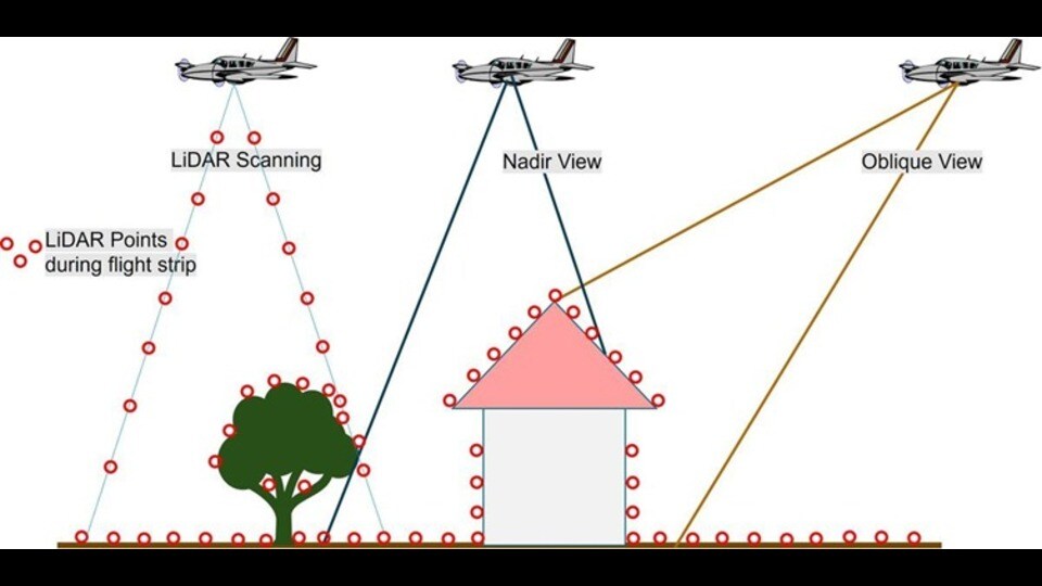
Dr D Vasudevan, chief general manager of Varanasi Smart City, noted that the aerial survey work is being conducted at an altitude of 3800 feet using a dual-engine aircraft, equipped with advanced sensor and camera technology capable of high-resolution mapping. Photogrammetry work, utilising LiDAR technology, comprehensively covers all ghats, streets, and narrow lanes.
This digital twin will be seamlessly integrated with the Kashi Integrated Command and Control Centre, enhancing the operational efficiency of various institutions including Jal Kal, Varanasi Municipal Corporation, Varanasi Development Authority, and Jal Nigam. Additionally, it will facilitate coordinated management of essential services such as waste disposal, fire control, traffic management, water distribution, and sewerage systems. Real-time data collection, including heat maps and thermographic data, will aid in crowd management in Varanasi.
The project is expected to be completed within the next nine months, according to Varanasi Smart City public relations officer S Nandan Sonthalia. It is being executed by the Mumbai-based agency Genesis International Corporation.


