
 E-Paper



Thunderstorm in Delhi; flights hit
Airport officials said that a few departing flights were also put on hold for a while. The delay left many travellers stranded at the terminals.


A dust storm, thunder and light rain on Sunday evening brought slight relief from rising temperatures but also disrupted air and road traffic in the capital. India Meteorological Department (IMD) has forecast pleasant weather on Monday too with scattered rain.
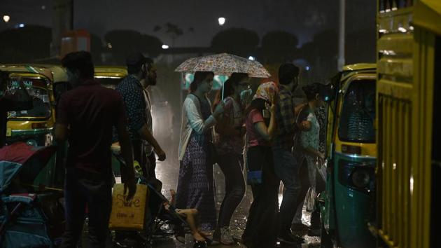
At around 8 pm, the dust storm with a speed of around 40-50 kmph disrupted air traffic leaving hundreds of passengers stranded at the Delhi Indira Gandhi International (IGI) airport. Airport operator, Delhi International Airport Ltd (DIAL), said five flights were diverted to Lucknow till 10 pm.
While Palam observatory recorded 4.8mm rain, the Safdarjung centre recorded 6.2mm rain between 8.30pm and 11.30pm.
Airport officials said that a few departing flights were also put on hold for a while. The delay left many travellers stranded at the terminals. “We had made adequate arrangements and real-time information was made available to the flyers at the terminals. Additional marshals were also deployed to manage traffic outside terminals and at approach roads,” the officer said.
“Duststorm and light showers are common seasonal activity and are expected to remain in Delhi-NCR till Monday. However, since the showers are short-lived, the impact will also be so. From Tuesday onwards, the temperature is expected to rise again,” said B P Yadav, deputy director-general, IMD.
A feeble Western Disturbance (WD) had occurred along with cyclonic circulation over Rajasthan, which triggered the thunderstorm on Sunday. The maximum temperature on Sunday was recorded as 36°C, a notch above normal. The minimum temperature settled at 25.6°C, six degrees above normal.
The city already saw an unusually hot day on Friday when the maximum temperature settled at 39.3°C, five notches above average.
On Saturday, the maximum temperature was recorded at 39°C, while the minimum was temperature was 22.4°C. The IMD has predicted heat wave conditions to hit the national capital from Tuesday. Heat wave conditions are likely to stay in the city between April 9 and April 13, said Met officials. A weather condition is described as ‘heat wave’ when the maximum temperature is above 40°C and the departure from the season’s normal is 4.5 degrees and above, or if the temperature crosses 45°C.
“Heatwave is a common phenomenon in the northern plains. The cold lasted in Delhi till around Holi, after which the wind direction and speed changed pushing the temperature upwards. Also, there was no major rain or shower activity over the last 20-25 days, which also resulted in high day and night temperatures. At times the heatwave strikes later, but owing to the prevalent factors, it is expected this week,” said Yadav.
Stay updated with all top Cities including, Bengaluru, Delhi, Mumbai and more across India. Stay informed on the latest happenings in World News along with Delhi Election 2025 and Delhi Election Result 2025 Live, New Delhi Election Result Live, Kalkaji Election Result Live at Hindustan Times.


