
 E-Paper



Biparjoy intensifies, PM takes stock of measures
Cyclone Biparjoy is expected to make landfall on Thursday afternoon between Mandvi in Gujarat and Karachi in Pakistan as a "very severe cyclonic storm" with a maximum wind speed of up to 150kmph. India's Prime Minister Narendra Modi has directed senior officers to ensure people in vulnerable locations are evacuated and to ensure the maintenance of all essential services. The National Disaster Response Force has pre-positioned 12 teams, equipped with boats, tree-cutters, telecom equipment, etc., and has kept 15 teams on standby. Indian Coast Guard and Navy have also deployed ships and helicopters for relief and search and rescue operations.

 Prefer HTon Google


Biparjoy barrelled towards the country’s west coast as an extremely severe cyclone on Monday, prompting the Gujarat government to rush in reinforcements, with the landfall expected on Thursday afternoon between Mandvi in Gujarat and Karachi in Pakistan.
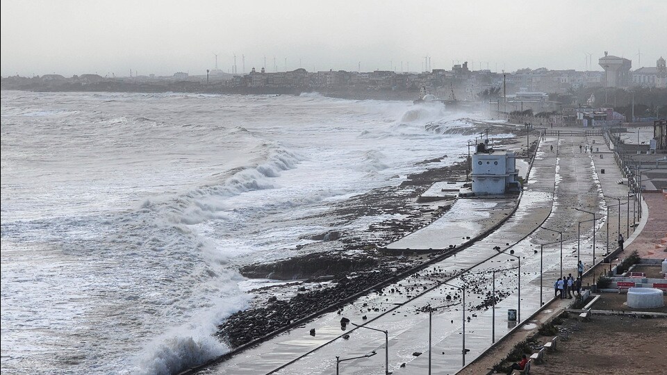
Prime Minister Narendra Modi chaired a high-level meeting on Monday, to review the preparedness of various departments and the Gujarat government to deal with Biparjoy’s impact.
According to the India Meteorological Department (IMD), Cyclone Biparjoy is likely to make landfall near Jakhau port in Gujarat’s Kutch district on Thursday afternoon as a “very severe cyclonic storm” with a maximum wind speed of up to 150kmph.
“Cyclone Alert for Saurashtra and Kutch Coast: Orange Message. ESCS BIPARJOY lay at 0830 IST today, about 320km SW of Porbandar, 360km SSW of Devbhumi Dwarka, 440 km South of Jakhau Port, 440 km SSW of Naliya,” IMD said in a tweet.
The Met department’s Ahmedabad centre director, Manorama Mohanty, said, “The cyclone is likely to make landfall near Jakhau port. It will hit Gujarat coast around noon on June 15. It will be preceded by winds with speeds of 135-145kmph gusting to 150kmph and extremely heavy rainfall.”
As the cyclone’s path became clearer on Monday, PM Modi directed senior officers to ensure people in vulnerable locations are evacuated and to ensure the maintenance of all essential services such as power, telecommunications, health, and drinking water etc., along with setting up of round-the-clock control rooms.
“He also directed that the safety of animals should also be ensured. He further directed for 24x7 functioning of control rooms,” an official statement said.
At the meeting, attended by Union home minister Amit Shah, principal secretary to the PM PK Mishra, Cabinet secretary Rajeev Gauba, and IMD officials, the PM was briefed about the measures taken by Gujarat government, the statement said.
The home ministry is reviewing the situation and is in touch with the state government, and central agencies, it said. NDRF has pre-positioned 12 teams, which are equipped with boats, tree-cutters, telecom equipment etc, and has kept 15 teams on standby.
“Indian Coast Guard and the Navy have deployed ships and helicopters for relief, search and rescue operations. Air Force and Engineer task force units of the Army, with boats and rescue equipment, are on standby for deployment. Surveillance aircraft and helicopters are carrying out serial surveillance along the coast. Disaster Relief teams (DRTs) and Medical Teams (MTs) of Army, Navy and Coast Guard are on standby,” the statement said.
“PM was also briefed about measures taken by the government of Gujarat to deal with the cyclone. Review meetings with the district administration have been held at the level of chief minister and the entire state administration machinery is geared up to meet any exigency situation,” it added.
In its latest bulletin at 11pm,IMD said the cyclone moved nearly northwestwards with a speed of 8kmph and lay centered over the same region, about 320km southwest of Porbandar, 330km southwest of Devbhumi Dwarka, 390km south-southwest of Jakhau Port, 400km south-southwest of Naliya and 540km south of Karachi (Pakistan) on Monday evening.
It is likely to move nearly northwards till Wednesday morning, then move north-northeastwards and cross Saurashtra and Kutch, and adjoining Pakistan coasts between Mandvi (Gujarat) and Karachi (Pakistan) near Jakhau Port (Gujarat) around noon of Thursday as a very severe cyclonic storm with maximum sustained wind speed of 125-135kmph gusting to 150kmph, the bulletin said.
Warning signals have been hoisted along the coasts for fishermen, and they have been advised not to venture into the central Arabian sea till June 15, and north Arabian sea during June 12. Fishermen out at sea have been advised to return to the coast.
Biparjoy developed as a depression over southeast Arabian Sea at 5.30am on June 6, and intensified into an extremely severe cyclonic storm by June 11.
IMD categorises a system as a cyclonic storm when its three-minute average maximum sustained wind speeds fall in the 63-88kmph range. A severe cyclonic storm has winds between 89 and 117kmph, a very severe cyclonic storm between 118 and 165kmph, and an extremely severe cyclonic storm between 166 and 220kmph.
Until this year, only two cyclones that developed over the Arabian Sea crossed the Gujarat coast in the month of June, IMD said on Monday.
“Based on the data during 1965-2022 for the month of June, 13 cyclones developed over the Arabian Sea. Out of these, two crossed Gujarat coast, one Maharashtra, one Pakistan coast, three Oman-Yemen coasts and six weakened over the sea. Prior to 2023, in the month of June, only two cyclones crossed Gujarat coast, one as a severe cyclonic storm in 1996 and another as an extremely severe cyclonic storm in 1998,” IMD said.
Biparjoy is on course to becoming the longest sustaining Arabian Sea cyclone, having completed 156 hours at cyclonic strength (64kmph) till Monday.
“In recent years, extremely cyclonic storm Kyarr (October, 2019) over Arabian Sea had a life period of nine days and 15 hours. Very Severe Cyclonic Storm Gaja (November, 2018) over southeast Bay of Bengal had a life period of nine days and 15 hours,” IMD added in a statement on Monday.
IMD has issued wind warnings, with gale wind speeds ranging from 165-175kmph, gusting to 195kmph, forecast over the northeast and adjoining east-central Arabian Sea on June 12.
While wind speeds are expected to decrease slightly in the following days, they will remain hazardous.
The Met department has also issued storm surge warnings for Kutch, Devbhumi Dwarka, Porbandar, Jamnagar, and Morbi districts, cautioning that storm surges of about 2-3 metres above the astronomical tide could inundate low-lying areas during landfall.
Meteorologists on Monday indicated that monsoon rains may be patchy in the Indian hinterland till the first week of July, on account of the cyclone pulling rain clouds away.
“Even though Biparjoy will bring rainfall to Gujarat and Rajasthan, we are not expecting monsoon onset over central India for nearly a week. I do not expect the monsoon to pick up properly until June 18 because Biparjoy once it weakens after landfall will remain a low pressure area and will not allow monsoon winds to pick up. It will in fact divert the moisture towards extreme northwest India,” said Mahesh Palawat, vice president, climate and meteorology, Skymet Weather, private weather forecaster.
IMD declared monsoon onset over Kerala on Thursday (June 8), seven days after it normally arrives in the state on June 1, even as climate scientists and meteorologists warned of a weak onset due to the severe cyclone Biparjoy.
(With agency inputs)



