
 E-Paper


How Terrain in Texas Hills Turned Stalled Rainstorm Into Flood Disaster
Water cascaded down cliffs and swelled waterways when shallow soil failed to absorb the deluge.


 Prefer HTon Google


A combination of steep terrain, shallow soil and a moisture-laden weather system that stalled over the Texas Hill Country caused the flash floods that killed at least 70 people Friday.
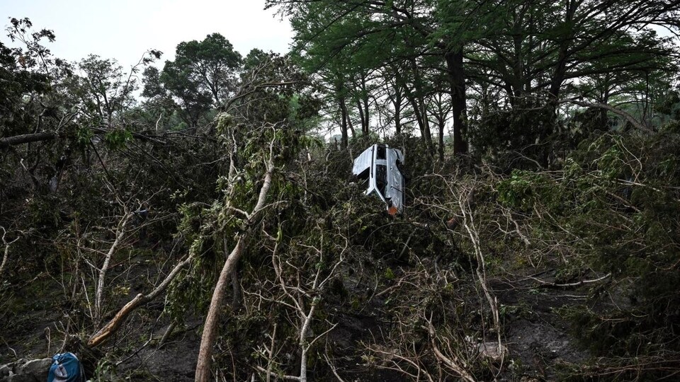
The weather system that caused the flooding was fueled by moist air from the coastal plain that swept up the Hill Country’s steep cliffs, condensed overhead, and for hours cascaded down those same cliffs. Narrow canyons then funneled the coursing water into creeks and rivers that rose and turned into deadly flash floods.
“Water moves very fast in the creeks, and flooding will happen very quickly,” according to Hatim Sharif, professor of civil engineering at the University of Texas, San Antonio, who studies the effects of water on the landscape. “In 90 minutes, you can have 20 feet of water.”
A flood gauge in the town of Hunt in Kerr County, stopped sending data at 4:35 a.m. Friday when the river was about 20 feet above flood stage.
Texas is the deadliest state in the country for flood-related deaths, and the so-called “Flash Flood Alley” between Dallas and San Antonio is considered the worst region for extreme flooding.
The state led the country in flood deaths with 1,069 between 1959 and 2019, according to a study by Sharif and colleagues published in 2021. The next-highest total was in Louisiana, with 693. In June, 13 people died in San Antonio when 6 inches to 7 inches of rain fell in several hours, causing a wall of water to wash away vehicles on a highway.
The flood-prone Hill Country covers 18 counties of south and central Texas, including the cities of Austin and San Antonio. A series of geologic fault zones called the Balcones Escarpment that varies in elevation from 300 feet just west of San Antonio and Austin to 1,000 feet near Del Rio, Texas, creates the steep cliffs and narrow canyons that characterize the region.
Once a rainstorm develops, there is little place for the water to go. It’s a semiarid area covered by a shallow layer of soil over bedrock. The ground doesn’t absorb much rainfall, and runoff can cause shallow rivers and creeks to rise quickly, Sharif said.
On Thursday and Friday, warm air from the remnants of a tropical storm pushed west from the Texas coast, flowed over the Balcones Escarpment and fell as heavy rainfall over a large area from Austin north to San Angelo and the Guadalupe River area, according to John Nielsen-Gammon, Texas state climatologist.
Much of the rainfall drained into the Guadalupe River, which flows 250 miles from its spring-fed source in western Kerr County, the area hardest hit by this flooding.
“We had a weak upper level disturbance from the west that helped destabilize the atmosphere and provide ascent of air in central and south central Texas,” Nielsen-Gammon said. “The last ingredient we had was a wind profile that allowed the storm to sit in place and redevelop over the same location for an hour or more.”
A separate low-pressure system fed the storm from the north.
Up to 18 inches of drenching rain fell over a three-hour period early Friday in some locations. A river gauge on the Guadalupe River in Comfort, Texas, downstream of Hunt, rose 31.5 feet between 9 a.m. and 11 a.m. Friday, according to the U.S. Geological Survey.
The amount of rainfall over the south and southeastern U.S. has increased by an estimated 15% over the past 40 years, according to Nielsen-Gammon. Warming oceans evaporate more moisture and a warmer atmosphere holds more water, according to climate scientists.
Sharif said that weather-forecasting models need to be improved to help residents understand the consequences of what happens to specific areas with various amounts of rainfall.
“People need to understand if there is 6 or 7 inches, what does this mean for my area?” Sharif said. “Will roads be flooded? There should be some models and information available for emergency-response people.”
Write to Eric Niiler at eric.niiler@wsj.com


