
 E-Paper



Chandigarh completes drone survey in 5 villages, 15 sectors under Centre’s ‘Naksha’ project
The pilot project covers five villages—Burail, Attawa, Kajheri, Palsora, and Sarangpur—along with Sectors 2 to 17; officials informed that the drone survey has been successfully completed, and field verification will be carried out by 20 survey teams, each comprising five members, in a systematic and time-bound manner


Under the central government’s ‘Naksha’ (mapping) project, the UT administration has completed drone surveys of five villages and 15 sectors. Field verification of property features is set to begin on September 20.
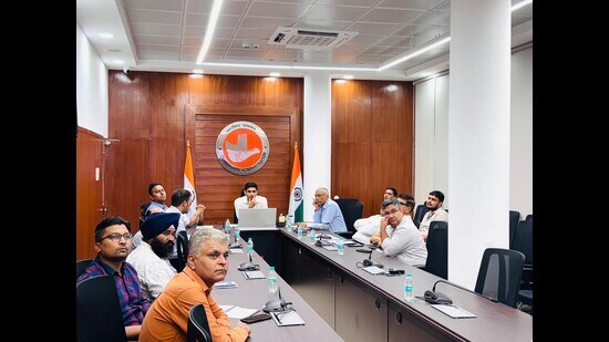
A review meeting of the project was held on Tuesday under the chairmanship of deputy commissioner (DC) Nishant Kumar Yadav. The pilot project covers five villages—Burail, Attawa, Kajheri, Palsora, and Sarangpur—along with Sectors 2 to 17. Officials informed that the drone survey has been successfully completed, and field verification will be carried out by 20 survey teams, each comprising five members, in a systematic and time-bound manner.
The central government’s NAKSHA (NAtional geospatial Knowledge-based land Survey of urban HAbitations) is a pilot programme under the Digital India Land Records Modernisation Programme (DILRMP) aimed to centralise land records, currently scattered across departments, into a single platform accessible with just one click.
The process to digitise land records was initiated by the administration in May this year and covers a total area of 30.61 square kilometres and a population of 1,47,945. The project was conceived due to poor maintenance of urban land records, rapid urbanisation, frequent property disputes, obstacles in planned development, complex land transactions and lack of transparency.
The DC also reviewed progress on the preparation of the Record of Rights (RoR) for properties in the Lal Dora areas of these villages. The consolidated property records will be used to issue Urban Property (UrPro) Cards. He emphasised the need for proper training of surveyors to ensure accuracy and efficiency in data collection.
Concluding the meeting, DC Yadav directed all stakeholders to strictly follow the project timelines to ensure timely completion. He further instructed the State Project Management Unit (SPMU) to maintain close coordination with all implementing agencies for smooth and effective execution.
The meeting was attended by officials from the Survey of India (SOI), National Informatics Centre (NIC), Municipal Corporation Chandigarh (MCC), Madhya Pradesh State Electronics Development Corporation (MPSEDC) (through video conferencing), and the SPMU, NAKSHA, UT Chandigarh.


