
 E-Paper



Farmers in Punjab, Haryana delaying fires to evade detection, as burnt area shrinks: New study
The total burnt area in both states has reduced by 25% to 35% over recent years, indicating real progress in cutting down crop-residue burning.

 Prefer HTon Google


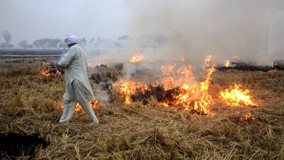
Farmers in Punjab and Haryana are increasingly shifting stubble burning to late afternoon and evening hours to evade satellite detection, even as the overall area burnt this year has declined significantly, a new analysis released on Monday has found.
The report, published by the environmental think-tank International Forum for Environment, Sustainability and Technology (iFOREST), warned that India’s current monitoring systems are capturing only a fraction of actual fires due to their limited observation window.
According to the study, the total burnt area in both states has reduced by 25% to 35% over recent years, indicating real progress in cutting down crop-residue burning.
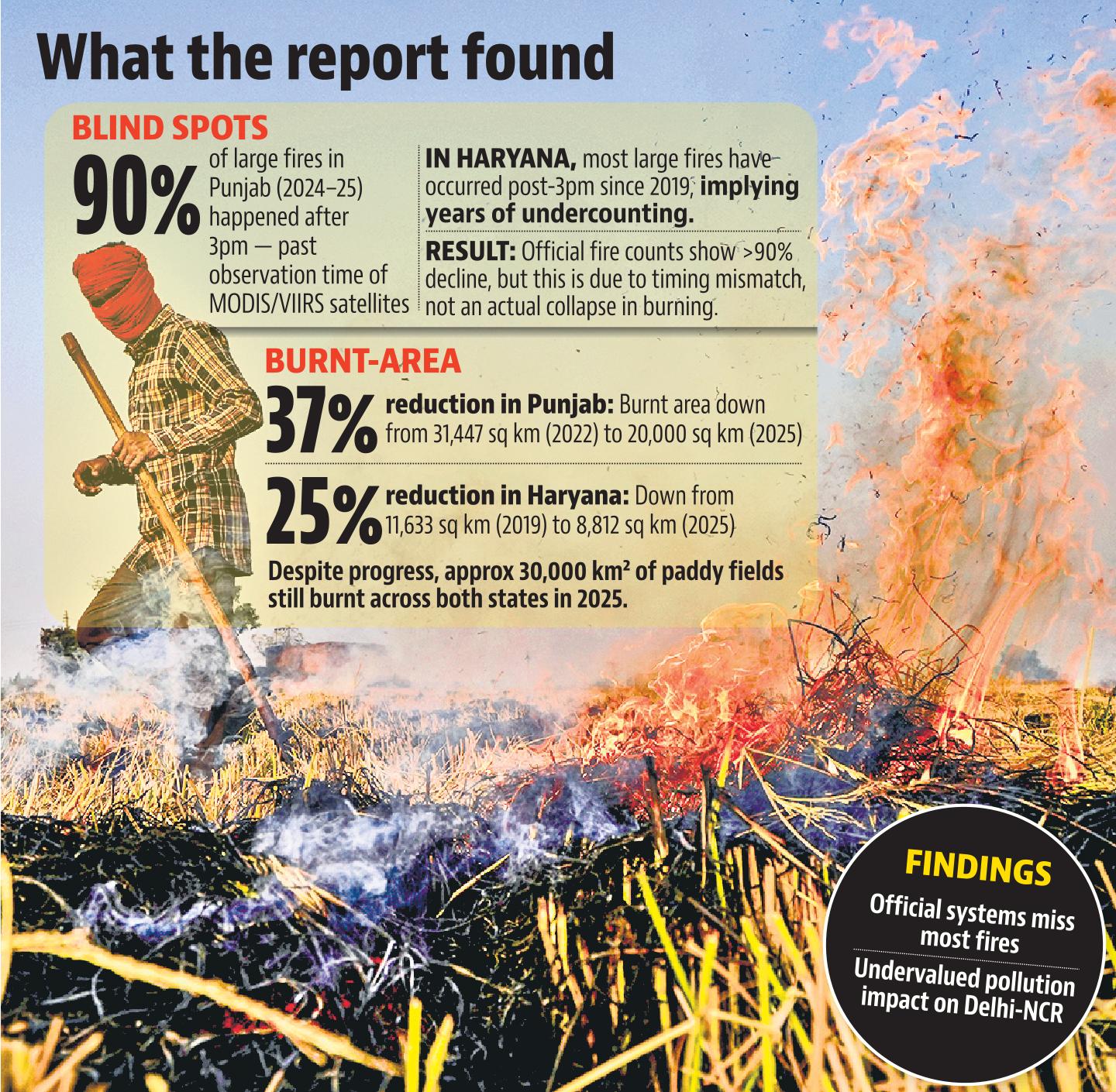
But the report also shows that the time of burning has shifted dramatically. In Punjab, over 90% of large farm fires in 2024 and 2025 occurred after 3pm, compared to just 3% in 2021. The trend appeared even earlier in Haryana, where most large fires have taken place after 3pm since 2019.
This shift, the report said, has created a widening gap between what is visible from space during official monitoring hours and what is actually happening on the ground. Current surveillance under the Consortium for Research on Agroecosystem Monitoring and Modeling from Space (CREAMS), led by the Indian Agricultural Research Institute (IARI), relies primarily on MODIS and VIIRS polar-orbiting satellites that pass over India only between 10:30am and 1:30pm. As a result, the majority of fires ignited later in the day escape detection.
“Thus, it misses the majority of large farm fires, which now occur later in the afternoon and evening,” the report states, calling for urgent modernisation of the monitoring protocol.
Every year, between October and November, Delhi’s air quality is impacted by farm fires in Punjab and Haryana, with northwesterly winds bringing this smoke towards the capital, where it often accumulates and adds to the existing pollution load in the region. On days, the peak daily contribution from stubble burning to Delhi’s PM 2.5 can go up to 35-45%.
At the launch webinar, Chandra Bhushan, CEO of iFOREST, said the findings provide “incontrovertible evidence” that India’s current monitoring system is structurally misaligned with real-world burning patterns. “Farmers have shifted burning to the late afternoon, while our monitoring relies on satellites that capture active fires only during a narrow window. The result is a massive underestimation of fires, emissions, and their contribution to air pollution in Delhi. We urgently need to overhaul the system,” he said.
While the timing trend highlights shortcomings in detection, the study also confirms a sustained fall in total burnt acreage. Sentinel-2 burnt-area mapping shows Punjab’s burnt cropland decreasing from 31,447 sq km in 2022 to around 20,000 sq km in 2025 – a 37% drop. Haryana’s burnt area fell from 11,633 sq km in 2019 to 8,812 sq km in 2025, a reduction of roughly 25%.
IARI data also reflects steep declines in active fire counts. Punjab recorded 5,114 farm fires until November 30 this year, down from 10,909 at the same time last year, and far below the peaks of 36,663 in 2023, 49,922 in 2022, and over 83,000 in 2020. Haryana logged 662 fires this year, its lowest in five years. But Bhushan cautioned that active fire counts alone do not offer a complete picture. “Burnt area provides a more reliable picture of stubble burning,” Bhushan said.
The report stated that by igniting fires closer to sunset, farmers are effectively avoiding detection by MODIS and VIIRS, which form the backbone of the CREAMS system. It recommends that CREAMS begin publishing burnt-area data – not just active fire detections – to give an accurate national estimate. It also urges the Indian Institute of Tropical Meteorology to revise its Decision Support System for Delhi’s air-quality forecasts to correctly quantify the contribution of crop-residue burning.
“We cannot manage what we do not measure accurately,” said Ishaan Kochhar, Programme Lead at iFOREST. “Policy decisions are currently being shaped by incomplete information. To solve the stubble-burning problem in the Indo-Gangetic Plain, the monitoring protocol must integrate geostationary data and burnt-area mapping.”
The report also flags a rise in farm-fire activity outside traditional hotspot states, including Uttar Pradesh and Madhya Pradesh, where burnt-area estimates are not yet being calculated – a trend it says requires immediate attention.
An IARI official, who asked not to be identified, said the findings were not new, with this trend also similarly flagged by scientists last year. The official said they were already working on this. “Burnt area is also being assessed by us since 2018, but we are not putting the data in public since this data needs ground validation too. We are working on overall technological gaps too,” the official said.


Stay updated with all top Cities including, Bengaluru, Delhi, Mumbai and more across India. Stay informed on the latest happenings in World News along with Delhi Election 2025 and Delhi Election Result 2025 Live, New Delhi Election Result Live, Kalkaji Election Result Live at Hindustan Times.


