
 E-Paper



Govt revises plan for corridor to link Anand Vihar, Zakhira
A Public Works Department official said the revised feasibility report of the new alignment has been shared with all stakeholder agencies, and it will address the last remaining objections that are raised


New Delhi A proposed signal-free corridor, which will connect east Delhi’s Anand Vihar to west Delhi’s Zakhira, has been given a fresh alignment, with the new stretch likely to be 21-km long having an estimated travel time of 20-25 minutes, officials overseeing the project said on Thursday.
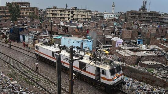
A Public Works Department (PWD) official said the revised feasibility report of the new alignment has been shared with all stakeholder agencies, and the PWD will address the last remaining objections that are raised by the agencies. “After addressing these objections, the revised plan will be submitted for final approval by the Unified Traffic and Transportation Infrastructure (planning and engineering) Centre (UTTIPEC) and public feedback will be taken,” the official said.
“We still have some objections remaining from the forest department. Sections of the Ring Road are deemed as a forest,” the official said.
The ambitious project was first floated in 2012 under the Sheila Dikshit-led Congress government, but its execution got delayed due to land availability-related issues, with primary objections from the Railways as a large chunk of the corridor will run along the railway tracks. The corridor alignment also faced objections from the erstwhile South MCD, which was planning to develop a new municipal headquarters near IP Estate. The corridor was earlier to be 25-km long with six lanes -- three on each carriageway.
However, under the new proposal, the corridor has been cut down to a 4-lane one -- the bulk of which will pass along an existing railway line -- with a 5-km underground tunnel passing below the New Delhi Railway Station, officials said.
“We have decided to adopt the four-lane model, as the project includes a tunnel that needs to pass under the thickly-populated residential areas of the Walled City, and there is not enough space for a six-lane tunnel. If the corridor were to be six-laned and the tunnel was to be four-laned, traffic movement would not be smooth and bottlenecks would emerge,” an engineer associated with the project said.
According to the new alignment, the corridor will begin at Anand Vihar in east Delhi and run at a distance of 15 metres from the railway tracks and pass through Patparganj and Preet Vihar. A bridge will be developed parallel to the existing railway bridge and the corridor will extend till the ITO intersection, passing close to the Pragati Power station.
“At the ITO intersection, the elevated corridor will pass between Tilak Bridge and the existing skywalk foot-over-bridge,” the engineer associated with the project said.
Thereafter, the tunnel section of the corridor will begin, with its opening proposed to be behind the Jammu Kashmir Study Centre at Deen Dayal Upadhaya Marg and its exit near Filmistan. “We have made sure that there are no conflict points with the underground metro tunnels at this point,” the official said.
After the tunnel, a second elevated section will be built, which will run along the railway lines from Filmistan to Sarai Rohilla railway station, and will continue till Zakhira.
Dr S Velmurugan, chief scientist, Central Road Research Institute (CRRI,) said that with the Ring Road and the Outer Ring Road reaching their peak carrying capacity, there is a need to develop such corridors to bear the additional vehicular load. “While new corridors are needed, the department should provide some ramps near key intersections to increase the number of beneficiaries in this case. To tackle traffic-jam related issues due to ramps, the department can develop the ramps at a small distance from the main intersections,” he said.
Stay updated with all top Cities including, Bengaluru, Delhi, Mumbai and more across India. Stay informed on the latest happenings in World News along with Delhi Election 2025 and Delhi Election Result 2025 Live, New Delhi Election Result Live, Kalkaji Election Result Live at Hindustan Times.


