
 E-Paper



Heatwave in parts of Capital for 2nd day, IMD predicts relief unlikely before June 10
“Over the last three days, the impact of easterly winds has completely ended and there are dry westerly winds blowing over the region once again, bringing dry and dusty weather to northwest India,” said an IMD official.


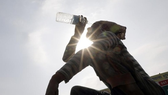
Parts of Delhi recorded heatwave conditions for the second consecutive day on Sunday, as six weather stations recorded a maximum temperature in excess of 44.8 degrees, shows India Meteorological Department (IMD) data. IMD has issued a yellow alert for Monday as well, forecasting that heatwave conditions will continue in parts of Delhi, adding that no relief is likely till at least June 10. The IMD issues a yellow alert to warn the public of a weather phenomenon in place, while it is upgraded to an orange alert, if preventive action is required.
On June 11, Delhi may see isolated rain activity under the influence of a fresh western disturbance, officials said.
A western disturbance refers to an area of “disturbed” or reduced air pressure, moving from the west to the east, carrying with it moisture associated with rainfall, snowfall and fog in northern India.
A heatwave is declared over the plains if the maximum temperature is 40°C or higher and 4.5 degrees above normal, with this criterion being satisfied over two consecutive days.
On Sunday, six out of the 11 weather stations in Delhi recorded a maximum temperature higher than the 44.8°C mark--Mungeshpur, which was Delhi’s hottest location at 47.3°C, Sports Complex in Akshardham (46.6°C), Najafgarh, (46.3°C), Pitampura (46.2°C), Ridge (45.7°C) and Jafarpur (45.1°C). However, Safdarjung observatory, like Saturday, did not meet the criteria for a heatwave.
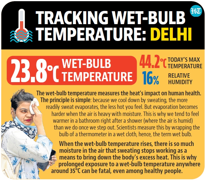
The Safdarjung observatory, Delhi’s base station, recorded a maximum of 44.2°C on Sunday – four notches above normal and a little over Saturday’s reading of 43.9°C. Safdarjung also recorded a minimum temperature of 27.4°C, which is around the normal mark for this time of year. The normal mark for Safdarjung for June 5 to 9 is 40.2°C, meaning in order to record heatwave conditions, the maximum there should be 44.8°C or higher.
Prior to this spell, Delhi last recorded a heatwave on May 15, when its maximum temperature touched 45.6°C at Safdarjung and 49.2°C at Mungeshpur, making it the hottest day of the year thus far. “We saw two active western disturbances in the second half of May, which brought sufficient rainfall to the Capital. Over the last three days, the impact of easterly winds has completely ended and there are dry westerly winds again blowing over the region once again, bringing dry and dusty weather to northwest India. Dry weather is expected till June 10, with the maximum to remain over 40 degrees at all stations,” said an IMD official.
IMD’s forecast for Monday shows strong surface winds of 20-30km/hr are expected during the day, however, these will be dry winds, with the maximum temperature expected to be around 43°C at Safdarjung and up to 46°C elsewhere. The minimum, meanwhile, could hover around 27°C.
“We will see a maximum temperature between 43°C and 46°C until June 9. On June 10, it may drop to around 41°C to 44°C and from June 11 onwards, there could be some rain,” the Met official added.

Stay updated with all top Cities including, Bengaluru, Delhi, Mumbai and more across India. Stay informed on the latest happenings in World News along with Delhi Election 2025 and Delhi Election Result 2025 Live, New Delhi Election Result Live, Kalkaji Election Result Live at Hindustan Times.


