
 E-Paper



BMC completes 3D mapping of Worli in first of its kind project in Mumbai
The 3D geospatial city model will help with change detection analysis, insights on unauthorised and illegal settlements, classification on building types, detailed infrastructure planning of roads, bridges, flyovers, in comparison to alternate infrastructure designs

 Prefer HTon Google


The Brihanmumbai Municipal Corporation (BMC) has prepared a three-dimensional (3D) development plan and the master plan of the Worli area called a 3D geospatial city model. This is a detailed digital 3D map that covers every parameter of the area, with a 360-degree digital panoramic view. The area covered under the project is 10 square kilometres, encompassing Worli’s entire G/South ward.
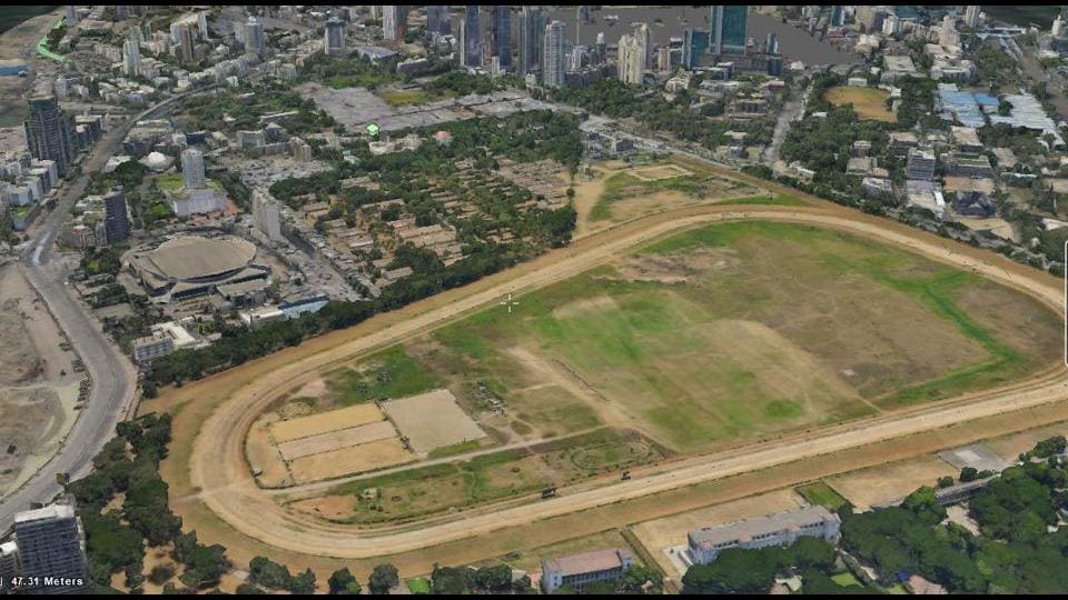
This will help the civic body in multiple development ventures and policy interventions in the area, infrastructure planning, natural disaster management, citizens’ safety, environment analysis, and assessment of public amenities.
The initiative was inaugurated by Maharashtra cabinet minister Aaditya Thackeray, who also represents the Worli Assembly constituency, on Friday. It was undertaken by BMC in partnership with Genesys. Announcing the completion of the project, BMC tweeted on Friday, “Mapping The Future! Using state-of-the-art tech supported by @Genesys_Int, BMC has completed an intricate digital 3D mapping of Worli in @mybmcWardGS. This initiative, inaugurated by Cabinet Minister @AUThackeray, will help in progressive planning & coordinating action on the ground.”
In a statement from the G/South ward, BMC said, “We live in a 3D world, planning and development activities encompassing urban governance, city infrastructure upgrades, etc, are still being carried out on 2D maps. To meet the demands of cities in the 21st century, it is imperative that urban governments are able to visualise their cities in 3D for getting comprehensive 360 [degree] views, undertake simulations and conduct detailed analysis on the data, etc. all of which is inefficient and close to impossible on archaic 2D maps.”
The 3D geospatial city model will help with change detection analysis, insights on unauthorised and illegal settlements, classification on building types, detailed infrastructure planning of roads, bridges, flyovers, in comparison to alternate infrastructure designs. BMC will also be able to find project-affected persons accurately, by overlaying the 3D model of the proposed project on the existing 3D model of the city. The imaging will help the civic body in urban flooding monitoring and mapping as well.
The 3D geospatial model was created using high-resolution aerial drone imagery and mobile street imagery vehicles mounted with light detection and ranging (LiDAR) sensors.
“This aerial data coupled with 3,600 high-definition street view imagery was then fused to create a true-to-life Geospatial Map resulting in a comprehensive 3D Digital Twin,” BMC said in a statement.


