
 E-Paper



Central Maharashtra sees fourth wettest monsoon since 1901
Since 1901, it is the fourth wettest monsoon season for Central Maharashtra as per the data released by India Meteorological Department


Pune: With erratic rainfall breaks and intense downpour this year, central Maharashtra has reported 17 per cent excess rainfall. Since 1901, this is the fourth wettest monsoon season for the region as per the data released by India Meteorological Department (IMD). Scientists from the Indian institute of Tropical Meteorology (IITM) have noted that heavy and intense rainfall events in central Maharashtra are likely to see an increase in the coming years.
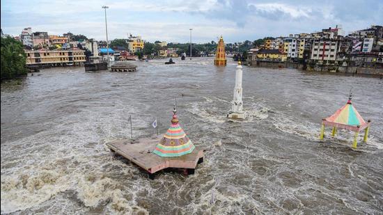
In 2021, central Maharashtra reported 869.1 mm actual rainfall against the normal rainfall of 746 mm between June 1 and September 29.
Roxy Mathew Koll, senior climate scientist, IITM, said that the changes in central Maharashtra are similar to large-scale changes in the monsoon pattern.
“Monsoon rainfall patterns from Gujarat to Odisha have shown changes. These changes are consistent with what is happening in central Maharashtra. We have observed that between June and September, which is the monsoon season, there are more long dry spells intermittently with three to four days of intense heavy rainfall. The pattern we are seeing in Maharashtra and central Maharashtra is also the same,” said Koll, adding that as per the total rainfall recorded in the last two decades, the total monsoon rainfall has decreased.
“With increased temperature, there is moisture available. Which is also one of the reasons why we have dry spells. It is likely to pour more. Also, there is an indirect response of monsoon wind patterns from the Indian ocean to land. This circulation has been weakening, because of which there is less rainfall. There is a possibility that decrease in rainfall may continue. However, there is no clarity as of now. Models are yet to give a clear indication as to what will happen,” said Dr Roxy Mathew Koll.
He said that even though monsoon rainfall may decrease, the number of heavy rainfall events will increase.
“This has increased landslides and flooding. The change in rainfall pattern is due to climate change and urbanisation. What we can further see is that there are more heavy rainfall days and an increase in heavy rainfall intensity. Along with this, arial cover has increased that larger areas are now witnessing heavy rainfall events,” said Koll.
He shared the Chiplun floods as a perfect example of climate change and urbanisation.
“For extreme weather conditions, it is important that each district comes up with a climate projection plan to address extreme weather events. As different districts have different topography, every district must have a plan ready,” said Koll.
Downpour count
Central Maharashtra has reported above normal rainfall since 1901. The rainfall between June 1 and September end is 746 mm.
Year-- Rainfall (in mm)
1914--851.4
1933--766.7
1938--755.3
1969--782.3
1988--762.8
2005--820.7
2006--935.2
2007--773.2
2017--852.3
2019—1,166.9
2020--967
2021--869.1
Wettest monsoon season for central Maharashtra since 1901
Year--Rainfall (in mm)
2019—1,166.9
2020--967
2006--935.2
2021--869.1
Between June 1 and September 29, Maharashtra received 19 per cent excess rainfall with all districts receiving normal to above normal rainfall in the monsoon season.
Central Maharashtra has reported 17 per cent more than normal rainfall. Whereas drought-prone Marathwada has reported an excess rainfall of 49 per cent. Vidarbha has reported three per cent more than normal rainfall. Konkan and Goa have reported 23 per cent in excess rainfall this season.
Source: IMD and IITM


