
 E-Paper



Weather Bee: How monsoon turned rainy again this week
How monsoon underwent this reversal can be explained by a key feature of the monsoon rain called the monsoon trough.

 Prefer HTon Google


The past two weeks have seen a quick reversal in the status of monsoon rains. Last week, most of the country remained dry. This week has seen relatively more widespread rainfall like the first week of July. How did this change happen? Through a rather routine process in the season, which often happens after the progress of the weather system is already complete. The following charts explain how.
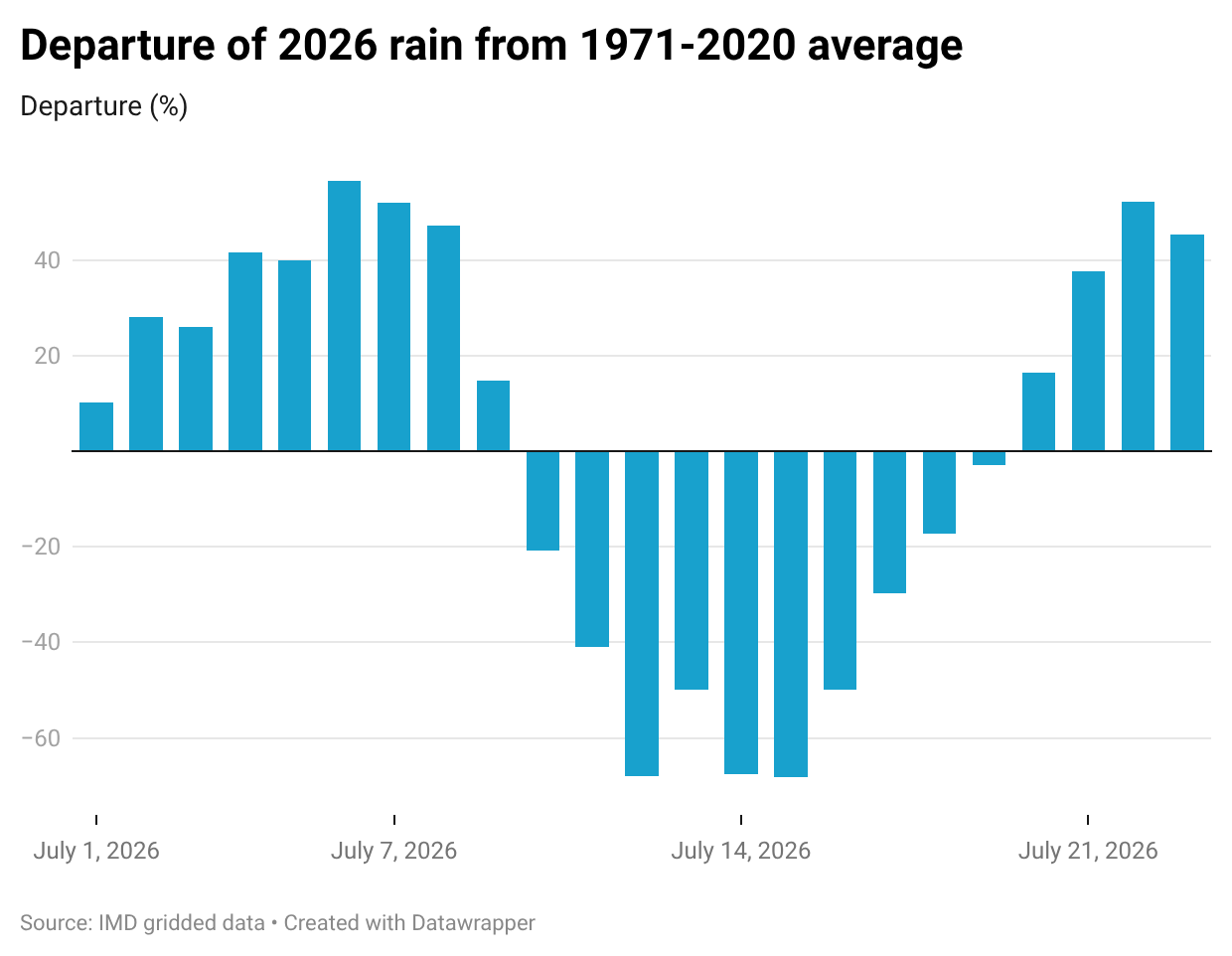
The change in the status of monsoon can be seen by tracking daily rainfall this July against the 1971-2020 average for those days, which the India Meteorological Department (IMD) considers as the Long Period Average (LPA) for tracking rainfall performance. From July 10 to July 19, India received less rain than the LPA on every day. The deficit was almost half or more of the LPA from July 11 to July 16. This has changed from July 20, with July 22 and July 23 rain around 50% more than the LPA.
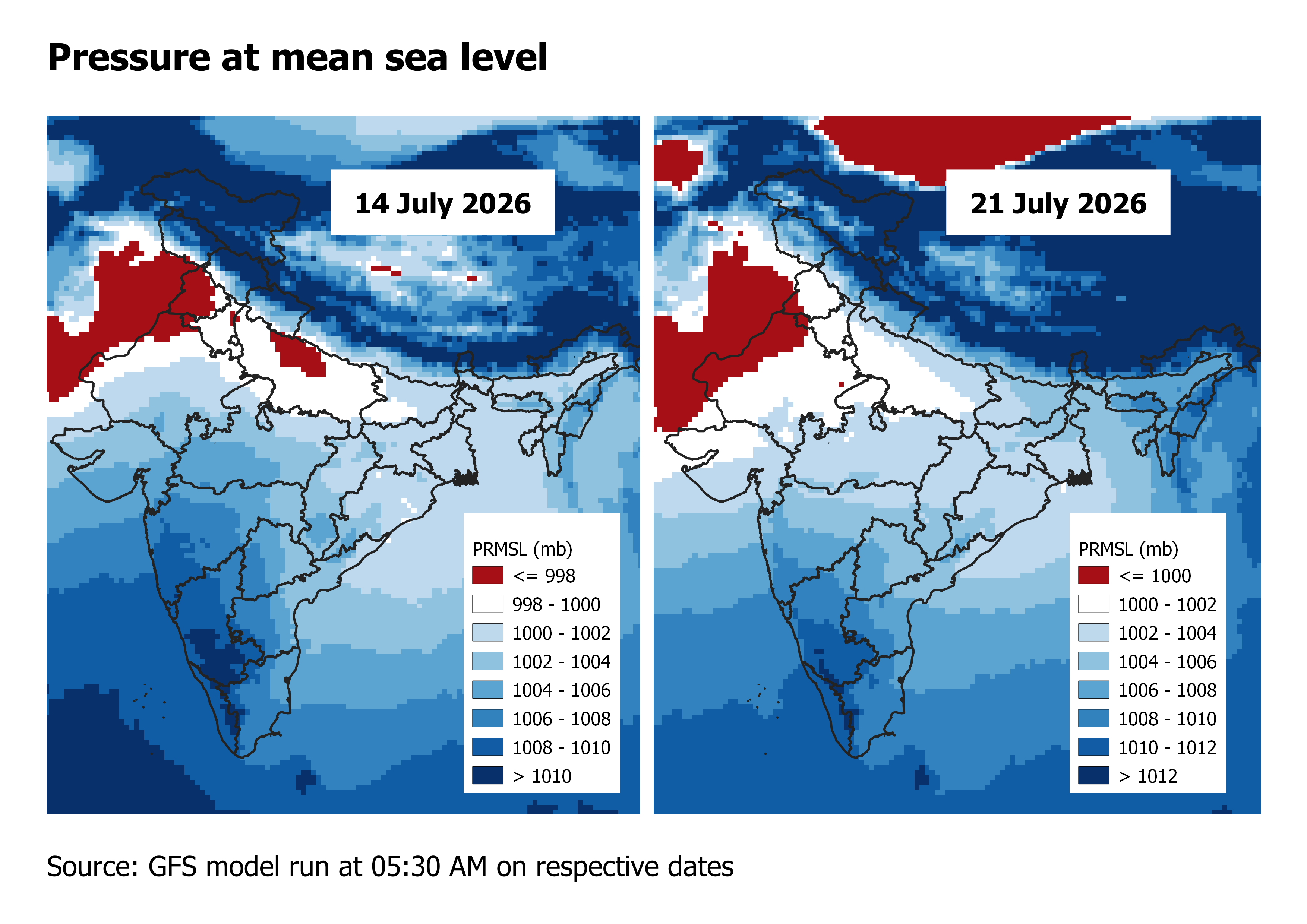
How monsoon underwent this reversal can be explained by a key feature of the monsoon rain called the monsoon trough. It refers to an area of low pressure which has an elongated shape like, as its name suggests, a trough. This shape is somewhat peculiar to the monsoon because low pressure areas can often look circular. To be sure, there is no particular threshold for how low this pressure must be. As is the case with most things pressure and temperature, it is the gradient that matters more than the absolute value. So the trough is more a place of relatively lower pressure than surrounding regions rather than a region where pressure has fallen below a threshold value.
This monsoon trough is usually found squarely over the Indo-Gangetic plains during what is called an active phase of the monsoon. This was the case on July 21. “The monsoon trough at mean sea level is near its normal position,” the IMD said. On the other hand, a week earlier, when daily rain was in deficit, the western end of the trough was north of its normal position. This shift can be seen in the accompanying maps for the two dates.
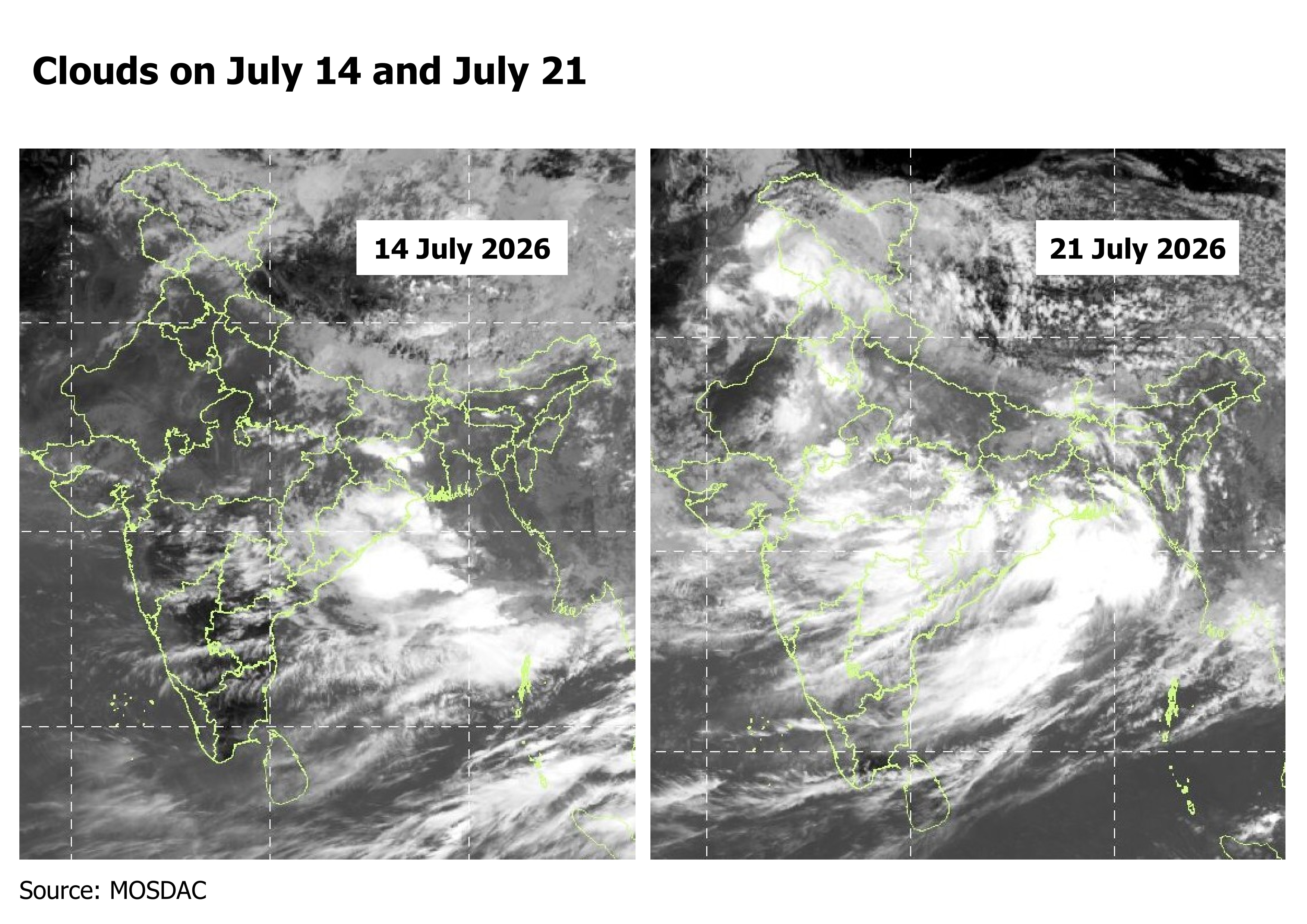
What does the shifting trough do? Any region of low pressure is often accompanied with rising air, which is necessary for cloud formation and then rain. This can be seen in the satellite images on the two dates for which pressure maps are shown above. Clouds are widespread on July 21 but largely on the eastern edge of the trough on July 14, when the western edge of the trough had shifted northward.
To be sure, the monsoon trough and its shifts are not the only ways in which the monsoon rain is driven. However, it is one of the more regular ways in which the intra-seasonal variation (at the scale of a few days to weeks) happens in the season. The rain trends in the past two weeks were the result of this variation.



