
 E-Paper



At 3.6 degrees, Delhi feels like 2° due to strong, chilly winds
Delhi’s “feels like” temperature, which takes into account wind speeds and humidity to assess how the human body perceives the temperature, was as low as 2 degrees Celsius, weather scientists said.


Residents of north-west India shivered in cold wave or severe cold wave conditions on Tuesday, with icy winds blowing across the Capital making the weather seem more frigid than it actually was. The Safdarjung observatory, which provides representative weather data for Delhi, recorded a minimum temperature of 3.6 degrees Celsius.
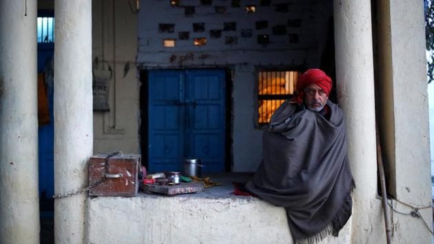
Delhi’s “feels like” temperature, which takes into account wind speeds and humidity to assess how the human body perceives the temperature, was as low as 2 degrees Celsius, weather scientists said. That was mainly because of strong, chilly winds blowing at 15 to 20kmph that enhanced the perception of cold, they said.
“For example, in winter a strong wind can feel much colder than the measured temperature would indicate. Conversely, on a humid day in summer, it can feel uncomfortably hotter than the air temperatures would suggest..,” according to the UK Met Office.
A cold wave occurs in the plains when the minimum temperature is 10 degrees Celsius or below and/or is 4.5 notches less than the season’s normal for two consecutive days. A cold wave is also declared when the minimum temperature is less than 4 degrees Celsius in the plains.
Also Read | Expect cold wave, fog in Delhi in the next four days: IMD
Delhi’s Lodhi Road and Ayanagar recorded minimum temperatures of 2.7 and 2.6 degrees Celsius, respectively. The maximum temperature in the city on Tuesday was 18.1 degrees Celsius, 2 degrees below normal.
Many stations in the northern plains recorded 0 degree or near 0 degrees Celsius minimum temperatures. Hisar and Narnaul, both in Haryana, recorded 0 degree and 0.3 degrees Celsius, respectively. Amritsar (Punjab) recorded a minimum temperature of 0.4 degrees Celsius. Bhilwara, Pilani, Sikar and Churu (all in Rajasthan) recorded a minimum temperature of 0.9, 0.9; 0.5 and 0.4 degrees Celsius, respectively.
“Severe cold wave was recorded in many parts of Punjab and Haryana and cold wave conditions were recorded in Delhi,” said Kuldeep Shrivastava, head of the Regional Weather Forecasting Centre.
“Extremely cold winds from snow-clad Jammu and Kashmir and Himachal Pradesh are reaching the plains now. The average wind speed was around 15kmph in Delhi, which increased the feeling of chill so the “feels like” temperature was around 2 degrees Celsius. Minimum temperatures will be low for the next two days and may even dip further,” he said.
New Year’s Day is likely to bring relief, when the minimum temperature is forecast to rise to around 5 degrees Celsius and to around 7 degrees Celsius on January 2 and 3, Shrivastava said.
A fresh western disturbance is likely to hit the Western Himalayan region around January 4, which may bring light rains and thundershowers to the plains including Delhi.
Under the influence of the strengthening of cold and dry northwesterly/northerly lower-level winds, minimum temperatures are likely to fall by about 2 degrees Celsius over most parts of north-west and central India during the next three days and rise by 3-5 degrees Celsius over the subsequent three days (January 1 to 3).
Ground frost conditions are likely over northern Rajasthan, Himachal Pradesh, Uttarakhand, Punjab, Haryana, Chandigarh and Delhi during the next two days.
“Many parts of north-west India are reaching the freezing point. We are expecting December 31 to be the coldest. Around January 2, a cyclonic circulation is likely to form over south Rajasthan and anticyclone over Chhattisgarh and Odisha. A confluence zone is likely to develop over Madhya Pradesh and east Rajasthan which is likely to bring rain to Punjab, Haryana and Delhi,” said Mahesh Palawat, vice president of climate change and meteorology at private forecaster Skymet Weather.
Highest weather station in India:
• India MD established a meteorological centre in Leh in Ladakh on Tuesday. At 3500 metres, it’s the highest met centre in India.
• Being located on a strategically important Western Himalayan region bordering China, Pakistan, Tibet and Afghanistan, IMD will be reporting daily weather parameters from the region.
• Ladakh has a complex mountainous terrain with little annual precipitation of only 10 cm/year making it a cold desert.
• It often experiences extreme weather events like cloud bursts, flash floods, glacial lake outbursts (GLOFs), avalanches and droughts.
• Examples include a severe cloudburst in August 2010 and 2015, an avalanche at Khardongla Pass in January 2019 and frequent blockage of the Leh-Manali and Leh- Srinagar highways due to heavy snowfall on mountain passes.
•The meteorological centre in Leh will strengthen the weathe- related early warning system in Ladakh.
• To begin with, IMD has established a surface observatory in Leh for reporting the daily meteorological parameters like humidity, temperature and snowfall.
• Ladakh has four Automatic Weather Stations, two each in both districts ,of which one is at Drass, the coldest place in India. Real Time weather data is available online on India Meteorological Department website.
• To improve the network, IMD proposes to install more weather stations next year at places like Nubra, Zanskar, Changthang and Parkachik, covering the whole of Ladakh.


