
 E-Paper



Met department under-reported rainfall intensity in Kerala, says government
The IMD underreported the intensity of rainfall that triggered unprecedented flooding that left more than 400 people dead and caused a trail of devastation across Kerala in August although it had accurately predicted heavy rain, according to a draft government report.


The India Meteorological Department (IMD) underreported the intensity of the rainfall that triggered unprecedented flooding that left more than 400 people dead and caused a trail of devastation across Kerala in August although it had accurately predicted heavy rain, according to a draft government report.
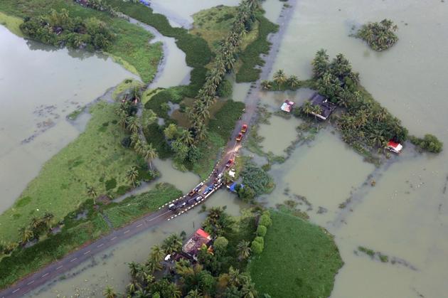
The report, prepared by the ministry of earth sciences (MoES), was an evaluation of the accuracy of IMD’s model in predicting the Kerala floods. A final version of the report will be released by October-end.
The immediate cause of the flooding was the formation of low-pressure weather systems over the Bay of Bengal, said the report, which added that the unprecedented rainfall could be linked to the impact of climate change.
“The report documents the unprecedented rainfall as an impact of climate change. In fact, we are seeing these events across the country and they will have to be documented,” said M Rajeevan, secretary, MoES.
Climate change has been blamed for extreme weather events across the world. Around 10,000 km of highways were destroyed because of the floods and landslides that affected Kerala in August.
Over 45,000 hectare of farmland were damaged. As per the revenue ministry, 11,000 houses were wrecked, and 1,11,000 houses partially damaged. More than a million people were displaced by the floods.
The MoES report has cautioned that such events may happen again in Kerala. “We are forecasting extremely heavy rain in Kerala and parts of Tamil Nadu between October 5 and 10 due to a weather system over the south-east Arabian Sea. There will be more such events in future,” said Rajeevan.
The draft report indicates that IMD’s model did predict the transition from normal monsoon rain to very heavy rainfall well but couldn’t predict the extreme volume of rain that pounded some districts.
“Weather transitions are being picked up very well by our model but it’s not picking up how high the rainfall can be during the transition phase. Even before the floods in Kerala this August, the model predicted that there is going to be a sharp rise in rainfall,” said Rajeevan.
IMD data released on Monday reveals that Kerala received about 24% excess rainfall this monsoon. Between August 1 and August 19, the state received 164% excess rainfall.
“Climate change is increasing the frequency and intensity of extreme temperature and rainfall events across the world. There is no doubt about it. This is based on both data and scientific models,” said SK Dash, a professor at the Centre for Atmospheric Sciences in the Indian Institute of Technology- Delhi.
Dash, who specialises in climate modelling, said: “Our models are not able to predict an extreme weather event 10 to 15 days in advance. But our weather forecasting models are able to read these events about three to four days in advance. But I agree with Rajeevan that the intensity is often not reflected well in these models. It’s also difficult to pin-point exact location which will experience the event but identifying a 30 to 40 km radius may be possible. It’s up to the local administration and state governments on how quickly they can respond to such alerts.”
With very heavy rain expected in Tamil Nadu, Puducherry, Kerala and coastal Karnataka between October 4 and 10, fishermen have been advised not to venture into southeast and central Arabian Sea from October 6 onwards, according to an alert issued by the IMD.


