
 E-Paper



Monsoon to cover northwest India by July: IMD’s forecast
The rain-bearing system, awaited by tens of millions for respite from what has been a scorching summer, has largely been stalled since June 11.

 Prefer HTon Google


The monsoon will resume its march across the country and cover northwest India, which includes Delhi and the key agrarian states of Punjab and Haryana, by July 3, the India Meteorological Department (IMD) said in a new forecast.
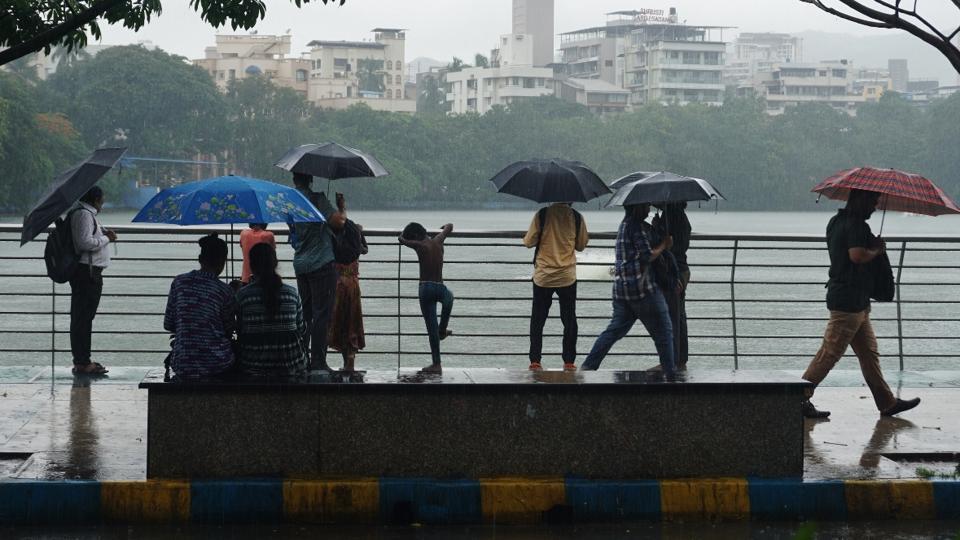
The rain-bearing system, awaited by tens of millions for respite from what has been a scorching summer and by farmers to irrigate their farmlands, has largely been stalled since June 11, having only inched a little further into parts of central India on Thursday.
“We are expecting a good revival around first week of July and the deficit from June will be covered during that period,” said M Ravichandran, secretary, ministry of earth sciences.
The system is expected to move over Gujarat, Maharashtra, Madhya Pradesh, Odisha, some parts of Gangetic West Bengal, remaining parts of Sub-Himalayan West Bengal, some parts of Jharkhand, some more parts of Bihar and some parts of East Uttar Pradesh during next 3-4 days. It will then pick up over northwest and central India beginning June 27, the agency predicted. “Rainfall activity is likely to be near normal to above normal over most parts of the country, except Western Himalayan Region and West Rajasthan,” an IMD’s forecast said.
“Southwest Monsoon likely to advance over remaining parts of Central India and most parts of remaining parts of northwest India during the week (June 27 to July 3),” the forecast added.
The government weather body also added that El Niño-Southern Oscillation (ENSO) neutral conditions currently prevail, with La Nina conditions expected to develop around August. El Nino is the cyclical warming of the equatorial Pacific region, which triggers a cascading effect on the weather around the world — in India, it has typically led to a weak monsoon season.
The La Nina is the opposite phenomenon and is linked to excess rains over the Indian subcontinent.
“Monsoon is reviving. As I said, monsoon will cover by the first week of July. We should expect good rains for next 2-3 weeks. We will have a normal-to-above-normal monsoon,” said M Rajeevan, former secretary, ministry of Earth sciences, and meteorologist
On a transition to La Nina, he said: “We should expect above normal rainfall in August due to emerging La Nina.”
“As long as El Nino is not there we can expect monsoon to be normal and good,” said Ravichandran.
India’s monsoon delivers nearly 70% of the country’s annual rain and is crucial for its economy since a large number of the country’s farmlands depend on rain for irrigation.
The monsoon’s progress had stalled for nearly nine days. As of Saturday, the northern limit of monsoon passed through Navsari, Jalgaon, Mandla, Pendra Road, Jharsuguda, Balasore, Haldia, Pakur, Sahibganj and Raxaul.
IMD expects further monsoon advancement into parts of North Arabian Sea, Gujarat, Maharashtra, Madhya Pradesh, Chhattisgarh, Odisha, West Bengal, Jharkhand, Bihar and East Uttar Pradesh in the next 3-4 days.
A trough at mean sea level is running off south Maharashtra-north Kerala coasts and lower-level winds are likely to strengthen along the west coast during next three days, the agency said, detailing factors that it sees as playing a part in the revival of the rains.
Also present are cyclonic circulations over interior Odisha and adjoining Chhattisgarh in lower and middle tropospheric levels, and over northeast and adjoining eastcentral Bay of Bengal. Under their influence, fairly-widespread to widespread, light to moderate rainfall accompanied with thunderstorm, lightning was likely over Gujarat, Konkan, Goa, Madhya Maharashtra & Marathwada, Karnataka, Kerala, Mahe, Lakshadweep; scattered to fairly widespread light to moderate rainfall was possible over Coastal Andhra Pradesh, Yanam, Rayalaseema, Telangana, Tamil Nadu, Puducherry and Karaikal during next 5 days, the agency forecast.
Since June 1, there’s a 17% overall rain deficiency, with northwest India experiencing a 61% deficiency. Twelve out of 36 subdivisions under IMD remain “large deficient,” while 12 more are “deficient.”
Widespread rainfall is expected over several southern and western states in the next five days due to various weather systems.
IMD’s June forecast suggested ENSO-neutral conditions will continue, with a strong possibility of transitioning to La Niña conditions around August-October 2024. The likelihood of positive Indian Ocean Dipole conditions during the monsoon season has significantly reduced.
Heatwave conditions persisted in isolated pockets of southwest Uttar Pradesh on Friday, with Orai recording the highest temperature of 44.6°C.
This year’s summer has been particularly unforgiving. Close to 60 people have died in hospitals with symptoms of excessive heat exposure due to the weather and the true toll may be significantly higher.
On Thursday, the city snapped an 11-day long heatwave spell as an approaching western disturbance slashed the maximum temperature from 43.6°C on Wednesday to 40°C on Thursday. Prior to that, the Capital recorded warm night conditions with the lowest falling no further than 35°C, which meant people had little relief even after sundown.



