
 E-Paper



No quick relief in sight, monsoon mayhem to continue in September, warns weather body
There is likely to be above-normal rainfall over several parts of north, west and central India till September 4

 Prefer HTon Google


There’s bad news for people in North West India who have been complaining that it has been wet; the region that has seen 23% excess rain in the monsoon that began June 1 is likely to see a wet September with weather models suggesting that widespread, heavy rain may continue well into September
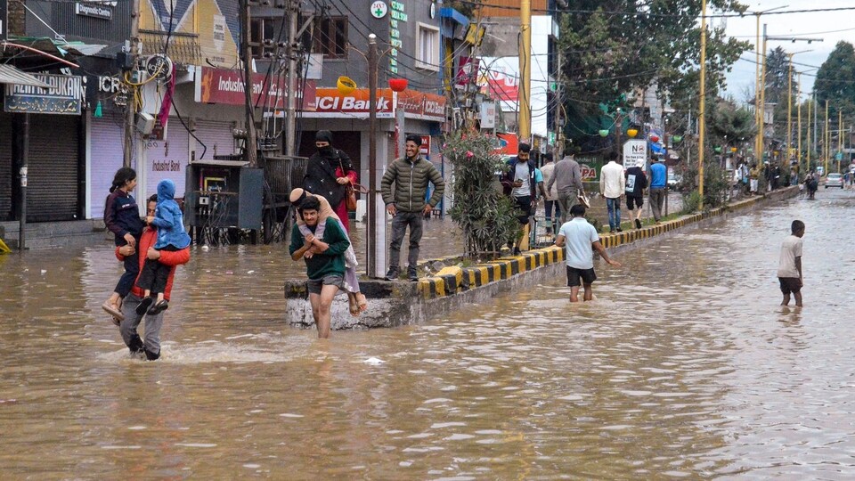
There is likely to be above-normal rainfall over several parts of north, west and central India till September 4, but largely wet conditions are likely to continue till September 18, India Meteorological Department’s extended range forecast (ERF) shows.
On July 31, IMD forecast that above normal rainfall in excess of 106% of the long period average is likely over the country during the second half of the southwest monsoon season (August and September). At the time, IMD officials said rainfall in August would be normal, and September, above normal.
“In the next two to three days, there will be more rains in north India including these regions already experiencing heavy rains presently. Then it is likely to continue over central India. We should expect a good monsoon for the next 10 days,” said weather scientist M Rajeevan, former secretary, ministry of earth sciences.
“This intensity of rainfall in Jammu and Kashmir and Himachal Pradesh is a result of the interaction of a western disturbance with monsoon winds,” M Mohapatra, IMD director general said on Tuesday, as extreme rainfall battered several parts of Jammu and Kashmir, Himachal Pradesh and Punjab and several northern rivers were in spate.
According to the Central Water Commission, on Tuesday, the highest flood level was crossed at 5 sites in Chenab and Tawi rivers and at two sites water levels are near to HFL in Jammu and Kashmir. Levels are “extreme” in Tawi and continue to rise.
“ The intensity of rain will start to decrease now over Jammu and Kashmir and Himachal Pradesh. The interaction with the WD led to exceptional rainfall but this is expected to gradually reduce. However rainfall over north and central and even western parts of the country will continue. A well marked low will traverse central India and bring rain. Thereafter another low pressure area is expected to develop around September 3, which will bring more rain,” Mohapatra said.
There is 5% excess rain over the country since June 1 with 18% deficiency over east and northeast India; 23% excess over northwest India; 9% excess over central India and 5% excess over the southern peninsula.



