E-Paper



Number Theory: Western disturbances have decreased temperatures, not rain deficit
Western disturbances have helped bring rain and snow to north-western India since the last week of January.
Published on: Feb 3, 2024, 01:09:47 IST

 Prefer HTon Google
Share via


Copy link

Although peninsular India received some rain in early January, most of India was very dry this year – at least until last week. Since the last week of January, western disturbances – storms originating in the Mediterranean region that lead to rain in India – have helped bring rain and snow to north-western India. This has helped reduce the deficit in snow and rain this year, but those deficits are still large, an HT analysis shows. Where the snowfall has, however, helped is in reducing temperatures in India’s mountains in the north. Here are four charts that show this.
Big deficit despite last week’s rain
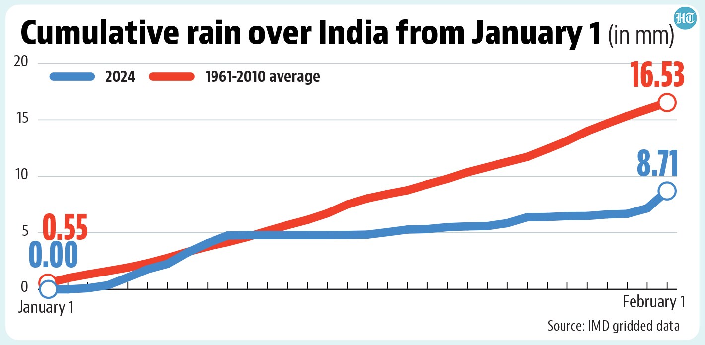
 Big deficit despite last week’s rainUp to February 1, India has received 8.7mm of rain this year, according to India Meteorological Department’s (IMD) gridded dataset. This is the 14th lowest rainfall since 1901 for the first 32 days of the year and 47% less than the 1961-2010 average, a benchmark for rain. To be sure, things would have been even worse without two crucial weeks of rain. 7mm out of the 8.7mm rain India has received so far in 2024 fell in just two weeks: the week ending January 10 (4.7mm) and the week ending February 1 (2.3mm).
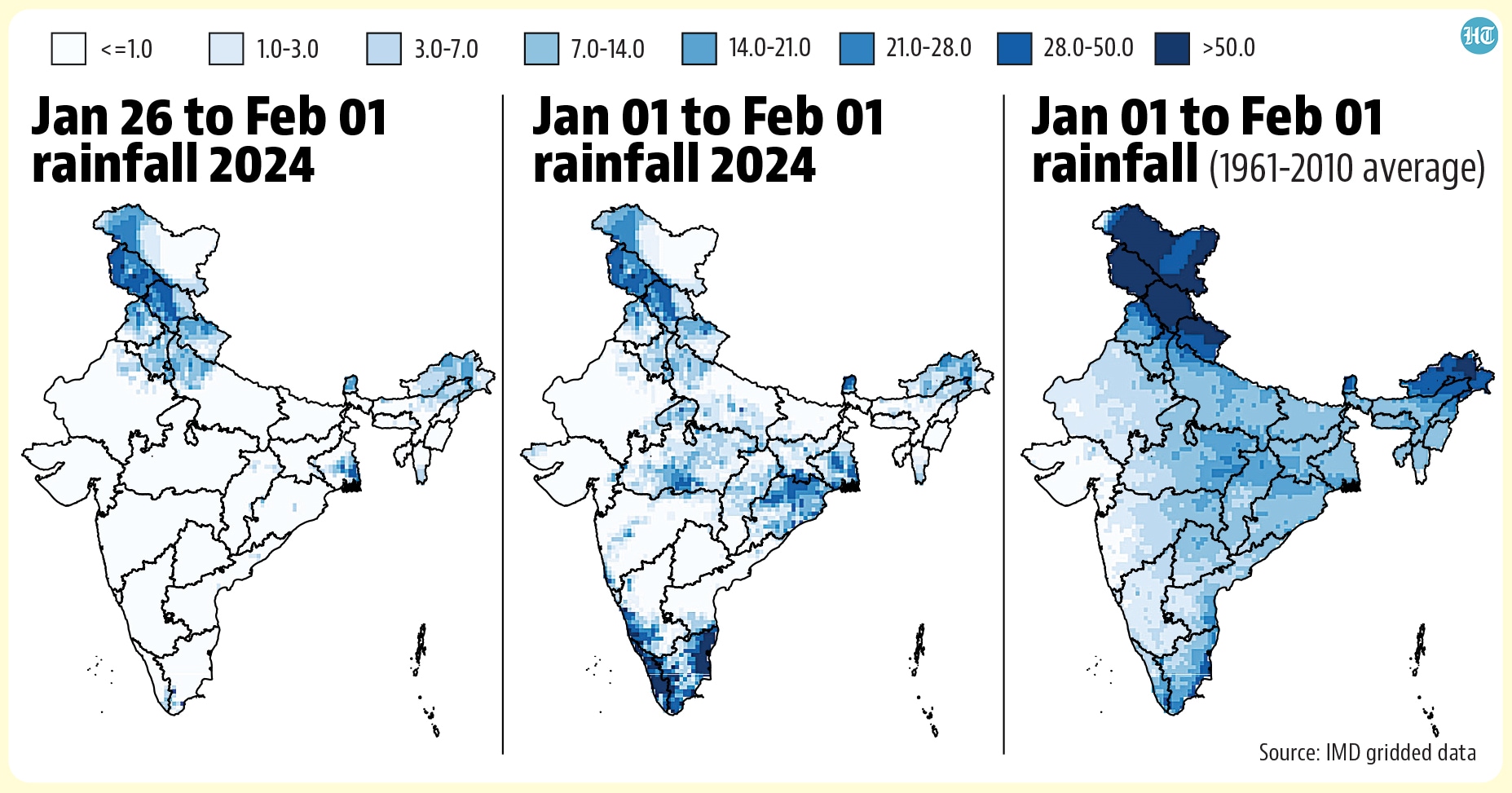
- Except southern states, most of India has a much bigger deficitAs the chart above shows, much of India’s rain this year fell in the week ending January 10 and was not due to western disturbances in the last week. The regional distribution of these spells and their impact on the deficit can be seen in the accompanying maps. Almost all the rain that north India has received in 2024 was in the past week. This rain has reduced northern India’s deficit, but not brought it close to the expected rain for the first 32 days of the year. On the other hand, southern India received a wetter spell in early January. Therefore, Karnataka, Tamil Nadu, and Kerala are the only states with either an insignificant rain deficit or a surplus. Other than these three states, every state has a deficit in excess of 50%, with the exception of Goa, which has a 21% deficit. The deficit is more than 80% in 21 of 32 states and UTs for which this calculation is possible, and more than 90% in 13.
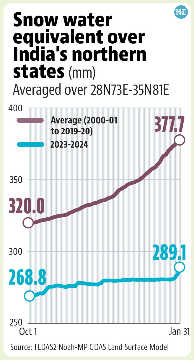
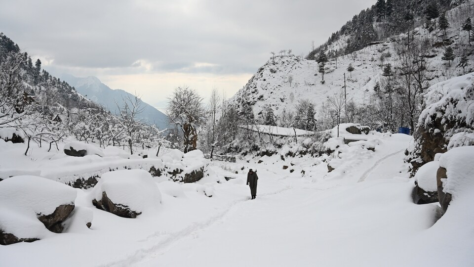
- India’s snow pack this year is still the lowest in satellite recordsHT reported on January 29 that India’s snow pack this year was at its lowest-ever recorded level in Nasa’s satellite records since 2001. The snowfall last week has not changed this by much. However, it has decreased the deficit India was facing. The deficit of snow water equivalent (SWE or the water content of snow pack) in India’s hilly states has decreased from 24.7% on January 25 to 23.5% on January 31, the latest data available. India gained 8.6mm of SWE during the week ending January 31, almost half of it (4.2mm) added just on January 31.
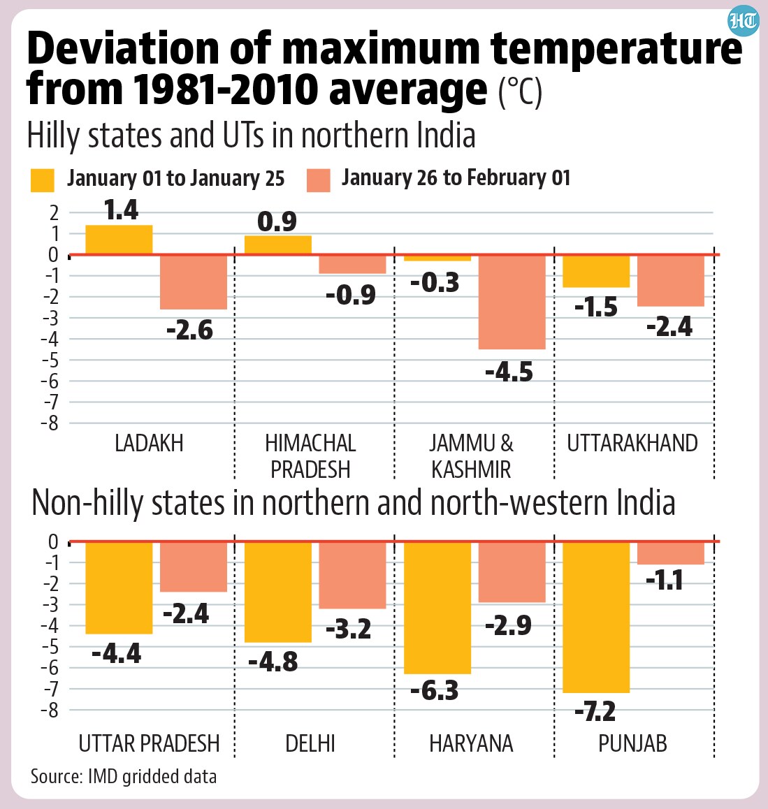
- But snowfall has decreased temperatures in the hill statesThe snowfall in India’s hill states may not have been enough for the expected snow pack, but it has helped cool day-time temperatures to the levels expected from winter. Among India’s northern and north-western states and UTs, only Himachal Pradesh, Jammu and Kashmir, and Ladakh experienced day-time temperatures (represented by maximum temperature) averaging above normal up to January 25. All three have turned colder than normal in the last week. Maximum temperature in Uttarakhand, which was colder than normal even up to January 25, has fallen further below normal due to the snowfall that began last week. To be sure, the lack of snowfall did not make the rest of northern India warm in January. Non-hill northern states were colder than normal because of another factor. The lack of storms allowed upper-level fog in northern states that do not receive snow, pushing down temperatures. The average maximum in Punjab, Haryana, and Delhi up to January 25 was 7.2°C, 6.3°C, and 4.8°C below the 1981-2010 average for this period for these states. The rain in the last week has kept the maximum below normal although the deviation became less extreme in the past week. On the other hand, southern, western, and north-eastern states – wherever western disturbances have not played a role – have experienced warmer than normal maximums through most of 2024 so far, including last week.