
 E-Paper



Western disturbance may bring more snowfall: IMD
This will be the third western disturbance in February and the tenth active one since January. On average, three to four western disturbances are experienced in January and February, according to the IMD.


New Delhi: A fresh western disturbance is set to hit the northwest on Tuesday, which is likely to bring snowfall to the Western Himalayas, particularly in Jammu and Kashmir, and strong winds to the northern plains for three days, the India Meteorological Department (IMD) said on Sunday.
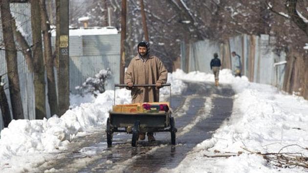
This will be the third western disturbance in February and the tenth active one since January. On average, three to four western disturbances are experienced in January and February, according to the IMD.
“Due to likely dry cold northwesterly winds over northwest India, cold wave conditions are very likely in isolated parts over Punjab, northeast Rajasthan, West Uttar Pradesh, East Madhya Pradesh and Chhattisgarh during next 24 hours and over Odisha during 48 hours,” IMD’s Sunday bulletin said.
The first western disturbance of February affected the region on February 1 and 2 and the second one on February 6. Cold Wave conditions were observed in many places of Punjab and Haryana in the first week of February. The lowest minimum temperature of 2. 1 degrees C in the first week was recorded in Punjab’s Bhatinda on February 5.
Between January 1 and February 8, rainfall was 101% in excess in central India and 35% in excess in northwest India. “Rains have reduced in February. There was above-normal rainfall in January due to high number of western disturbances. We are expecting strong winds during the next few days in the northwestern region,” said RK Jenamani, senior scientist at the IMD.
Plentiful snowfall in the hills in the past couple of weeks means that cold winds are likely to lower the minimum temperature in the plains for the next couple of days.
“The wind direction is northwesterly now bringing cold dry air from the hills which have received a lot of snow in the past month . There are also clear skies which is why heating during the day is radiated back at night,” said Kuldeep Shrivastava, head of the regional weather forecasting centre
“The nights are relatively cold. But the cold wave conditions in Punjab, parts of Rajasthan, Uttar Pradesh and central India will abate from February 11 when the western disturbance starts affecting the region. We are not expecting any rains in the plains in the coming days, only strong winds. Minimum and maximum temperature is also likely to rise after February 11,” he said.
The minimum temperature in Delhi on Sunday morning was 6.6 degrees C at Safdarjung, 4 degree C below normal. Winter chill however is likely to dissipate from February 13 as both maximum and minimum temperatures start rising. “We are expecting maximum temperature to rise to about 25 degree C and minimum temperature to 10 degree C in the next one week after which the feel of winter will gradually reduce,” added Shrivastava.
In some years, more troughs (areas of low pressure) form because the westerly jet stream (strong upper level winds blowing from the west to east) is not very steady. When the winds are weak, more troughs form, leading to more western disturbances, said DS Pai, senior scientist at IMD, Pune.


