E-Paper



Weather Bee: May weather so far almost a mirror image of April weather
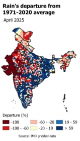
An HT analysis suggests that this is because rainfall trends in May so far have also turned into almost a mirror image of April rainfall trends.

 Prefer HTon Google


North-western, western, and north-eastern regions of India experienced a warmer than normal April. For the former two regions, the first eight days of May have brought relief from that heat. The weather in the May so far is almost a mirror image of the weather in April for north-western and western India.
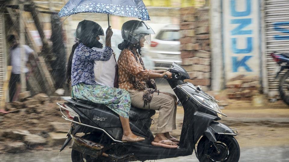
An HT analysis suggests that this is because rainfall trends in May so far have also turned into almost a mirror image of April rainfall trends.
As HT reported last week, north-western, western, and north-eastern regions of India experienced a warmer than normal (1981-2010 average) April by average maximum temperature. For north-eastern India, this trend has continued in the first eight days of May. However, for north-western and western India, maximum temperatures are cooler on average this month. As the accompanying maps for deviation in maximum temperature in April and May show, this makes the temperature trends this month look like a mirror image of the temperature trends in April.

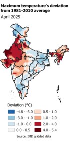
To be sure, as the maps also show, not all regions have experienced a reversal in weather conditions in May. For example, regions like eastern parts of Uttar Pradesh, Bihar, Jharkhand, West Bengal, Odisha, Chhattisgarh, and most of peninsular India were cooler than normal on average in April; and are also cooler in the May so far.
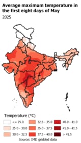
Another thing to keep in mind while reading temperature trends in May is that it is one of the hottest periods of the year for most of India. This can be seen in the normal maximum temperature for the first eight days of May. Large parts of India usually experience an average maximum of more than 40°C at this time of the year. This means that despite big downward deviations in maximum temperature in the month so far, these regions have still experienced a maximum temperature of more than 35°C, which may not be pleasant.

There is another reason why the relatively cool temperatures in May so far may have felt uncomfortable at times: rain. Here is why. The reason for maximum temperatures turning cooler than normal in May is that north-western and western India received rain far more than usual for this time of the year. This can be seen in rain’s departure from the 1971-2020 average, considered the Long Period Average (LPA) and used for tracking rain’s performance. Most of western and western India has a big rain surplus with respect to the LPA in the May so far. This was not the case in April, when most of these regions had a big deficit with respect to the LPA of the month. However, while rain may have cooled temperatures significantly, it can also increase humidity, which can increase the feeling of heat at the time of the day when it is not raining. This is because humid air prevents the ability of the human body to lose heat through perspiration.