
 E-Paper



Intach expo helps visitors understand Delhi through prism of old maps
An exhibition in Delhi showcases over 40 historic maps, revealing the city's changing landscapes from 1807 to 1984, highlighting environmental shifts.

 Prefer HTon Google


New Delhi
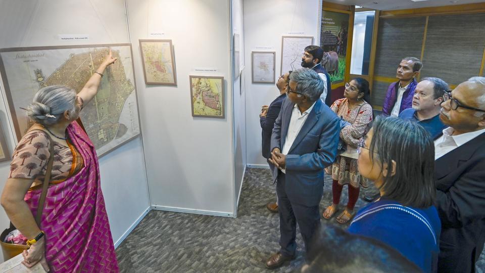
From a “Sketch of Environs” map of Delhi dating to 1807—showing natural stormwater channels and the prominent ‘gates’ at the time—to a map of Shahjahanabad from 1850, when the Chandni Chowk stretch had its iconic “chowk” and even water flowing through it, over 40 old maps, covering the best part of two centuries, were showcased on Friday by the Indian National Trust for Art and Cultural Heritage (Intach) at its Lodhi Estate office.
Displayed as part of an exhibition titled “The Romance of Old Maps: Tracing Lost Landscapes”, the maps are on show on Saturday and Sunday from 11 am to 7pm. The expo traces show how the landscape of Delhi, even long before it became the Capital, changed drastically as lush greenery and water bodies gradually disappeared, while the Yamuna changed its course, moving further away from the walls of the Red Fort.
The maps of Delhi (also referred to as Dihlee in some maps) from 1807 to 1984 show stories of landscapes, water systems and the city gradually expanding over time. “These maps often reveal natural features and urbanisation patterns which advance our understanding of the past and indicate directions for the future. The display includes maps of Delhi from 1807 to 1984,” said Manu Bhatnagar, principal director, Intach.
Bhatnagar said research required for conservation efforts in various parts of the country led to the acquisition of old maps. “The maps also show the original extent of the morphological Ridge far beyond the present-day protected Ridge.”
The exhibition also has on display maps of the original plan the British had for Lutyens Delhi from 1910-12; a 1903 Coronation Darbar map showing how the army once camped at the present-day Delhi University, to even post-Independence maps from the 1960s, which show Delhi aflush with brick kilns, even as the city had begun expanding outwards.
Even the tale of these maps landing in Intach’s repository is an interesting tale. Bhatnagar said that while a number of these were already part of their archives, others were acquired over time, from the hands of scrap dealers in Chandni Chowk, flea markets in London and even shops in Shimla over the past few decades.
Historian Swapna Liddle, part of the inauguration of the exhibition, pointed towards the 1807 map clearly showing how water would naturally flow from the Ridge towards the Yamuna—through channels which are presently either built upon, or carrying sewage. “It shows clear streams, following the contour. The present-day Barapullah drain, or the drain passing through Defence Colony in present day, are all visible. While they carry sewage now, they were clear water channels earlier,” she said.
The exhibition also displays manoeuvre maps, cantonment plans and bazaar maps, offering a window into the city’s social, military and commercial life across decades. Some maps beyond Delhi were also on display. These include early maps of Nainital, Shimla and Mussoorie, a survey map of Mt Everest, Swami Pranavananda’s route maps of Kailash Mansarovar from 1929, and an 1822 map of the principal rivers of India.
Other maps of note included order-of-battle maps from the First World War, including a representation of battles such as Neuve Chapelle, where Subedar Darwan Singh Negi of the 39th Garhwal Rifles earned the Victoria Cross, Bhatnagar said.
“By revealing landscapes that have been lost, transformed, or quietly endured, these maps deepen our understanding of place and encourage a more thoughtful, sensitive engagement with the land. In doing so, they invite us to imagine futures that are more informed, more humane, and more sustainable,” Intach states.


Stay updated with all top Cities including, Bengaluru, Delhi, Mumbai and more across India. Stay informed on the latest happenings in World News along with Delhi Election 2025 and Delhi Election Result 2025 Live, New Delhi Election Result Live, Kalkaji Election Result Live at Hindustan Times.


