
 E-Paper



Where is Delhi stuck? New traffic study on cards to decode daily jams
The proposed study will have 10 major components, from traffic volume and road geometry surveys to congestion mapping and accident analysis. It will identify high-demand travel zones, bottlenecks, and intercity or interstate movement patterns to give a clearer picture of how Delhi’s roads are used


In a bid to tackle Delhi’s chronic traffic chaos, the transport department is preparing to launch a comprehensive study that will map the city’s traffic flow, congestion points and public transport needs.
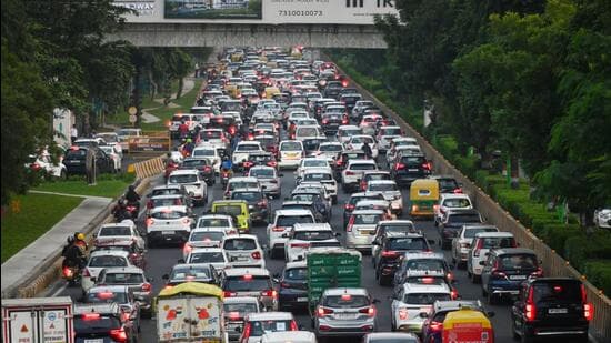
Officials said this will be the first government-backed exercise in several years to scientifically study how people move across the Capital and where the city’s mobility gaps lie.
The survey will analyse traffic patterns on key corridors, including the Ring Road and Outer Ring Road, to assess road use during peak and off-peak hours. It will also look at parking demand, identify accident-prone spots, and suggest ways to improve coordination between buses, the Metro, and non-motorised transport.
“Delhi hasn’t had a proper traffic or origin-destination survey in years. The city’s population and vehicle density have grown rapidly, but we’re still planning with old data,” said a senior transport department official. “This study will give us a scientific base for future traffic management and public transport planning. We’ll be hiring an expert consultant, and work should begin within a month.”
The proposed study will have 10 major components, from traffic volume and road geometry surveys to congestion mapping and accident analysis. It will identify high-demand travel zones, bottlenecks, and intercity or interstate movement patterns to give a clearer picture of how Delhi’s roads are used.
A detailed origin–destination study will also trace how and why people travel across the city — for work, school or logistics — to identify corridors under the most pressure.
“We need to understand where Delhiites are coming from and going to, and when. Such data is crucial for planning future infrastructure, including rationalising bus routes,” another official said.
The department will also audit road design, intersections, lanes and turning radii to see whether poor layouts are worsening congestion. This will be linked to mapping travel time reliability indices, which track delays on major stretches.
Delhi now has more than 14 million registered vehicles, with about 1,000 new vehicles added daily, according to transport department data. Yet despite multiple infrastructure upgrades, traffic jams and air pollution continue to worsen.
Between 1981 and 2023, the number of vehicles in Delhi rose roughly 21 times, but the city’s total road length merely doubled from 15,487km to 33,198km, as per the Delhi Traffic Police’s 2023 crash report. Private vehicles, including cars and two-wheelers, make up nearly 93% of all registered vehicles in the Capital.
The study will also look at parking management, a key contributor to congestion. Much of the city’s carriageway is taken up by on-street parking, officials said, and rationalising parking supply will be among the main recommendations.
Another focus area will be the integration of public transport, examining how DTC buses, Metro stations, auto-rickshaw stands and pedestrian networks connect at key hubs. The report is expected to recommend upgrades in bus bays, footpaths, signage and passenger information systems to improve multimodal access.
Accident-prone black spots identified through data from Delhi Police and the Road Safety Cell will be mapped and analysed to help frame a broader road safety plan aimed at reducing fatalities and improving pedestrian safety.
Experts said the lack of credible, up-to-date data has long hampered mobility planning.
“Delhi faces the challenge of managing massive traffic inflow and ensuring smooth movement across its network,” said S Velmurugan, chief scientist and head of the traffic engineering and safety division at the Central Road Research Institute (CRRI). “Highway traffic gets discharged onto the Ring Road and Outer Ring Road, which then clogs the city’s circular routes. With over 100 entry points into the city, traffic volumes are rising steadily. A comprehensive survey can finally pinpoint cost-effective, high-impact solutions to improve flow and integration.”

Stay updated with all top Cities including, Bengaluru, Delhi, Mumbai and more across India. Stay informed on the latest happenings in World News along with Delhi Election 2025 and Delhi Election Result 2025 Live, New Delhi Election Result Live, Kalkaji Election Result Live at Hindustan Times.


