
 E-Paper



IMD forecasts thunder activity until October 8 in Pune
Thunder storms, lightning with 43mm rainfall recorded at 5.30 pm by India Meteorological Department on Friday


Thunder storms, lightning with 43mm rainfall recorded at 5.30 pm by India Meteorological Department (IMD), shook the city once again and caused water logging in several areas. IMD has predicted that thundery activity will continue until October 8 2019.
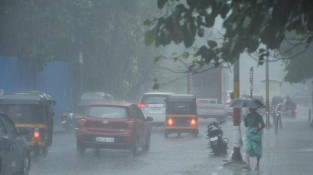
The city witnessed slow moving heavy traffic and waterlogged roads in Yerawada, Mhatre Bridge, Karve road, Baner, and Aundh.
Anupam Kashyapi, head of weather department, IMD, said, “Thunderstorm was observed at a few places over Gangetic West Bengal and at isolated places over Konkan and Goa, Coastal Karnataka, Punjab, Haryana, Chandigarh and Delhi, Himachal Pradesh, West Rajasthan, Odisha, Tamil Nadu, Puducherry and Karaikal, North and South Interior Karnataka, Assam and Meghalaya and Nagaland, Manipur, Mizoram and Tripura.” He added that thundery activity along with light to moderate rain will follow until October 8 2019, with the temperatures hovering between 32 to 29 as maximum degree Celsius and 21.9 to 20 degree Celsius.
IMD also added that on October 9 and 10, fairly widespread to widespread rainfall with isolated heavy falls are likely over parts of east and northeast India and scattered to fairly widespread rainfall likely to occur over rest of the country except over Punjab, Haryana, Rajasthan, Gujarat and Madhya Pradesh where weather is to be likely dry.
According to Kashyapi, the withdrawal of southwest monsoon is likely to commence from parts of northwest India.
1,071.9mm: 2019 is Pune’s third wettest monsoon in recorded history
The southwest monsoon officially ended, despite the India Meteorological Department (IMD) still tracking a delayed withdrawal.
Between June 1 and September 30, 2019, the city recorded 1071.9 mm of rain, its third-highest of all time, since IMD began recording the same.
Historically, Pune city recorded its highest monsoon in 2005 with 1,163.3 mm of rain, followed by the 2006 monsoon which has 1,103.8 mm of rainfall.
Despite a 15-day delay to the monsoon onset in 2019, Pune still witnessed 321.9 mm of rain, more than its seasonal average of 750 mm.
“This year, because of the presence of either strong westerlies or upper air circulation over the north Konkan, Pune recorded surplus monsoon rainfall. As a result of the convergence of the Arabian sea branch of the monsoon and the Bay of Bengal branch of the monsoon, and also the presence of the offshore trough, there were heavy downpours over central Maharashtra,” an IMD release stated.
Central Maharashtra, Vidarbha and Konkan all recorded 55%, 12% and 32% excess rain this season, respectively. Marathwada is the only subdivision that recorded 12% deficient rainfall. The IMD forecast that the withdrawal in northwest India will start in the next four days.


