
 E-Paper



Mercury falls to 3.3°C, may go up from Jan 2: IMD
Delhi recorded eight cold wave days this December, the same as in 2018. The city had recorded nine cold wave days in 1965, the most so far on record, the IMD said.


Delhi’s average mean minimum temperature this December was the second-lowest in the last 15 years, the India Meteorological Department (IMD) said on Thursday. The minimum temperature on Thursday also dipped to the season’s lowest, at 3.3 degree Celsius. IMD scientists said the cold wave will continue in Delhi and the National Capital Region (NCR) on Friday, but the minimum temperature will start increasing, and is expected to touch 7°C by Sunday.
Data released by the IMD on Thursday showed that the mean minimum temperature (MMT) this December was 7.1°C, lower than 8.3°C — the normal for this month. In 2018, this had dipped to 6.7°C, according to IMD data. Before that, the average MMT for December was lowest in 2005 (6°C) and in 1996 (5.9°C).
Delhi also recorded eight cold wave days this December, the same as in 2018. The city had recorded nine cold wave days in 1965, the most so far on record, the IMD said.
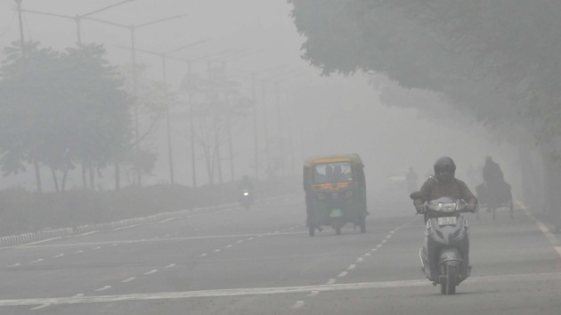
Delhi on Thursday also recorded the lowest minimum temperature of the season, with the mercury at the Safdarjung observatory, which is considered the official marker of the city, dipping to 3.3°C, four degrees below the season’s normal. The maximum temperature was 17.4°C, two below normal. Dense fog also reduced the visibility at the Palam observatory to 50 metres.
Fog hits flights at IGIA
Several flyers were stranded at Delhi’s Indira Gandhi International Airport on Thursday morning as fog disrupted operations, forcing two incoming flights to be diverted and delaying the departure of other flights. But no flight was cancelled, airport officials said adding that the impact was lower because all three runways were operational.
Read more| 2020: A year of strange weather events
According to officers, CAT III low visibility procedures were implemented around 2am at the airport, as the runway visual range recorded visibility below 200 metres. The lowest visibility was recorded at 175m, because of which two incoming flights, one from Kolkata and another from Dubai, had to be diverted to Jaipur as they could not land in Delhi.
The fog also disrupted departure of scheduled flights during the early hours of Thursday. “Some departures were delayed when the visibility dropped drastically. This caused delay to the following flights also, affecting 50-60 flights scheduled on Thursday. However, the situation improved in the afternoon and also because the air traffic at the airport is less as compared to pre-Covid times,” said an officer from the airport who wished not to be named.
In order to accommodate more passengers, the airport operator also plans to reopen Terminal 1, which is currently shut due to ongoing expansion work.
Kuldeep Srivastava, head of the IMD’s regional forecasting centre, said clear skies over Delhi-NCR, multiple western disturbances affecting the Himalayan region and the global impact of La Niña were the major reasons behind such low minimum temperatures. La Niña is characterised by below-normal sea surface temperatures in the Pacific Ocean near the equator, a result of shifting wind patterns in the atmosphere.
“Delhi recorded “near-normal” minimum temperatures till December 12 as a result of clouds and rainfall in the plains under the influence of western disturbances affecting the region,” he said.
Read more| Farmers’ protest: Consensus on two issues, says Tomar; next meeting on January 4
Clear skies also pushed the temperature below normal this season. Clouds trap some of the outgoing infrared radiation and radiate it back downward, warming the ground, he added.
“After December 12, western disturbances mostly affected the western Himalayan region, leading to significant snowfall and rain over Jammu and Kashmir and Himachal Pradesh,” Srivastava said.
He, however, said that from Friday the temperatures will start rising again as an impact of another active western disturbance crossing over Delhi-NCR. On Friday, the minimum temperature is likely to remain around 4 degree Celsius, and by Sunday it is expected to increase and reach up to 7 degree Celsius.
Meanwhile, with the low temperature and slow wind speed, pollution levels also spiked on Thursday. Central Pollution Control Board (CPCB) recordings show that the overall air quality index (AQI) of Delhi on Thursday was 347, in the ‘very poor’ category. On Wednesday, the overall AQI of the city was 290, in the ‘poor’ zone.
The CPCB on Thursday reiterated its order from December 23, asking the agencies to step-up enforcement and keep stone-crushers and hot-mix plants shut till January 2.
IMD scientists said that with an approaching western disturbance, the wind speeds are expected to improve, bringing pollution down.
VK Soni, head of IMD’s environment monitoring and research centre, said that the AQI is expected to improve from Saturday significantly from Saturday.
“There will be marginal improvement on Friday, but from Saturday there would be a significant improvement because of improved wind speed,” Soni said.

Stay updated with all top Cities including, Bengaluru, Delhi, Mumbai and more across India. Stay informed on the latest happenings in World News along with Delhi Election 2025 and Delhi Election Result 2025 Live, New Delhi Election Result Live, Kalkaji Election Result Live at Hindustan Times.


